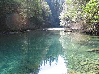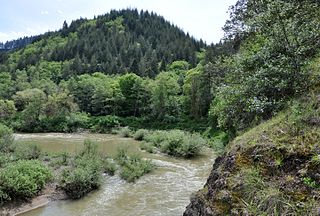
The Sandy River is a 56-mile (90 km) tributary of the Columbia River in northwestern Oregon in the United States. The Sandy joins the Columbia about 14 miles (23 km) upstream of Portland.

The Clackamas River is an approximately 83-mile (134 km) tributary of the Willamette River in northwestern Oregon, in the United States. Draining an area of about 940 square miles (2,435 km2), the Clackamas flows through mostly forested and rugged mountainous terrain in its upper reaches, and passes agricultural and urban areas in its lower third. The river rises in eastern Marion County, about 55 miles (89 km) east-southeast of Salem. The headwaters are on the slopes of Olallie Butte in the Mount Hood National Forest, about 10 miles (16 km) north of Mount Jefferson, at an elevation of 4,909 feet (1,496 m) in the Cascade Range. The Clackamas flows briefly north and then flows northwest through the mountains, passing through North Fork Reservoir and Estacada. It then emerges from the mountains southeast of Portland. It joins the Willamette near Oregon City and forms the boundary between Oregon City and Gladstone.

The Hood River, formerly known as Dog River, is a tributary of the Columbia River in northwestern Oregon in the United States. Approximately 25 miles (40 km) long from its mouth to its farthest headwaters on the East Fork, the river descends from wilderness areas in the Cascade Range on Mount Hood and flows through the agricultural Hood River Valley to join the Columbia River in the Columbia River Gorge.

The Lewis River is a tributary of the Columbia River, about 95 miles (153 km) long, in southwestern Washington in the United States. It drains part of the Cascade Range north of the Columbia River. The drainage basin of the Lewis River covers about 1,046 square miles (2,709 km2). The river's mean annual discharge is about 6,125 cubic feet per second (173.4 m3/s). Unlike nearby Lewis County and Fort Lewis the Lewis River was not named for Meriwether Lewis, but rather for A. Lee Lewis, an early settler who homesteaded near the mouth of the river.

The Bull Run River is a 21.9-mile (35.2 km) tributary of the Sandy River in the U.S. state of Oregon. Beginning at the lower end of Bull Run Lake in the Cascade Range, it flows generally west through the Bull Run Watershed Management Unit (BRWMU), a restricted area meant to protect the river and its tributaries from contamination. The river, impounded by two artificial storage reservoirs as well as the lake, is the primary source of drinking water for the city of Portland, Oregon.

Oak Grove Fork Clackamas River is a 21-mile (34 km) tributary of the Clackamas River in the U.S. state of Oregon. From its headwaters in the Warm Springs Indian Reservation near Abbot Pass in the Cascade Range, the river flows generally west through Mount Hood National Forest in Clackamas County to the unincorporated community of Ripplebrook. Here it enters the main stem of the Clackamas River. Oak Grove Fork feeds Timothy Lake and Lake Harriet, two artificial impoundments built along its course to control water flows to hydroelectric plants.

Muddy Fork is a tributary, about 6 miles (10 km) long, of the Sandy River in the U.S. state of Oregon. Arising at the base of Sandy Glacier on the west slope of Mount Hood, it flows west through the Mount Hood Wilderness in the Mount Hood National Forest. It joins the Sandy River in Old Maid Flat, about 5 miles (8 km) northeast of Rhododendron. The stream offers limited fishing for coastal cutthroat trout.

The Little Zigzag River is a tributary, about 5 miles (8.0 km) long, of the Zigzag River in the U.S. state of Oregon. The Zigzag and Little Zigzag drain the Zigzag Glacier on Mount Hood, a high volcanic peak in the Cascade Range. Their combined waters flow westward to meet the Sandy River near the community of Zigzag. Little Zigzag Falls, a popular hiking destination, is on the river near U.S. Route 26 east of Zigzag.

Fifteenmile Creek is a 54-mile (87 km) long tributary of the Columbia River in the U.S. state of Oregon. It drains 373 square miles (966 km2) of Hood River and Wasco counties. Arising in the Cascade Range near Mount Hood, it flows northeast then west to its confluence with the Columbia near The Dalles.

The North Fork Payette River is a river in western Idaho in the United States. It stretches over 113 miles (182 km) from north to south, flowing from the Salmon River Mountains to near Banks, where it joins with the South Fork Payette River to form the Payette River, a tributary of the Snake River. Its watershed comprises more than 900 square miles (2,300 km2) of forested mountains and sprawling lakes and wetlands.

The Winchuck River is a short coastal stream that runs through the Rogue River–Siskiyou National Forest to the Pacific Ocean in the U.S. states of Oregon and California. Flowing generally west from its origin near Elk Mountain, the river enters the sea at Crissey Field State Recreation Site, about 1⁄2 mile (0.80 km) north of the Oregon–California border and about 5 miles (8 km) south of Brookings.

The South Fork Breitenbush River is a 10-mile (16 km) tributary of the Breitenbush River in the U.S. state of Oregon. The river flows generally northwest from Russell Lake in the Mount Jefferson Wilderness of the Cascade Range to near Breitenbush Hot Springs, where it merges with the North Fork Breitenbush River to form the main stem.

The North Fork Alsea River is a 16-mile (26 km) tributary of the Alsea River in the U.S. state of Oregon. It begins at Klickitat Lake, fed by Klickitat and Lake creeks in the Central Oregon Coast Range, and flows generally south to near Alsea, where it joins the South Fork Alsea River to form the main stem. For most of its course, the North Fork winds through the Siuslaw National Forest in Lincoln County and then Benton County. It passes under Oregon Route 34 northeast of Alsea.

The East Fork South Fork McKenzie River is a tributary of the South Fork McKenzie River in Lane County in the U.S. state of Oregon. It begins in and passes through part of the Willamette National Forest of the Cascade Range. Flowing generally northwest along the base of Sawtooth Ridge, it empties into Cougar Reservoir on the South Fork McKenzie River, about 5 miles (8 km) upstream of that stream's mouth on the McKenzie River.

The North Fork Umatilla River is a tributary of the Umatilla River in Union and Umatilla counties in the U.S. state of Oregon. Its headwaters lie in the Umatilla National Forest in the Blue Mountains of northeastern Oregon. It flows generally northwest to meet the South Fork Umatilla River near Graves Butte. Together the two forks form the main stem Umatilla.

The North Fork Smith River is 28-mile (45 km) tributary of the Smith River that begins in the U.S. state of Oregon and ends in the U.S. state of California. Arising near Chetco Peak in the Klamath Mountains, it flows generally south to meet the Middle Fork Smith River at Gasquet, California. The combined streams form the Smith River.

The South Fork Salmon River is a tributary of the Salmon River in Clackamas County in the U.S. state of Oregon. Arising near Plaza Lake, it flows generally northeast along the east side of Salmon Mountain to meet the Salmon 11 miles (18 km) upstream of the larger stream's confluence with the Sandy River at Brightwood.

The West Fork Salmon River is a tributary of the Salmon River in Clackamas County in the U.S. state of Oregon. Beginning near Timberline Lodge at the base of Mount Hood in the Cascade Range, it flows generally south to meet the main stem Salmon near Red Top Meadow, slightly south of the intersection of U.S. Route 26 and Oregon Route 35. The entire course of the river, which has no named tributaries, lies within the Mount Hood National Forest.

The Middle Fork Coquille River is a tributary, about 40 miles (64 km) long, of the South Fork Coquille River in the U.S. state of Oregon. It begins near Camas Mountain in Douglas County in the Southern Oregon Coast Range. It flows generally south, bypassing the community of Camas Valley while passing through the valley of the same name, then curves west and north to Remote in Coos County. The Middle Fork then flows generally west, passes by the small community of Bridge, and meets the South Fork near Myrtle Point. The confluence with the South Fork is 41 miles (66 km) by water to where the main stem of the Coquille River enters the Pacific Ocean at Bandon.


