Related Research Articles

Warwick is a city in Kent County, Rhode Island, the third largest city in the state with a population of 82,823 at the 2020 census. It is located approximately 12 miles (19 km) south of downtown Providence, Rhode Island, 63 miles (101 km) southwest of Boston, Massachusetts, and 171 miles (275 km) northeast of New York City.

Cranston, once known as Pawtuxet, is a city in Providence County, Rhode Island. The official population of the city in the 2020 United States Census was 82,934, making it the second largest in the state. The center of population of Rhode Island is located in Cranston. Cranston is a part of the Providence metropolitan area.

West Warwick is a town in Kent County, Rhode Island, United States. The population was 31,012 at the 2020 census.

Route 37, also known as the Lincoln Avenue Freeway, is a state highway running 3.47 miles (5.58 km) in Providence County and Kent County, Rhode Island, United States. A freeway for its entire length, it serves the cities of Cranston and Warwick and is also a major east–west freeway in the Providence metropolitan area, linking T. F. Green Airport with Interstate 295. The western terminus of Route 37 is an at-grade intersection with Natick Avenue in Cranston. The freeway has numbered interchanges with I-295, Rhode Island Route 2, Pontiac Avenue, and I-95 before terminating at a trumpet interchange with U.S. Route 1 in Warwick.

Fiskeville is a small village in the south west corner of Cranston, Rhode Island, United States, the south east corner of the Town of Scituate, Rhode Island and across the northern side of Coventry, Rhode Island. The village's Main Street forms the border between Cranston and Scituate. Fiskeville grew up as one of several mill towns along the Pawtuxet River in the mid-1800s. The Fiskeville textile mill was formed by Dr. Caleb Fiske, a Revolutionary War doctor turned businessman in 1812. The village became home to those who worked in the mill, mostly immigrants from Portugal, France, Italy and England. Fiskeville is usually associated with Cranston rather than with Scituate as most of the original buildings including Dr. Fiske's residence were in Cranston. Although the mill and about a dozen nearby mill houses were in Scituate. Poets Karen Haskell and Darcie Dennigan both grew up, a few doors down from each other, in the 1970s and 1980s on Main Street in Fiskeville.

Hillsgrove, originally Hill's Grove, is a village in western central Warwick, Rhode Island.

The Pawtuxet River is a river in the U.S. state of Rhode Island. It flows 12.3 miles (19.8 km) and drains a watershed of 231.6 square miles (600 km2). There are four dams along the river's length.

Pawtuxet Village is a section of the New England cities of Warwick and Cranston, Rhode Island. It is located at the point where the Pawtuxet River flows into the Providence River and Narragansett Bay.

Crompton is a community in West Warwick, Rhode Island, United States. It is named after Samuel Crompton, inventor of the spinning mule.
Warwick Mall is an enclosed American shopping mall in Warwick, Rhode Island, on the north side of Interstate 295 near the junction with Interstate 95. Composed of more than 1,000,000 square feet (100,000 m2) of retail space, it features more than 80 stores and a food court. The mall opened for business in 1970, with Boston-based Filene's and Jordan Marsh alongside Providence-based Peerless and The Outlet, and national chain Woolworth as initial anchors, JCPenney being later added as a sixth anchor.

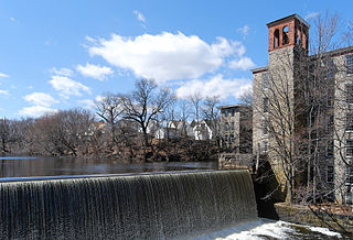
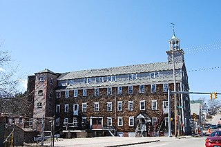
River Point in West Warwick, Rhode Island, United States, is a community made up of mill houses and three mills - the Valley Queen Mill, the Royal Mill and the Cotton Shed. Built in 1834 by the Greene Company, the Valley Queen Mill is the oldest of the three buildings. It originally operated as a cotton factory, producing coarse cotton cloths under the Greene Company name.
Norwood is a neighborhood in the city of Warwick, Rhode Island. Norwood is bounded by Route 37, the Pawtuxet River, Sherwood Avenue, the former Christopher Rhodes Elementary School, North Palm Boulevard, Palm Boulevard, and Post Road. Such borders mark the area traditionally served by the fire station previously located at the current site of the Norwood Boys & Girls Club.

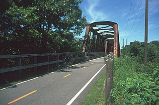
The Washington Secondary Rail Trail is a rail trail located in Rhode Island.

The Community College of Rhode Island (CCRI) is a public community college in Rhode Island. It is the only community college in the state and the largest community college in New England. The college's primary facility is located in Warwick, with additional college buildings throughout the state.

The North Branch Pawtuxet River is a river in the U.S. state of Rhode Island. It flows approximately 8.9 miles (14.3 km). There are 9 dams along the river's length.

The South Branch Pawtuxet River is a river in the U.S. state of Rhode Island. It flows approximately 9.8 miles (15.8 km). There are 11 dams along the river's length.

The Knight Estate is a historic estate in Warwick, Rhode Island, that is home to the Knight Campus of the Community College of Rhode Island. Developed as a country estate for a family of industrialists and later donated to the state, the main house and its outbuildings were listed on the United States National Register of Historic Places in 1984.

Pontiac is a historic village in Warwick, Rhode Island, and part of the Pawtuxet River Valley.

Lippitt, Rhode Island is a village within the town of West Warwick, Rhode Island.

Anthony is a village along Route 117 within the town of Coventry, Rhode Island near the villages of Washington and Quidnick on the southwestern banks of the Pawtuxet River. The village comprises "Anthony, Arnold, Boston, Mapledale, Meeting, Taft, Washington and Laurel Avenue."
References
- ↑ "FAMILY HISTORY | Warwick Ice Cream Co". Archived from the original on 2013-12-21. Retrieved 2013-12-20.
- ↑ Miriam, Camp (2012-08-13). "Warwick Ice Cream rendering (1940)—Rhode Island | Francis Ch…". Flickr. Retrieved 2016-07-29.
- ↑ "The "Gentleman's Farm"". Warwickhistory.com. Retrieved 2016-07-29.
- ↑ "Home". thenaticks.com.