
The Republics of the Union of Soviet Socialist Republics or the Union Republics were ethnically based administrative units of the Union of Soviet Socialist Republics (USSR). The Soviet Union was created by the treaty between the soviet socialist republics of Belarus, Ukraine, Russia, and the Transcaucasian Federation, by which they became its constituent republics. For most of its history, the USSR was a highly centralized state despite its nominal structure as a federation of republics; the decentralization reforms during the era of Perestroika ("Restructuring") and Glasnost ("Openness") conducted by Mikhail Gorbachev are cited as one of the factors which led to the dissolution of the USSR in 1991.

Irkutsk is the largest city and administrative center of Irkutsk Oblast, Russia. With a population of 617,473 as of the 2010 Census, Irkutsk is the 25th largest city in Russia by population, the 5th largest in the Siberian Federal District, and one of the largest cities in Siberia.

The Jewish Autonomous Oblast is a federal subject of Russia in the Russian Far East, bordering Khabarovsk Krai and Amur Oblast in Russia and Heilongjiang province in China. Its administrative center is the town of Birobidzhan.

Irkutsk Oblast is a federal subject of Russia, located in southeastern Siberia in the basins of the Angara, Lena, and Nizhnyaya Tunguska Rivers. The administrative center is the city of Irkutsk. It's neighboring located with the Republic of Buryatia and the Tuva Republic in the south and southwest, with Krasnoyarsk Krai in the west, with the Sakha Republic in the northeast, and with Zabaykalsky Krai in the east; and shares with every locations except only Khövsgöl Province in Mongolia. It had a population of 2,428,750 at the 2010 Census.

Novosibirsk Oblast is a federal subject of Russia located in southwestern Siberia. Its administrative and economic center is the city of Novosibirsk. The population was 2,788,849 as of the 2018 Census.

Kemerovo Oblast–Kuzbass, also known by its short names as Kemerovo Oblast and Kuzbass (Кузба́сс) after the Kuznetsk Basin, is a federal subject of Russia, located in southwestern Siberia, where the West Siberian Plain meets the South Siberian Mountains. The oblast, which covers an area of 95,500 square kilometers (36,900 sq mi), shares a border with Tomsk Oblast in the north, Krasnoyarsk Krai and the Republic of Khakassia in the east, the Altai Republic in the south, and with Novosibirsk Oblast and Altai Krai in the west. Kemerovo is the administrative center of the oblast, though Novokuznetsk is the largest city in the oblast, in terms of size. Kemerovo Oblast is one of Russia's most urbanized regions, with over 70% of the population living in its nine principal cities. Its ethnic composition is predominantly Russian, but Ukrainians, Tatars, and Chuvash also live in the oblast. The population recorded during the 2010 Census was 2,763,135.
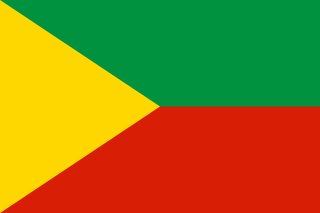
Chita Oblast was a federal subject of Russia in southeast Siberia, Russia. Its administrative center was the city of Chita. It had extensive international borders with China (998 km) and Mongolia (868 km) and internal borders with Irkutsk and Amur Oblasts, as well as with the republics of Buryatia and Yakutia. Its area was 431,500 square kilometers (166,600 sq mi). Population: 1,155,346 (2002 Census); 1,377,975 (1989 Census).
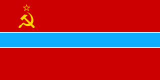
Uzbekistan is the common English name for the Uzbek Soviet Socialist Republic and later, the Republic of Uzbekistan, that refers to the period of Uzbekistan from 1924 to 1991 as one of the constituent republics of the Soviet Union. It was governed by the Uzbek branch of the Soviet Communist Party, the only legal political party, from 1925 until 1990. From 1990 to 1991, it was a sovereign part of the Soviet Union with its own legislation. Sometimes, that period is also referred to as Soviet Uzbekistan.
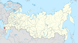
The Karachay-Cherkess Republic or Karachay-Cherkessia is a federal subject of Russia. It is geographically located in the North Caucasus region of Southern Russia and is administratively part of the North Caucasian Federal District. Karachay-Cherkessia has a population of 477,859.

The Volga German Autonomous Soviet Socialist Republic was an Autonomous Soviet Socialist Republic established in Soviet Russia. Its capital was the Volga River port of Engels.

The Republic of Buryatia is a federal subject of Russia, located in Siberia. Formerly part of the Siberian Federal District, it has been a part of the Russian Far East since 2018 and indigenous Buryat Mongolians coexist with fellow non-Buryat Russians. Its capital is the city of Ulan-Ude, which means Red Gateway in Buryat Mongolian. Its area is 351,300 square kilometers (135,600 sq mi) with a population of 972,021.
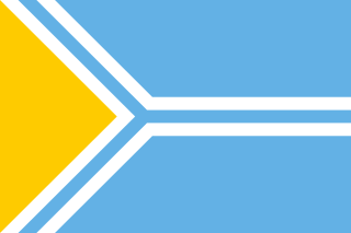
The flag of Tuva, a republic in the Russian Federation, is a light blue field with a white-fimbriated pall of the same color bordering a yellow triangle on the hoist.
Siberian natural resources refers to resources found in Russian Siberia, in the North Asian Mainland. The Siberian region is rich in resources, including coal, oil and metal ores
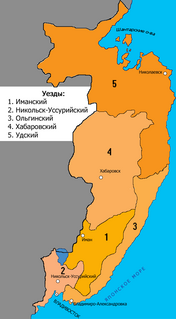
Primorskaya Oblast was an administrative division of the Russian Empire and the early Russian SFSR, created on October 31, 1856 by the Governing Senate. The name of the region literally means "Maritime" or "Coastal." The region was established upon a Russian conquest of Daur people that used to live along Amur River. Before the Russian conquest, the territory belonged to the Chinese region of Manchuria.

National delimitation in the Union of Soviet Socialist Republics was the process of specifying well-defined national territorial units from the ethnic diversity of the Union of Soviet Socialist Republics (USSR) and its subregions. The Russian-language term for this Soviet state policy was razmezhevanie, which is variously translated in English-language literature as "national-territorial delimitation" (NTD), "demarcation", or "partition". National delimitation formed part of a broader process of changes in administrative-territorial division, which also changed the boundaries of territorial units, but was not necessarily linked to national or ethnic considerations. National delimitation in the USSR was distinct from nation-building, which typically referred to the policies and actions implemented by the government of a national territorial unit after delimitation. In most cases national delimitation in the USSR was followed by korenizatsiya (indigenization).

Northern Oblast was an oblast of the Russian Soviet Federative Socialist Republic from 1936 to 1937. Its seat was in the city of Arkhangelsk. The oblast was located in the north of European Russia and its territory is currently divided between Arkhangelsk, Vologda, Kostroma and Kirov oblasts and the Nenets Autonomous Okrug.

The Russian Soviet Federative Socialist Republic, previously known as the Russian Soviet Republic and the Russian Socialist Federative Soviet Republic as well as being unofficially known as Soviet Russia, the Russian Federation or simply Russia, was an independent federal socialist state from 1917 to 1922, and afterwards the largest and most populous of the Soviet socialist republics of the Soviet Union (USSR) from 1922 to 1991, until becoming a sovereign part of the Soviet Union with priority of Russian laws over Union-level legislation in 1990 and 1991, the last two years of the existence of the USSR. The Russian Republic was composed of sixteen smaller constituent units of autonomous republics, five autonomous oblasts, ten autonomous okrugs, six krais and forty oblasts. Russians formed the largest ethnic group. The capital of the Russian SFSR was Moscow and the other major urban centers included Leningrad, Stalingrad, Novosibirsk, Sverdlovsk, Gorky and Kuybishev.

The Governor of Irkutsk Oblast is highest official of Irkutsk Oblast. The office of governor of Irkutsk Governorate was established in 1783 as part of the Russian Empire. In 1926, under the Soviet Union, the governorate became part of the newly created Siberian Krai, which lasted until its division in 1930 into East and West Siberian Krais. The area of the former Irkutsk Governorate became part of the East Siberian Krai. In 1936 East Siberian Krai was further divided up, and in 1937 the remaining area was split into Chita Oblast and Irkutsk Oblast. Since then Irkutsk Oblast has been an independent federal subject of Russia.

Kokshetau Oblast, was an administrative division of the former Kazakh Soviet Socialist Republic (1944–1991) in the Soviet Union, established on March 16, 1944. Upon Kazakhstan's independence in 1991, the oblast continued to exist until May 3, 1997. It was formerly known between 1944 and 1993 as Kokchetav Oblast.

Yury Abramovich Nozhikov was a Soviet electrical engineer and Russian politician who was the first governor of Irkutsk Oblast in 1991–1997.


