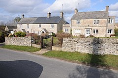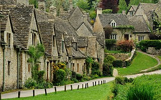
Gloucestershire is a ceremonial county in South West England. It is bordered by Herefordshire to the north-west, Worcestershire to the north, Warwickshire to the north-east, Oxfordshire to the east, Wiltshire to the south, Bristol and Somerset to the south-west, and the Welsh county of Monmouthshire to the west. The city of Gloucester is the largest settlement and the county town.

Stroud is a market town and civil parish in Gloucestershire, England. It is the main town in Stroud District. The town's population was 13,500 in 2021.
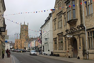
Cotswold is a local government district in Gloucestershire, England. It is named after the wider Cotswolds region and range of hills. The council is based in the district's largest town of Cirencester. The district also includes the towns of Chipping Campden, Fairford, Lechlade, Moreton-in-Marsh, Northleach, Stow-on-the-Wold and Tetbury, along with numerous villages and surrounding rural areas.

Stroud District is a local government district in Gloucestershire, England. The district is named after its largest town of Stroud. The council is based at Ebley Mill in Cainscross. The district also includes the towns of Berkeley, Dursley, Nailsworth, Stonehouse and Wotton-under-Edge, along with numerous villages and surrounding rural areas. Over half of the district lies within the Cotswolds Area of Outstanding Natural Beauty.

Whitminster is a village and civil parish in Gloucestershire, England, on the A38 trunk road approximately 6 miles (10 km) south of Gloucester and 6 miles (10 km) north-west of Stroud. The parish population at the 2011 census was 881. The hamlet of Wheatenhurst is signposted from the A38 at Whitminster. Whitminster is close to Junction 13 of the M5 motorway, with Bristol, South Wales and the south Midlands all within an hour's drive.
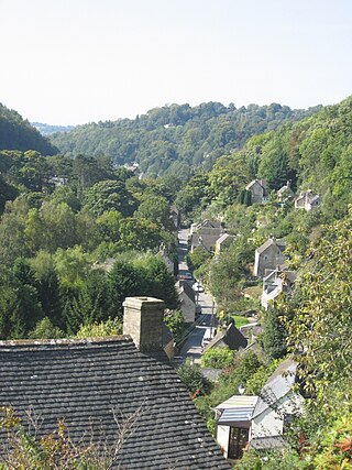
Chalford is a large village in the Frome Valley of the Cotswolds in Gloucestershire, England. It is to the southeast of Stroud about four miles upstream. It gives its name to Chalford parish, which covers the villages of Chalford, Chalford Hill, France Lynch, Bussage and Brownshill, spread over two square miles of the Cotswold countryside. At this point the valley is also called the Golden Valley.

Stone is a small village in the parish of Ham and Stone, Gloucestershire, England. It stands on the A38 road, just south-west of its crossing of the Little Avon River, roughly halfway between Bristol and Gloucester at grid reference ST684953. It is adjacent to the county boundary with South Gloucestershire. The part of the community just north-east of the river is called Woodford. In 2019 it had an estimated population of 527.

Hardwicke is a large village on the A38 road 7 km south of the city of Gloucester, Gloucestershire, England. Despite its proximity to Gloucester, the village comes under Stroud Council. The population of the village taken at the United Kingdom Census 2011 was 3,901.

Abenhall is a small village and former civil parish, now in the parish of Mitcheldean, in the Forest of Dean district, in the county of Gloucestershire, England. It lies on the road between Mitcheldean and Flaxley in the Forest of Dean. The parish included the settlement of Plump Hill, which is actually more populous than Abenhall itself, and was once part of the Hundred of St Briavels. Originally a mining and iron-making centre like much of the surrounding area, the village is notable for its 14th century Church of St Michael, which is built of local red sandstone and has ornate contemporary carvings relating to the Forest of Dean's principal industries. These include a shield bearing the arms of the Freeminers on the west wall and a mid-15th century octagonal font, that has tools of miners and metalworkers incised on its sides. Abenhall is a tiny, ancient village in a secluded quiet valley near Mitcheldean. The parish includes the settlement of Plump Hill, on the Mitcheldean to Cinderford Road as it climbs into the high Forest. Abenhall is on the Flaxley to Mitcheldean Road. Originally a mining and iron making centre, it is notable for its 14th century Church of St Michael, which is built of local red sandstone and has excellent contemporary carvings relating to the Forest of Dean's industries. These include a shield bearing the arms of the Freeminers on the west wall and the fabulous mid-15th century octagonal font, that has tools of miners and metalworkers incised on its sides. In the west tower is a spectacular new window installed 14 April 2011 by stained glass artist Thomas Denny; presented by the current free miners of the Forest of Dean to represent their gratitude and present day continuation of the ancient local customs of coal, iron ore and stone mining. In 1931 the parish had a population of 230.

Hawkesbury is a hamlet and civil parish in South Gloucestershire, England. The hamlet, consisting of a few cottages around a triangular green, lies west of Hawkesbury Upton, off the A46 road.
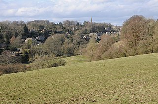
Bisley-with-Lypiatt is a civil parish in the Stroud district of Gloucestershire, England. It had a population of 2350 in 2019. It includes Bisley, Lypiatt, Eastcombe and Oakridge.
Rodborough is a large village and civil parish in the district of Stroud, Gloucestershire, in South West England. It is directly south of the town of Stroud, north of the town of Nailsworth and north-west of the town of Minchinhampton. The parish includes the settlements of Bagpath, Butterrow, Kingscourt, Lightpill and Rooksmoor, and is adjacent to the Stroud suburb of Dudbridge. The population taken at the 2011 census was 5,334.

Nympsfield is a village and civil parish in the English county of Gloucestershire. It is located around four miles south-west of the town of Stroud. As well as Nympsfield village, the parish contains the hamlet of Cockadilly. The population taken at the 2011 census was 382.

Frampton Mansell is a small English village 5 miles east-south-east of Stroud, Gloucestershire, in the parish of Sapperton. It lies off the A419 road between Stroud and Cirencester. It has a prominent mid-19th century, Grade II listed church with a set of five original stained-glass windows.

Bussage is a village in Gloucestershire, England, in the district of Stroud.

Standish is a small village and civil parish in the Stroud local government district in Gloucestershire, England.
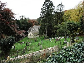
Randwick is a village bordering the market town of Stroud in Gloucestershire, England, the United Kingdom. It is known locally for its folk traditions such as the Randwick Wap, a celebration of May Day, and its annual pantomime.

Hunts Grove is a new village being built on the southern edge of the city of Gloucester. Building began in 2010 and is expected to continue into the 2030s.

Epney is a small village in the civil parish of Longney and Epney, in the Stroud district, in Gloucestershire, England, on the River Severn, 8 miles (13 km) South-West of Gloucester. It is between Longney and Upper Framilode. The village has a pub called The Anchor Inn.

Longney is a village in the civil parish of Longney and Epney, in the Stroud district, in Gloucestershire, England, on the River Severn 5 miles south-west of Gloucester. The parish is long and narrow and the main trades are agricultural, with several farms throughout. Longney is the Saxon name meaning a long island. The population of the Longney and Epney parish is 285 (2011).
