Related Research Articles

The Bass Coast Shire is a local government area in Victoria, Australia, located in the southeastern part of the state. It covers an area of 866 square kilometres (334 sq mi) and in June 2018 had a population of 35,327. It includes the towns of Bass, Cape Paterson, Cape Woolamai, Corinella, Coronet Bay, Cowes, Inverloch, Kilcunda, Lang Lang, Newhaven, Rhyll, San Remo, Summerlands and Wonthaggi as well as the historic locality of Krowera. It also includes the popular tourist destination Phillip Island. It was formed in 1994 from the amalgamation of the Shire of Bass, Shire of Phillip Island, Borough of Wonthaggi, parts of the Shire of Woorayl, Shire of Korumburra and City of Cranbourne.
Jumbunna is a town in South Gippsland, Victoria, Australia. The name is taken from the eastern Kulin language of the Bunnerong tribe and means "a place to meet and talk".
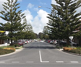
Wonthaggi is a seaside town located 132 kilometres (82 mi) south east of Melbourne via the South Gippsland and Bass highways, in the Bass Coast Shire of Gippsland, Victoria, Australia. Known originally for its coal mining, it is now the largest town in South Gippsland, a regional area with extensive tourism, beef and dairy industries.
Kilcunda is a seaside town located 117 kilometres (73 mi) south east of Melbourne between Phillip Island and Wonthaggi near Dalyston via the South Gippsland Highway on the Bass Highway, in the Bass Coast Shire of Gippsland, Victoria, Australia. Known originally as a train station near Wonthaggi, it is now the location of a very popular swimming hole at the Bourne Creek Trestle Bridge and at the 2016 census, Kilcunda had a population of 578.
The Bass Coast Rail Trail is a rail trail located in the Bass Coast Shire of Gippsland, Victoria, Australia.
The South Gippsland railway line is a partially closed railway line in Victoria, Australia. It was first opened in 1892, branching from the Orbost line at Dandenong, and extending to Port Albert. Much of it remained open until December 1994. Today, only the section between Dandenong and Cranbourne remains open for use. The section of the line from Nyora to Leongatha was used by the South Gippsland Tourist Railway until it ceased operations in 2016. The section from Nyora to Welshpool, with extension trail to Port Welshpool and a portion of the former line at Koo Wee Rup, have been converted into the Great Southern Rail Trail.
The South Gippsland Railway was a tourist railway located in South Gippsland, Victoria, Australia. It controlled a section of the former South Gippsland railway line between Nyora and Leongatha, and operated services from Leongatha to Nyora, via Korumburra, the journey taking about 65 minutes.
Nyora is a railway station on the former South Gippsland line in South Gippsland, Victoria, Australia.

The Wonthaggi railway line is a closed railway line located in South Gippsland, Victoria, Australia. Its primary purpose was to serve the State Coal Mine but the line also provided passenger and general goods services. The line was opened in 1910 and closed in 1978.
Woodleigh was a railway station on the Wonthaggi line, in Victoria, Australia.

Kernot was a railway station in Victoria, Australia, built on the Wonthaggi railway line. Not long after the line opened the station was equipped with a 10,000-gallon tank and crane, and was located within walking distance of the Kernot General Store which closed at the same time as the line did in 1978.
Almurta was a railway station on the Wonthaggi railway line, located on the Bass Coast in Victoria. It operated from the opening of the Wonthaggi line in 1910, until the line closed in 1978. It was originally announced that the station would be called "Rees", but that name never seems to have been applied.
Glen Forbes was a railway station on the Wonthaggi railway line, located on the Bass Coast, Victoria, Australia. The station opened with the line in 1910 and was originally called "Kernot". The name was changed to Glen Forbes in 1915. The station operated until the early 1970s, shortly before the closure of the Wonthaggi line.
Dalyston was a railway station on the Wonthaggi railway line, in the Bass Coast area of Victoria. The station opened with the line and operated until the line's closure in 1978. A short distance beyond Dalyston a line branched off to Dudley Area, one of the many "mining branches" on the line. There is almost no trace left of the station. The Bass Coast Rail Trail now runs thought the site.

State Mine was a railway yard and signal box on the Wonthaggi line in Bass Coast, Victoria, Australia. It was named for and served the adjacent State Coal Mine which provided black coal for the steam locomotives of the Victorian Railways. The mine opened in 1909 with the branchline opened in 1910. Production declined in the 1930s as larger seams were worked out but remained in operation until 1968 when regular steam operations were phased out.

Wonthaggi was a railway station located in the town of Wonthaggi, Victoria, Australia. Built to serve the town as well as the State Coal Mine, the station was the official terminus station of the Wonthaggi line, but two short branch lines continued from the station, leading to the Kirrak and Eastern Area mine extensions.

Kirrak was a railway branch line, it was built in 1939 to service the Kirrak Coal mine located near the town of Wonthaggi, Australia. The last day of operation of the mine was Fri 20 December 1968. Monash Railway Club chartered the local 102 hp [75 kW] Walker railmotor to travel to State mine and to Kirrak mine that day. The last wagons of coal were not removed from Kirrak until the end of the month. All references to the line were removed from railway records in 1976. The photo in the external link was taken at State mine, not at Kirrak.

The Tatanagar–Bilaspur section is part of the Howrah–Nagpur–Mumbai line and connects Tatanagar in the Indian state of Jharkhand and Bilaspur in Chhattisgarh. Part of one of the major trunk lines in the country, it passes through an industrial-mining area and handles high volumes of freight, particularly coal and iron ore.

The State Coal Mine, also known as State Coal Mine Heritage Area, is a former 20th-century state-owned black coal mine located in Wonthaggi, Victoria, Australia. The mine was operational from 1910 until 1968 and is now a state park and tourist attraction.

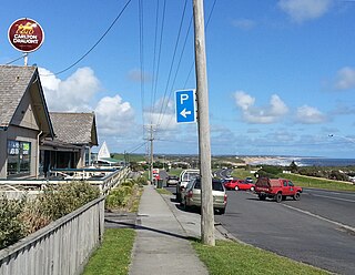
Dalyston is a seaside town located 125 kilometres (78 mi) south east of Melbourne via the South Gippsland and Bass Highways, in the Bass Coast Shire of Gippsland, Victoria, Australia. Known originally as a train station at Powlett River near Wonthaggi, it is now the location of the Victorian Desalination Plant, and at the 2011 census, it had a population of 606. It's Bass Coast’s fastest-growing suburb, with the 2011 census showing Dalyston’s population more than doubled from 278 residents in 2006 to 606 in 2011.
References
38°37′21″S145°35′48″E / 38.6225°S 145.5966°E
| | This article about rail transport in Victoria, Australia is a stub. You can help Wikipedia by expanding it. |