
Westville is a neighborhood of the city of New Haven, Connecticut. The area is positively reviewed for its walkability, diverse population, and livability. It is more expensive than the average American city, has lower crime rates, and graduates children from high school at rates above the national average.

The Sweet Auburn Historic District is a historic African-American neighborhood along and surrounding Auburn Avenue, east of downtown Atlanta, Georgia, United States. The name Sweet Auburn was coined by John Wesley Dobbs, referring to the "richest Negro street in the world," one of the largest concentrations of African-American businesses in the United States. A National Historic Landmark District was designated in 1976, covering 19 acres (7.7 ha) of the neighborhood, significant for its history and development as a segregated area under the state's Jim Crow laws.

The Hampton Terrace Historic District, originally called the Lakewood Manor Subdivision, is a U.S. historic district located in the Old Seminole Heights neighborhood of Tampa, Florida. The district is roughly bounded by Hanna Avenue to the north, 15th Street to the east, Nebraska Avenue to the west, and Hillsborough Avenue to the south. Hampton Terrace Historic District was so designated by its inclusion in the National Register of Historic Places on January 27, 1999.
The Armada Road Multi-Family District is a U.S. historic district in Venice, Florida. The district is bounded by Granada Avenue, Harbor Drive South, Armada Road South, and Park Boulevard South, encompasses approximately 160 acres (0.65 km2), and contains 11 historic buildings. On December 18, 1989, it was added to the U.S. National Register of Historic Places.
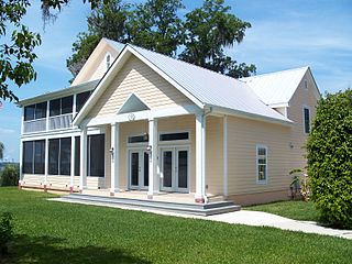
The Tenney House and Groveland Hotel is a historic site in Federal Point, Florida. It is located at 100 and 102 Commercial Avenue. On October 30, 1997, it was added to the U.S. National Register of Historic Places.

The Lewis Mausoleum is a historic mausoleum in Jacksonville, Florida. It is located in Memorial Cemetery, at the junction of Edgewood Avenue and Moncreif Road. On October 24, 1997, it was added to the U.S. National Register of Historic Places.

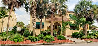
The Valencia Hotel and Arcade is a historic hotel in Venice, Florida. It is located at 229 West Venice Avenue. On November 10, 1994, it was added to the U.S. National Register of Historic Places.

The Johnson Schoolcraft Building is a historic site in Venice, Florida. It is located at 201-203 West Venice Avenue. On December 27, 1996, it was added to the U.S. National Register of Historic Places.

The Edge House is a historic house located at 1218 West Broad Street in Groveland, Florida. It is locally significant as an excellent example of a Queen Anne Style residence, and is also the only example of this style in the City of Groveland.

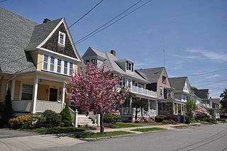
Edgewood Historic District is a historic district located in the west-central portion of New Haven, Connecticut. It was listed on the National Register of Historic Places in 1986. A predominantly residential area roughly bisected by Edgewood Avenue, a broad boulevard which features a large central esplanade and forms the principal east-west artery through the heart of the district. The area includes 232 contributing buildings, 4 other contributing structures, and 1 contributing object. Most of these were built between about 1888 and 1900, and represent the city's first neighborhood planned under the tenets of the City Beautiful movement. They are generally either Queen Anne or Colonial Revival in style, and are set on larger lots.

The Dixie Coca-Cola Bottling Company Plant, also known as Baptist Student Center, or Baptist Collegiate Ministry, Georgia State University, is a historic building at 125 Edgewood Avenue in Atlanta, Georgia. Built in 1891, it was the headquarters and bottling plant of the Dixie Coca-Cola Bottling Company, and the place where the transition from Coca-Cola as a drink served at a soda fountain to a mass-marketed bottled soft drink took place. It was declared a National Historic Landmark in 1983, and is one of the only buildings in Atlanta dating to Coca-Cola's early history. Since 1966 the building has been the Baptist Student Ministry location for Georgia State University.

The Edgewood Historic District–Taft Estate Plat is a historic district in Cranston, Rhode Island that is bounded by Windsor Road, Narragansett Bay, Circuit Drive and Broad Street. The district represents the final subdivision of a country estate amassed by industrialist Orray Taft (1793-1865). It was laid out in 1904 and most of its residential stock was built between 1905 and 1930. The average size of the lots was 5400 square feet, although there was some variance in size, and a one-acre plot was reserved for the Taft mansion. The houses are architecturally heterogeneous, reflecting all of the major styles of the period; some properties were designed by Norman Isham.
Edgewood Historic District may refer to:
The city of New Haven, Connecticut has many distinct neighborhoods. In addition to Downtown, centered on the central business district and the Green, are the following neighborhoods: the west central neighborhoods of Dixwell and Dwight; the southern neighborhoods of The Hill, historic water-front City Point, and the harborside district of Long Wharf; the western neighborhoods of Edgewood, West River, Westville, Amity, and West Rock; East Rock, Cedar Hill, Prospect Hill, and Newhallville in the northern side of town; the east central neighborhoods of Mill River and Wooster Square, an Italian-American neighborhood; Fair Haven, an immigrant community located between the Mill and Quinnipiac rivers; Quinnipiac Meadows and Fair Haven Heights across the Quinnipiac River; and facing the eastern side of the harbor, The Annex and East Shore.

Riverside and Avondale are two adjacent and closely associated neighborhoods, alternatively considered one continuous neighborhood, of Jacksonville, Florida. The area is primarily residential, but includes some commercial districts, including Five Points, the King Street District, and the Shoppes of Avondale.

The Edgewood Historic District–Shaw Plat is a residential historic district in the Edgewood neighborhood of northeastern Cranston, Rhode Island. It is bounded by Broad Street on the west, Marion Avenue on the south, and Narragansett Bay on the east; it consists of the properties that line the parallel streets, Shaw and Marion Avenues, and the short section of Narragansett Boulevard that runs between Shaw and Marion Avenues. On the north, it abuts the separately-listed Edgewood Historic District–Arnold Farm Plat. The area was platted out between 1867 and 1895, with the construction of most of its housing taking place between 1867 and the start of World War II, with the most construction going on between 1895 and 1930. The district also includes the previously listed Edgewood Yacht Club. In 1853, the 25 acres of land that became the Shaw Plat was sold to Allen Shaw of Providence for $3,660.

The Edgewood Historic District–Arnold Farm Plat is a residential historic district in the Edgewood neighborhood of eastern Cranston, Rhode Island. It is bounded on the north by Albert Avenue, on the east by Narragansett Bay, on the south by Columbia Avenue, and on the west by Broad Street. The district was primarily built out as a streetcar suburb of Providence between 1890 and 1930, and feature styles from Queen Anne and Colonial Revival to Dutch Colonials and two- and three-decker multiunit houses. Prior to its development, the area had been farmed by several generations of the Arnold family.

The Edgewood Historic District–Anstis Greene Estate Plat is a residential historic district in the Edgewood neighborhood of eastern Cranston, Rhode Island. The 34-acre (14 ha) area is bounded on the west by Broad Street, the east by Narragansett Bay, the south by Rosewood Avenue, and on the north by Marion Avenue, where it abuts the Edgewood Historic District-Shaw Plat. The area, originally part of a much larger property belonging to Zachariah Rhodes in the 17th century, was platted for residential development in the decades following the arrival of the streetcar on Broad Street, providing commuter service to Providence. The land was willed by Anstis Rhodes Greene to a group of heirs, who progressively developed their individual portions. The only significant surviving elements that predate this development are two small family cemeteries.
The Edgewood Historic District–Sally Greene Homestead Plats is a residential historic district in the Edgewood neighborhood of eastern Cranston, Rhode Island. Bounded by Glen Avenue to the north, Broad Street to the west, Massasoit Street to the south, and the Providence River to the east, this area was developed between 1900 and 1963 as a streetcar suburb for middle and lower middle class residents on what was once a country estate. The district was listed on the National Register of Historic Places in 2016.


