Related Research Articles
Continental drift is the hypothesis that the Earth's continents have moved over geologic time relative to each other, thus appearing to have "drifted" across the ocean bed. The idea of continental drift has been subsumed into the science of plate tectonics, which studies the movement of the continents as they ride on plates of the Earth's lithosphere.

The National Cooperative Soil Survey Program (NCSS) in the United States is a nationwide partnership of federal, regional, state, and local agencies and institutions. This partnership works together to cooperatively investigate, inventory, document, classify, and interpret soils and to disseminate, publish, and promote the use of information about the soils of the United States and its trust territories. The activities of the NCSS are carried out on national, regional, and state levels.

Maryland Route 146 is a state highway in the U.S. state of Maryland. The state highway runs 16.81 miles (27.05 km) from MD 45 in Towson north to MD 23 near Jarrettsville. MD 146 connects Towson with Loch Raven Reservoir, an impoundment of Gunpowder Falls. The state highway also serves the northern Baltimore County community of Jacksonville and Jarrettsville in western Harford County. MD 146 was constructed as two different state highways on either side of Loch Raven Reservoir. The section of the state highway in Towson was built in the 1910s and the portion through Jacksonville to Jarrettsville was constructed in the late 1920s and early 1930s. The gap in MD 146 through Loch Raven Reservoir was filled in two steps of maintenance swaps in the early 1960s and late 1970s.

Florence Bascom was an American pioneer for women as a geologist and educator. Bascom became an anomaly in the 19th century when she earned two bachelor's degrees. Earning a Bachelor of Arts in 1882, and a Bachelor of Science in 1884 both at the University of Wisconsin. Shortly after, in 1887, Bascom earned her master's degree in geology at the University of Wisconsin. Bascom was the second woman to earn her PhD in geology in the United States, in 1893. Receiving her PhD from Johns Hopkins University, this made her the first woman to earn a degree at the institution. After earning her doctorate in geology, in 1896 Bascom became the first woman to work for the United States Geological Survey as well as being one of the first women to earn a master's degree in geology. Bascom was known for her innovative findings in this field, and led the next generation of female geologists. Geologists consider Bascom to be the "first woman geologist in America".

U.S. Route 13 (US 13) is a United States Numbered Highway running from Fayetteville, North Carolina, north to Morrisville, Pennsylvania. In the U.S. state of Maryland, the route runs 42.48 miles (68.36 km) from the Virginia border south of Pocomoke City in Worcester County north to the Delaware border in Delmar, Wicomico County, where the route intersects Maryland Route 54 (MD 54)/Delaware Route 54 (DE 54), which runs along the state line. The majority of the route within Maryland is a four-lane divided highway that passes through rural areas of woodland and farmland. The route also runs through a few municipalities including Pocomoke City and Princess Anne and it bypasses Fruitland and Salisbury to the east on the Salisbury Bypass, which is a freeway. US 13 intersects many major roads including the southern terminus of US 113 in Pocomoke City, MD 413 in Westover, and MD 12 and US 50 where the route is on the Salisbury Bypass. The route shares a concurrency with US 50 along a portion of the Salisbury Bypass.
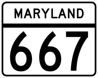
Maryland Route 667 is a state highway in the U.S. state of Maryland. The highway runs 17.61 miles (28.34 km) from Chesapeake Avenue in Crisfield east to U.S. Route 13 in West Pocomoke. MD 667 forms the old alignment of MD 413 from Crisfield to Hudson Corner in southern Somerset County. The highway has a curvaceously course through the villages of Hopewell and Marion Station while MD 413 passes them on a straight course. The portion of MD 667 between Hudson Corner and West Pocomoke serves the community of Rehobeth. This segment, which was built as Maryland Route 406, serves as a shortcut allowing traffic between Crisfield and Pocomoke City to avoid Westover at the junction of MD 413 and US 13. Portions of MD 667 are part of the Beach to Bay Indian Trail.
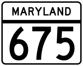
Maryland Route 675 is a collection of state highways in the U.S. state of Maryland. These two highways are sections of old alignment of U.S. Route 13 in Princess Anne in Somerset County and Delmar in northern Wicomico County. MD 675 was designated after US 13 bypassed Princess Anne in the late 1950s. MD 675B was assigned several years after US 13 bypassed Delmar in the mid-1950s. MD 675A existed in Pocomoke City before it was replaced by US 13 Business in the mid-1990s.

The Aquia Formation is a geologic sandstone formation that extends from the upper Chesapeake Bay to the James River near Hopewell, Virginia. It consists of clayey, silty, very shelly, glauconitic sand. Fossil records indicate that this stratigraphic unit was created during the Paleocene.
The West Virginia Speleological Survey (WVaSS) is a speleological organization and ongoing cave survey program that has gathered information and published about West Virginia caves and karst since 1967.
Robert Thomas Hill was a significant figure in the development of American geology during the late 19th and early 20th centuries. As a pioneer Texas geologist, Hill discovered and named the Comanche series of the Lower Cretaceous, and was a lifelong student of the structure and stratigraphy of the Cretaceous deposits of Central Texas and neighboring regions.
Geologic mapping of Georgia is the creation of geologic maps—special-purpose maps made to show geological features—of the State of Georgia in the United States. Rock units or geologic strata are shown by colors or symbols to indicate where they are exposed at the surface. Structural features such as faults and shear zones are also shown. Since the first national geological map, in 1809, there have been numerous maps which included the geology of Georgia. The first Georgia-specific geologic map was created in 1825. The most recent state-produced geologic map of Georgia, by the Georgia Department of Natural Resources is 1:500,000 scale, and was created in 1976 by the department's Georgia Geological Survey. It was generated from a base map produced by the United States Geological Survey. The state geologist and Director of the Geological Survey of Georgia was Sam M. Pickering, Jr. Since 1976, several geological maps of Georgia, featuring the state's five distinct geologic regions, have been produced by the federal government.

Edmund Johnston Garwood was a British geologist and President of the Geological Society of London from 1930 to 1932.
The Raritan Formation is a Cretaceous (Turonian) sedimentary geologic formation of the Atlantic Coastal Plain.
The Patuxent Formation is a Cretaceous geologic formation of the Atlantic coastal plain.

Florida's Hazelhurst terrace and shoreline is an ancient relict shoreline or delta present in the southeastern United States's Atlantic seaboard dating from the Late Miocene to Early Pliocene.

Glen Dale Farm is a historic farm property at 1455 Cider Mill Road in Cornwall, Vermont. Its 3.5-acre (1.4 ha) property, which includes five contributing buildings, was listed as Glen Dale on the National Register of Historic Places in 2002. Farmed since the 1770s, the farm achieved prominence in the second half of the 19th century as one of the nation's top breeding sites of merino sheep.

The Cambrian Hardyston Formation or Hardyston Quartzite is a mapped bedrock unit in Pennsylvania and New Jersey.

Robinson Magisterial District is one of ten magisterial districts in Mason County, West Virginia, United States. The district was originally established as a civil township in 1863, and converted into a magisterial district in 1872. In 2020, Robinson District was home to 3,166 people.
References
- 1 2 Memorial of Edward Bennett Mathews, American Mineralogist (1945) 30 (3-4): 135–141.
- ↑ A Short History of the Maryland Geological Survey, Maryland Department of Natural Resources. Accessed 29 June 2022.
| International | |
|---|---|
| National | |
| People | |
| Other | |