
The United Kingdom Hydrographic Office (UKHO) is the UK's agency for providing hydrographic and marine geospatial data to mariners and maritime organisations across the world. The UKHO is a trading fund of the Ministry of Defence (MoD) and is located in Taunton, Somerset, with a workforce of approximately 900 staff.

Admiralty charts are nautical charts issued by the United Kingdom Hydrographic Office (UKHO) and subject to Crown Copyright. Over 3,500 Standard Nautical Charts (SNCs) and 14,000 Electronic Navigational Charts (ENCs) are available with the Admiralty portfolio offering the widest official coverage of international shipping routes and ports, in varying detail.

Sir George Henry Richards was Hydrographer of the Royal Navy from 1863 to 1874.
Vice Admiral Sir Henry Mangles Denham was a Royal Navy officer who went on to be Commander-in-Chief, Pacific Station.
George Edward Richards (1852–1927) was a British naval officer and hydrographer. He commanded the survey ship HMQS Paluma which in the late 19th century surveyed the Great Barrier Reef in Queensland, Australia. Richards served aboard the schooner Renard in 1878, and HMQS Paluma in 1887. He was commanding officer of HMS Rambler surveying the Strait of Belle Isle in 1897.

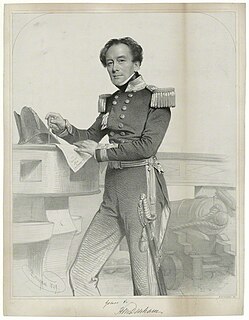
Admiral Henry Wolsey Bayfield was a British naval officer and surveyor.

Captain Frederick William Leopold Thomas, c.1812–1885, RN, FSA (Scot) was a naval officer, photographer, and historian, noted for his surveys of Scotland, and for taking the first photographs of St Kilda.

The Hydrographer of the Navy is the principal hydrographical Royal Naval appointment. From 1795 until 2001, the post was responsible for the production of charts for the Royal Navy, and around this post grew the United Kingdom Hydrographic Office (UKHO).
Rear-Admiral George Stephen Ritchie CB DSC was a British admiral noted for his cartographic and hydrographic work.
Admiral Byron Drury (1815–1888) was a British naval officer.
Admiral Martin White was an officer of the Royal Navy. He worked his way up the ranks during a 53-year career; retiring as Captain and made up to Admiral in retirement and settling in Jersey. He was particularly known for gathering and publishing nautical data and mappings of the Channel Islands, English Channel, French Coast, Bristol Channel and Irish Sea and even gained a mention in the French Maritime Atlas of the 1800s.
Peter Frederick Shortland was a British naval officer and hydrographic surveyor. He was noted for his work in North America, and for surveys involving deep soundings, particularly in preparation for the laying of submarine cables.

Henry Charles Otter was a Royal Navy officer and hydrographic surveyor, noted for his work in charting Scotland in the mid-19th century. He was active in surveying in the Baltic Sea during the war with Russia (1853-6) and in supporting the laying of the first transatlantic telegraph cable in 1858.

John Augustine Edgell was an officer in the Royal Navy and Hydrographer of the Navy from 1932 to 1945. He was noted for his support for innovations such as echo sounding and radio navigation, for the surveying and chart production operations of his department during World War II, and for his advocacy of the science of oceanography

William Hewett was a Royal Navy officer noted for making the first comprehensive survey of the North Sea and for his work on tides.

George Thomas was a Master in the Royal Navy who was one of the early surveyors of the coasts of Great Britain

Sir Herbert Edward Purey-Cust, KBE, CB was an officer in the Royal Navy and Hydrographer of the Navy from 1909 to 1914.

Charles Gepp Robinson was a Royal Navy Officer and hydrographic surveyor particularly noted for his survey work in the west of Scotland.

Sir Archibald Day was an officer in the Royal Navy and Hydrographer of the Navy from 1950-1955. He played an important part in planning the evacuation from Dunkirk in 1940, and wrote a history of the Hydrographic Service.

Admiral Admiral Frederic Bullock was a Royal Navy officer noted for his work as a surveyor, particularly in the Thames Estuary.

