El Impenetrable National Park

Last updated

El Impenetrable National Park
Parque Nacional El Impenetrable
Parque Nacional El Impenetrable.jpg
Relief Map of Argentina.jpg
Red pog.svg
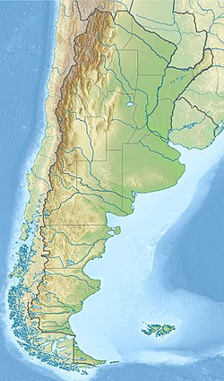
Location within Argentina
Location Chaco Province and Formosa Province, Argentina
Coordinates 25°00′34.2″S60°59′45.24″W / 25.009500°S 60.9959000°W / -25.009500; -60.9959000 Coordinates: 25°00′34.2″S60°59′45.24″W / 25.009500°S 60.9959000°W / -25.009500; -60.9959000
Area1,289 km2 (498 sq mi)
Established2017
Governing body Administración de Parques Nacionales

El Impenetrable National Park (Spanish : Parque Nacional El Impenetrable) is a national park in the Gran Chaco region of northern Argentina. It was established in 2014 on the lands of the former Estancia La Fidelidad, which were expropriated after the owner, Manuel Roseo, was murdered in 2011 in an attempt to gain control of the estate. The park opened to visitors in 2017. [1] [2] It is the largest natural park in northern Argentina, with a total area of approximately 128,000 hectares. [1] [2]

Related Research Articles

<span class="mw-page-title-main">Geography of Argentina</span> Geographic features of Argentina

The geography of Argentina describes the geographic features of Argentina, a country located in Southern South America. Bordered by the Andes in the west and the South Atlantic Ocean to the east, neighbouring countries are Chile to the west, Bolivia and Paraguay to the north, and Brazil and Uruguay to the northeast.

<span class="mw-page-title-main">Buenos Aires</span> Capital and largest city of Argentina

Buenos Aires, officially the Autonomous City of Buenos Aires, is the capital and primate city of Argentina. The city is located on the western shore of the Río de la Plata, on South America's southeastern coast. "Buenos Aires" can be translated as "fair winds" or "good airs", but the former was the meaning intended by the founders in the 16th century, by the use of the original name "Real de Nuestra Señora Santa María del Buen Ayre", named after the Madonna of Bonaria in Sardinia, Italy. Buenos Aires is classified as an alpha global city, according to the Globalization and World Cities Research Network (GaWC) 2020 ranking.

<span class="mw-page-title-main">Formosa Province</span> Province of Argentina

Formosa Province is a province in northeastern Argentina, part of the Gran Chaco Region. Formosa's northeast end touches Asunción, Paraguay, and the province borders the provinces of Chaco and Salta to its south and west, respectively. The capital is Formosa.

<span class="mw-page-title-main">Río Negro Province</span> Province of Argentina

Río Negro is a province of Argentina, located in northern Patagonia. Neighboring provinces are from the south clockwise Chubut, Neuquén, Mendoza, La Pampa and Buenos Aires. To the east lies the Atlantic Ocean.

<span class="mw-page-title-main">Ushuaia</span> City in Tierra del Fuego, Argentina

Ushuaia is the capital of Tierra del Fuego, Antártida e Islas del Atlántico Sur Province, Argentina. With a population of nearly 80,000 and a location below the 54th parallel south latitude, Ushuaia claims the title of world's southernmost city. A smaller city with fewer than 3,000 inhabitants, Puerto Williams in Chile, is nearer to the 55th parallel south, at a latitude of 54°56' S compared to Ushuaia at 54°48' S.

<span class="mw-page-title-main">Argentina national football team</span> Mens association football team

The Argentina national football team represents Argentina in men's international football and is administered by the Argentine Football Association, the governing body for football in Argentina.

<span class="mw-page-title-main">Tourism in Argentina</span>

Argentina has a vast territory and a variety of climates and microclimates ranging from tundra and polar in the south to the tropical climate in the north, through a vast expanse of temperate climate. Natural wonders include the Aconcagua, the highest mountain in the world outside the Himalayas, the widest river and estuary of the planet, the Iguazú Falls, the Humid Pampas, and the Argentine Sea. Visitors enjoy the culture, customs and Argentine cuisine.

<span class="mw-page-title-main">Entre Ríos Province</span> Province of Argentina

Entre Ríos is a central province of Argentina, located in the Mesopotamia region. It borders the provinces of Buenos Aires (south), Corrientes (north) and Santa Fe (west), and Uruguay in the east.

<span class="mw-page-title-main">Neuquén Province</span> Province of Argentina

Neuquén is a province of Argentina, located in the west of the country, at the northern end of Patagonia. It borders Mendoza Province to the north, Rio Negro Province to the southeast, and Chile to the west. It also meets La Pampa Province at its northeast corner.

<span class="mw-page-title-main">San Juan Province, Argentina</span> Province of Argentina

San Juan Province is a province of Argentina, located in the western part of the country. Neighbouring provinces are, moving clockwise from the north, La Rioja, San Luis and Mendoza. It borders with Chile to the west.

<span class="mw-page-title-main">La Rioja Province, Argentina</span> Province of Argentina

La Rioja is a province of Argentina located in the west of the country. The landscape of the province consist of a series of arid to semi-arid mountain ranges and agricultural valleys in between. It is in one of these valleys that the capital of the province, the city of la La Rioja, lies. Neighboring provinces are from the north clockwise Catamarca, Córdoba, San Luis and San Juan. The dinosaur Riojasaurus is named after the province.

<span class="mw-page-title-main">Gran Chaco</span> Region of south-central Southern America

The Gran Chaco or Dry Chaco is a sparsely populated, hot and semiarid lowland natural region of the Río de la Plata basin, divided among eastern Bolivia, western Paraguay, northern Argentina, and a portion of the Brazilian states of Mato Grosso and Mato Grosso do Sul, where it is connected with the Pantanal region. This land is sometimes called the Chaco Plain.

<span class="mw-page-title-main">Bwindi Impenetrable National Park</span> National park in Uganda

The Bwindi Impenetrable National Park (BINP) is in southwestern Uganda. The park is part of the Bwindi Impenetrable Forest and is situated along the Democratic Republic of the Congo (DRC) border next to the Virunga National Park and on the edge of the Albertine Rift. Composed of 321 square kilometres (124 sq mi) of both montane and lowland forest, it is accessible only on foot. BINP is a United Nations Educational, Scientific and Cultural Organization-designated World Heritage Site.

<span class="mw-page-title-main">Bermejo River</span>

The Bermejo River is a river in South America that flows from Bolivia to the Paraguay River in Argentina. The river is generally called Bermejo in spite of its different names along its way, but it also has its own Native American names; in Wichí it is called Teuco, and in Guaraní it is called Ypitá. In the plains of Argentina's Gran Chaco the Bermejo forms wetlands and splits into two branches. The southern branch is the bed of the old Bermejo River, now an intermittent stream called Río Bermejito. The northern branch is now the main stem of the Bermejo and is called the Teuco River, Bermejo Nuevo, or simply the Bermejo River. The two branches rejoin at 25°39′S60°11′W, near Villa Río Bermejito, forming the Lower Bermejo River.

<span class="mw-page-title-main">Provincial park</span> Protected area managed at the provincial level

A provincial park is a park administered by one of the provinces of a country, as opposed to a national park. They are similar to state parks in other countries. They are typically open to the public for recreation. Their environment may be more or less strictly protected.

<span class="mw-page-title-main">El Calafate</span> City in Santa Cruz Province, Argentina

El Calafate, also known as Calafate, is a city in Patagonia, Argentina. It is situated on the southern border of Lake Argentino, in the southwest part of the Santa Cruz Province, about 320 kilometres (200 mi) northwest of Río Gallegos. The name of the city is derived from a little bush with yellow flowers and dark blue berries that is very common in Patagonia: the calafate ; the word comes from the word calafate, which is Spanish for 'caulk'.

<span class="mw-page-title-main">Monte Quemado</span> Municipality and village in Santiago del Estero, Argentina

Monte Quemado is a municipality and village in Santiago del Estero in Argentina. It is the capital city of the Copo Department, Province of Santiago del Estero, Argentina, in the Chaco Austral region, practically in the El Impenetrable phytogeographic zone. It lies on national road RN 16, a route that runs parallel to a branch of the General Manuel Belgrano Railway and the aqueduct diverter from the Salado del Norte River known as the Canal de Dios. Precisely in Monte Quemado it starts as a branch of the aqueduct, the branch that goes to the south is called the Virgen del Carmen Canal, which runs parallel to provincial road RP 5 that connects Monte Quemado with Campo Gallo. Another land route which coincides with the RN 16 and RP 5 in Monte Quemado is provincial road RP 4.

<span class="mw-page-title-main">CD Aguiluchos USA</span> Football club

Club Deportivo Aguiluchos USA is an American soccer club, founded in 2012 and based in Oakland, California, that competes in the West Region, Golden Gate Conference of the National Premier Soccer League, the fourth division of the American soccer pyramid.

The 2030 FIFA World Cup will be the 24th FIFA World Cup, a quadrennial international football tournament contested by the men's national teams of the member associations of FIFA. The event will mark the centennial of the first World Cup.

References

  1. 1 2 Mark Johanson (15 September 2018). Argentina's Impenetrable forest opens up. The Guardian. Accessed August 2020.
  2. 1 2 El Impenetrable National Park. The Conservation and Land Trust. Archived 24 August 2017.