Related Research Articles

A microwave radiometer (MWR) is a radiometer that measures energy emitted at one millimeter-to-metre wavelengths (frequencies of 0.3–300 GHz) known as microwaves. Microwave radiometers are very sensitive receivers designed to measure thermally-emitted electromagnetic radiation. They are usually equipped with multiple receiving channels to derive the characteristic emission spectrum of planetary atmospheres, surfaces or extraterrestrial objects. Microwave radiometers are utilized in a variety of environmental and engineering applications, including remote sensing, weather forecasting, climate monitoring, radio astronomy and radio propagation studies.

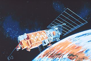
The Nimbus satellites were second-generation U.S. robotic spacecraft launched between 1964 and 1978 used for meteorological research and development. The spacecraft were designed to serve as stabilized, Earth-oriented platforms for the testing of advanced systems to sense and collect atmospheric science data. Seven Nimbus spacecraft have been launched into near-polar, sun-synchronous orbits beginning with Nimbus 1 on August 28, 1964. On board the Nimbus satellites are various instrumentation for imaging, sounding, and other studies in different spectral regions. The Nimbus satellites were launched aboard Thor-Agena rockets and Delta rockets.
The Special Sensor Microwave/Imager (SSM/I) is a seven-channel, four-frequency, linearly polarized passive microwave radiometer system. It is flown on board the United States Air Force Defense Meteorological Satellite Program (DMSP) Block 5D-2 satellites. The instrument measures surface/atmospheric microwave brightness temperatures (TBs) at 19.35, 22.235, 37.0 and 85.5 GHz. The four frequencies are sampled in both horizontal and vertical polarizations, except the 22 GHz which is sampled in the vertical only.

The coastal zone color scanner (CZCS) was a multi-channel scanning radiometer aboard the Nimbus 7 satellite, predominately designed for water remote sensing. Nimbus 7 was launched 24 October 1978, and CZCS became operational on 2 November 1978. It was only designed to operate for one year (as a proof-of-concept), but in fact remained in service until 22 June 1986. Its operation on board the Nimbus 7 was limited to alternate days as it shared its power with the passive microwave scanning multichannel microwave radiometer.
The Scanning Multichannel Microwave Radiometer (SMMR) [pronounced simmer] was a five-frequency microwave radiometer flown on the Seasat and Nimbus 7 satellites. Both were launched in 1978, with the Seasat mission lasting less than six months until failure of the primary bus. The Nimbus 7 SMMR lasted from 25 October 1978 until 20 August 1987. It measured dual-polarized microwave radiances, at 6.63, 10.69, 18.0, 21.0, and 37.0 GHz, from the Earth's atmosphere and surface. Its primary legacy has been the creation of areal sea-ice climatologies for the Arctic and Antarctic.

GCOM, is a JAXA project of long-term observation of Earth environmental changes. As a part of Japan's contributions to GEOSS, GCOM will be continued for 10 to 15 years with observation and utilization of global geophysical data such as precipitation, snow, water vapor, aerosol, for climate change prediction, water management, and food security. On May 18, 2012, the first satellite "GCOM-W" was launched. On December 23, 2017, the second satellite "GCOM-C1" was launched.
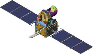
Megha-Tropiques was a satellite mission to study the water cycle in the tropical atmosphere in the context of climate change. A collaborative effort between Indian Space Research Organisation (ISRO) and French Centre National d’Etudes Spatiales (CNES), Megha-Tropiques was successfully deployed into orbit by a PSLV rocket in October 2011.
NOAA-7, known as NOAA-C before launch, was an American operational weather satellite for use in the National Operational Environmental Satellite System (NOESS) and for the support of the Global Atmospheric Research Program (GARP) during 1978-1984. The satellite design provided an economical and stable Sun-synchronous platform for advanced operational instruments to measure the atmosphere of Earth, its surface and cloud cover, and the near-space environment. An earlier launch, NOAA-B, was scheduled to become NOAA-7, however NOAA-B failed to reach its required orbit.

Measurement of sea ice is important for safety of navigation and for monitoring the environment, particularly the climate. Sea ice extent interacts with large climate patterns such as the North Atlantic oscillation and Atlantic Multidecadal Oscillation, to name just two, and influences climate in the rest of the globe.
The microwave sounding unit (MSU) was the predecessor to the Advanced Microwave Sounding Unit (AMSU).
NOAA-6, known as NOAA-A before launch, was an American operational weather satellite for use in the National Operational Environmental Satellite System (NOESS) and for the support of the Global Atmospheric Research Program (GARP) during 1978-1984. The satellite design provided an economical and stable Sun-synchronous platform for advanced operational instruments to measure the atmosphere of Earth, its surface and cloud cover, and the near-space environment.
NOAA B was an American operational weather satellite for use in the National Operational Environmental Satellite System (NOESS) and for the support of the Global Atmospheric Research Program (GARP) during 1978-1984. The satellite design provided an economical and stable Sun-synchronous platform for advanced operational instruments to measure the atmosphere of Earth, its surface and cloud cover, and the near-space environment.
Collocation is a procedure used in remote sensing to match measurements from two or more different instruments. This is done for two main reasons: for validation purposes when comparing measurements of the same variable, and to relate measurements of two different variables either for performing retrievals or for prediction. In the second case the data is later fed into some type of statistical inverse method such as an artificial neural network, statistical classification algorithm, kernel estimator or a linear least squares. In principle, most collocation problems can be solved by a nearest neighbor search, but in practice there are many other considerations involved and the best method is highly specific to the particular matching of instruments. Here we deal with some of the most important considerations along with specific examples.
Sea ice concentration is a useful variable for climate scientists and nautical navigators. It is defined as the area of sea ice relative to the total at a given point in the ocean. This article will deal primarily with its determination from remote sensing measurements.

ADEOS I was an Earth observation satellite launched by NASDA in 1996. The mission's Japanese name, Midori means "green". The mission ended in July 1997 after the satellite sustained structural damage to the solar panel. Its successor, ADEOS II, was launched in 2002. Like the first mission, it ended after less than a year, also following solar panel malfunctions.
The Weddell Polynya, or Weddell Sea Polynya, is a polynya or irregular area of open water surrounded by sea ice in the Weddell Sea of the Southern Ocean off Antarctica and near the Maud Rise. The formation of the polynya exposes relatively warmer ocean waters to a cold atmosphere, leading to a large exchange of heat which drives deep convection in the ocean, often reaching depths of a 1,000 to 2,000 meters.
Nimbus 7 was a meteorological satellite. It was the seventh and last in a series of the Nimbus program.
Nimbus 5 was a meteorological satellite for the research and development of sensing technology. It was the fifth successful launch in a series of the Nimbus program.
Nimbus 6 was a meteorological satellite. It was the sixth in a series of the Nimbus program.
NOAA-8, known as NOAA-E before launch, was an American weather satellite operated by the National Oceanic and Atmospheric Administration (NOAA) for use in the National Environmental Satellite Data and Information Service (NESDIS). It was first of the Advanced TIROS-N series of satellites. The satellite design provided an economical and stable Sun-synchronous platform for advanced operational instruments to measure the atmosphere of Earth, its surface and cloud cover, and the near-space environment.
References
- ↑ Robert J. Gurney; James L. Foster; Claire L. Parkinson (1993). Atlas of satellite observations related to global change. Cambridge University Press. pp. 371–. ISBN 978-0-521-43467-6.