Related Research Articles

The Nez Perce are an Indigenous people of the Plateau who still live on a fraction of the lands on the southeastern Columbia River Plateau in the Pacific Northwest. This region has been occupied for at least 11,500 years.

The Snake River is a major river in the interior Pacific Northwest region of the United States. About 1,080 miles (1,740 km) long, it is the largest tributary of the Columbia River, which is the largest North American river that empties into the Pacific Ocean. Beginning in Yellowstone National Park, western Wyoming, it flows across the arid Snake River Plain of southern Idaho, the rugged Hells Canyon on the borders of Idaho, Oregon and Washington, and finally the rolling Palouse Hills of southeast Washington. It joins the Columbia River just downstream from the Tri-Cities, Washington, in the southern Columbia Basin.
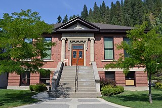
Shoshone Countyshə-SHOHN is a county in the U.S. state of Idaho. As of the 2020 census, the population was 13,169. The county seat is Wallace and the largest city is Kellogg. The county was established in 1864, named for the Native American Shoshone tribe.

Lewis County is a county located in the north central region of the U.S. state of Idaho. As of the 2020 census, the population was 3,533, making it the fourth-least populous county in Idaho. The county seat is Nezperce, and Kamiah is the largest city. Partitioned from Nez Perce County and established in 1911, it was named after the explorer Meriwether Lewis. Most of the county is within the Nez Perce Indian Reservation, though Native Americans comprise less than 6% of the county population. Similar to the opening of lands in Oklahoma, the U.S. government opened the reservation for white settlement in November 1895. The proclamation had been signed less than two weeks earlier by President Cleveland.

Idaho County is a county in the U.S. state of Idaho, and the largest by area in the state. As of the 2020 census, the population was 16,541. The county seat is Grangeville. Previous county seats of the area were Florence (1864–68), Washington (1868–75), and Mount Idaho (1875–1902).

Clearwater County is a county located in the U.S. state of Idaho. As of the 2020 census, the population was 8,734. The county seat is Orofino. Established in 1911, the county was named after the Clearwater River. The county is home to North Fork of the Clearwater River, and a small portion of the South Fork and the main Clearwater. Also in the county are the Dworshak Reservoir, Dworshak State Park, Dworshak National Fish Hatchery, and the Dworshak Dam, third highest in the U.S. The modest Bald Mountain ski area is located between Orofino and Pierce.

Pierce is a city in the northwest United States, located in Clearwater County, Idaho. The population was 508 at the 2010 census, down from 617 in 2000.

The Nez Perce War was an armed conflict in 1877 in the Western United States that pitted several bands of the Nez Perce tribe of Native Americans and their allies, a small band of the Palouse tribe led by Red Echo (Hahtalekin) and Bald Head, against the United States Army. Fought between June and October, the conflict stemmed from the refusal of several bands of the Nez Perce, dubbed "non-treaty Indians," to give up their ancestral lands in the Pacific Northwest and move to an Indian reservation in Idaho Territory. This forced removal was in violation of the 1855 Treaty of Walla Walla, which granted the tribe 7.5 million acres of their ancestral lands and the right to hunt and fish on lands ceded to the U.S. government.

North Central Idaho is an area which spans the central part of the state of Idaho and borders Oregon, Montana, and Washington. It is the southern half of the state's Panhandle region and is rich in agriculture and natural resources. Lewis and Clark traveled through this area on their journey to the Pacific Ocean in September 1805, crossing Lolo Pass and continuing westward in canoes on the Clearwater River. They returned the following spring on their way eastward.

The Nez Perce National Forest is a 4,000,000-acre (16,000 km2) United States National Forest located in west-central Idaho. The forest is bounded on the east by the state of Montana, on the north by the Clearwater National Forest, on the west by a portion of the Wallowa–Whitman National Forest and on the south by the Payette National Forest.
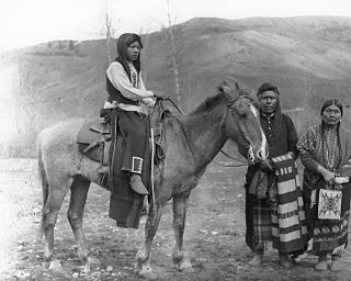
The Palouse are a Sahaptin tribe recognized in the Treaty of 1855 with the United States along with the Yakama. It was negotiated at the 1855 Walla Walla Council. A variant spelling is Palus. Today they are enrolled in the federally recognized Confederated Tribes and Bands of the Yakama Nation and some are also represented by the Colville Confederated Tribes, the Confederated Tribes of the Umatilla Indian Reservation and Nez Perce Tribe.
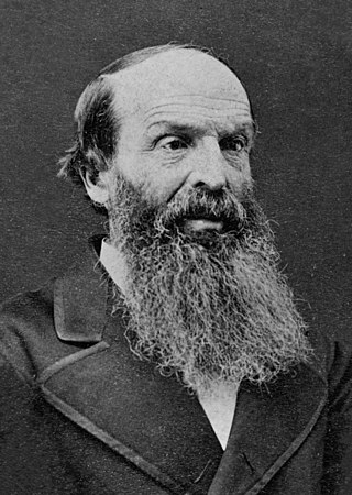
Henry Harmon Spalding (1803–1874) and his wife Eliza Hart Spalding (1807–1851) were prominent Presbyterian missionaries and educators working primarily with the Nez Perce in the U.S. Pacific Northwest. The Spaldings and their fellow missionaries were among the earliest Americans to travel across the western plains, through the Rocky Mountains and into the lands of the Pacific Northwest to their religious missions in what would become the states of Idaho and Washington. Their missionary party of five, including Marcus Whitman and his wife Narcissa and William H. Gray, joined with a group of fur traders to create the first wagon train along the Oregon Trail.
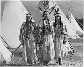
The Sahaptin are a number of Native American tribes who speak dialects of the Sahaptin language. The Sahaptin tribes inhabited territory along the Columbia River and its tributaries in the Pacific Northwest region of the United States. Sahaptin-speaking peoples included the Klickitat, Kittitas, Yakama, Wanapum, Palus, Lower Snake, Skinpah, Walla Walla, Umatilla, Tenino, and Nez Perce.

Idaho State Highway 11 (SH-11) is a state highway in north central Idaho. It runs 42.481 miles (68.37 km) from U.S. Route 12 near Greer, north to Forest Service Roads 246 and 247 near Headquarters.
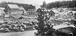
Florence is a ghost town in Idaho County, Idaho, United States. About 14 air miles (22 km) east-northeast of present-day Riggins in remote north central Idaho at an elevation of 6,080 feet (1,850 m). It was settled as a mining camp in the winter of 1861. Almost concurrent with its settlement, Washington Territory established Idaho County on December 20, 1861, in anticipation of a gold rush that brought over 9,000 residents within the first year., The town quickly became the seat with the first district court taking place at Florence on 22 September 1862. While the rich placer gold fields in the Florence Basin brought thousands of prospectors and contributed to the establishment of Idaho Territory in 1863, the rush to Florence was short-lived as intensive mining depleted the richest ground. At the first census of Idaho Territory, only 575 residents remained. By the territorial census of 1864, the population dwindled further to 254 residents. Even in its decline, Florence continued as the county seat until 1 June 1869 when the territorial legislature moved the county seat to the Warren's Camp settlement of Washington. The town thrived again from 1895–1900, based more on lode mining. Then the town slowly faded away, having only ten inhabitants in 1940, and was totally abandoned sometime after 1951.
William Craig was an American frontiersman and trapper. He left his Virginia home as a young man and headed west, after allegedly killing a man in self-defense. He trapped with the Sublettes and Jedediah Smith in the Blackfoot country until he joined Joseph R. Walker's California Expedition of 1833–34.

The following works deal with the cultural, political, economic, military, biographical and geologic history of pre-territorial Idaho, Idaho Territory and the State of Idaho.
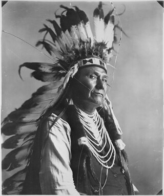
The Battle of Cottonwood was a series of engagements July 3–5, 1877, in the Nez Perce War between the Native American Nez Perce people, and U.S. Army soldiers and civilian volunteers. Near Cottonwood, Idaho Territory, the Nez Perce, led by Chief Joseph, brushed aside the soldiers and continued their 1,170 miles (1,880 km) fighting retreat to cross the Rocky Mountains in an attempt to reach safety in Canada.
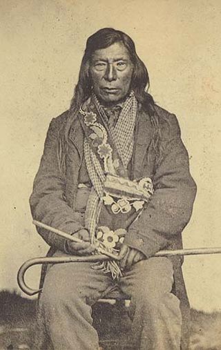
Hallalhotsoot, also Hal-hal-tlos-tsot or "Lawyer" was a leader of the Niimíipu and among its most famous, after Chief Joseph. He was the son of Twisted Hair, who welcomed and befriended the exhausted Lewis and Clark Expedition in 1805. His mother was a Flathead woman. Lawyer learned the languages of his parents and knew some English.
The history of Walla Walla, Washington begins with the settling of Oregon Country, Fort Nez Percés, the Whitman Mission and Walla Walla County, Washington.
References
- ↑ "Disputing the "Facts"". Myricopia. 2018-01-04. Retrieved 2024-06-02.
- 1 2 1848 Mexican War discharge paper for Elias D. Pierce. National Archives Bounty Land file #52221.
- ↑ Deed from Elliott and Elizabeth Nixon to Elias D. Pierce, transcribed in "John Doe on demise of Elias D. Pierce v. Sweetser" Indiana Supreme Court 1850. Indiana State Archives.
- ↑ Burcham, Ralph Jr. (1950). Elias Davidson Pierce, Discoverer of Gold in Idaho: A Biographical Study. University of Idaho Graduate School, Moscow, Idaho: Unpublished thesis. p. 8.
- 1 2 3 4 5 "Elias Davidson Pierce and the Founding of Pierce Number 8". idahohistory.contentdm.oclc.org. Retrieved 2024-06-02.
- ↑ Brosnan, C. J. (1918). History of the State of Idaho. New York, Chicago, Boston: Charles Scribner's Sons. pp. 90.
- 1 2 "Clearwater Historicl Museum History". 2011-03-04. Archived from the original on 2011-03-04. Retrieved 2024-06-02.