Else (Werre)

Last updated
Else
Bifurkation-Melle.JPG
The bifurcation near Melle: the Else is on the right and the Hase on the left.
Location
CountryGermany
States North Rhine-Westphalia and Lower Saxony
Reference no.DE: 466
Physical characteristics
Source 
  locationOrigin: Bifurcation from the Hase near Melle
  coordinates 52°12′16″N8°15′22″E / 52.20444°N 8.25611°E / 52.20444; 8.25611
  elevationca. 79.9 m above  sea level (NN)
Mouth  
  location
Near Kirchlengern/Löhne into the Werre
  coordinates
52°11′56″N8°40′42″E / 52.19889°N 8.67833°E / 52.19889; 8.67833
  elevation
ca. 52 m above  sea level (NN)
Length31.5 km (19.6 mi) [1]
Basin size415.5 km2 (160.4 sq mi) [1]
Basin features
Progression WerreWeserNorth Sea
Landmarks
Population100000
Tributaries 
  leftOldendorfer Mühlenbach, Zwickenbach, Eickener Mühlenbach, Suttbach, Kilverbach, Bennier Graben, Ahler Bruchgraben, Darmühlenbach, Gewinghauser Bach, Knollerbach, Ostbach (Mühlenbach), Eselsbach, Markbach, Sunderbach
  rightStrotbach, Laerbach, Maschgraben, Violenbach, Bruchriede, Mühlenbach, Alte Else, Warmenau, Neue Else with Werfener Bach, Brandbach (Bolldammbach)

The Else is a left tributary of the river Werre in the northeast of North Rhine-Westphalia and in southern Lower Saxony. The Else is a distributary of the river Hase and begins at a river bifurcation near Melle.

Contents

Origin

The River Else does not have a source but originates at a hydrological phenomenon known as a river bifurcation. The bifurcation is near Gesmold (part of the borough of Melle) in Lower Saxony, where the river Else branches off the river Hase (at Hase river kilometre 158.9). The bifurcation may have been created or established artificially; or at least maintained artificially. This is however unclear. In history there were disputes over the distribution of water that was able to be controlled by man-made means. For example, the entire water flow could be diverted either into the River Hase or River Werre during conflicts. Today the Hase loses a third of its water mass at the bifurcation. The Hase flows northwest to the Ems, while the Else flows east to the Weser.

Course

The River Else flows slowly through the Ravensberg Hills and through the wetlands known as the Else meadows (Elseauen). The Else and Werre valleys, which were formed during the ice age, are bordered in the south by the Teutoburg Forest and in the north by the ridge of the Wiehen Hills. After the bifurcation in Melle the river flows east into North Rhine-Westphalia, passing the state border at river kilometre 19.2 and crossing Rödinghausen and Bünde, before discharging, after a distance of approximately 35 km, into the Werre near the eastern edge of Kirchlengern. The Werre swings east at its mouth by almost 90°, thus aligning itself with the west-to-eastern course of the Else. The River Else passes under the A 30 federal motorway three times (at Gesmold (km 33), at Bruchmühlen (km 22) and at Bünde (km 15). The Else Valley Bridge crosses the river at Kirchlengern. The Else is dammed several times along its length. A particularly large number of weirs is located on the lower reaches between Bünde and its mouth; the Else's velocity here is controlled over a short distance by 4 weirs.

Tributaries

Delta of River Else in River Werre Elsemundung.JPG
Delta of River Else in River Werre

Designated tributaries, which flow into river Else or the parallel led river Neue Else are (from bifurcation to mouth):

(L/R; KM): Left right supply, with river kilometer, delta with km 0)

Watershed

Distributary Neue Else near Bunde Die Neue Else Buende.JPG
Distributary Neue Else near Bünde

The watershed of river Else has a size of 414,6 km². In the watershed approximately live 100,000 people.

The following municipalities lie at river Else:

In addition to the watershed lie totally or partly:

Nature reserve

On the North-Rhine/Westphalian side there are two adjacent nature reserves with the same name of Elseaue ("Else water meadows") with a total area of 117 hectares (290 acres). The reserves were established in 1994 and 1995. The area lies north of the Else and south of the railway line from Löhne to Osnabrück along a 3.5 km long section of the river. The area is protected, because it is a near-natural floodplain in the middle of the intensively farmed Ravensberg Land. On the floodplain, the remnants of former river courses of the Else may be recognized. The floodplain is largely turned over to grassland with flood banks. The steep river banks, up to 3m high, are a haven for the kingfisher.

Tourism

In Bünde there is an association for canoe sports. Due to its good water quality, fishing in always possible in the river. In addition the Else-Werre cycle way on the river continues to lead along and of the delta into the Werre up to the Weser.

See also

Related Research Articles

<span class="mw-page-title-main">Teutoburg Forest</span> Forest in Germany, site of a major Roman defeat

The Teutoburg Forest is a range of low, forested hills in the German states of Lower Saxony and North Rhine-Westphalia. Until the 17th century, the official name of the hill ridge was Osning. It was first renamed the Teutoburg Forest in 1616 in commemoration of the Battle of the Teutoburg Forest in 9 AD, which most likely took place at Kalkriese instead.

<span class="mw-page-title-main">Wiehen Hills</span> Hill range in North Rhine-Westphalia and Lower Saxony in Germany

The Wiehen Hills are a hill range in North Rhine-Westphalia and Lower Saxony in Germany. The hills run from west to east like a long finger away from the main upland area of the Lower Saxon Hills, beginning at the Weser River near Minden and terminating in the vicinity of Osnabrück. It is the northernmost of the German Central Upland ranges extending into the Northern Lowlands. Their highest hill is the Heidbrink near Lübbecke with an altitude of 320 metres (1,050 ft).

<span class="mw-page-title-main">Bünde</span> Town in North Rhine-Westphalia, Germany

Bünde is a town in the Herford district, in North Rhine-Westphalia, Germany.

<span class="mw-page-title-main">Hase</span> River in Lower Saxony, Germany

The Hase is a 169.7-kilometre-long (105.4 mi) river of Lower Saxony, Germany. It is a right tributary of the Ems, but part of its flow goes to the Else, that is part of the Weser basin. Its source is in the Teutoburg Forest, south-east of Osnabrück, on the north slope of the 307-metre-high (1,007 ft) Hankenüll hill.

<span class="mw-page-title-main">Löhne</span> Town in North Rhine-Westphalia, Germany

Löhne is a town in the district of Herford, in North Rhine-Westphalia, Germany.

<span class="mw-page-title-main">Kirchlengern</span> Town in North Rhine-Westphalia, Germany

Kirchlengern is a municipality in the district of Herford, in North Rhine-Westphalia, Germany.

<span class="mw-page-title-main">Rödinghausen</span> Municipality in North Rhine-Westphalia, Germany

Rödinghausen is a municipality in the district of Herford, in North Rhine-Westphalia, Germany.

<span class="mw-page-title-main">Werre</span> River in Germany

The Werre is a river in the Detmold region (Regierungsbezirk) of North Rhine-Westphalia, Germany, left tributary of the Weser. Its source is near Horn-Bad Meinberg. The Werre flows generally north through the towns Detmold, Lage, Bad Salzuflen, Herford and Löhne. It flows into the Weser close to Bad Oeynhausen. The total length of the Werre is 71.9 km. It crosses the districts of Lippe, Herford and Minden-Lübbecke.

<span class="mw-page-title-main">Große Aue</span> River in Germany

The Große Aue is an 88-kilometre-long (55 mi), southwestern, left tributary of the River Weser in northern North Rhine-Westphalia and central Lower Saxony in Germany.

<span class="mw-page-title-main">Bünde station</span> Railway station in Bünde, Germany

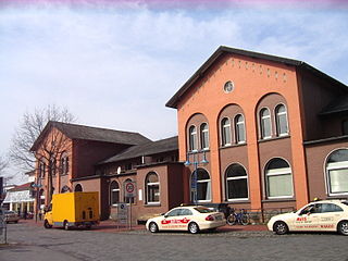
Bünde (Westf) station is located in Bünde in the German state of North Rhine-Westphalia on the Löhne–Rheine railway and Rahden–Herford railway. The rail services are operated by Deutsche Bahn, WestfalenBahn and Eurobahn.

The Ahler Bruchgraben is a left tributary of the River Else in the northeast of the German federal states of North Rhine-Westphalia and Lower Saxony. The stream is part of the Weser basin and drains a small area of the Ravensberg Hills.

<span class="mw-page-title-main">Löhne–Rheine railway</span> Railway line in Germany

The Löhne–Rheine railway is a two-track, continuously electrified railway main line from Löhne in the German state of North Rhine-Westphalia via Osnabrück in Lower Saxony to Rheine in North Rhine-Westphalia. It runs parallel to the Wiehen Hills to the north and to the Teutoburg Forest to the south. The line opened in 1855 and 1856 and was one of the oldest railways in Germany.


Beckendorfer Mühlenbach is a 6.3 km long river in northeast North Rhine-Westphalia, Germany. It is a tributary of the Schwarzbach, and is a part of the Beckendorfer Mühlenbachtal Nature Reserve.

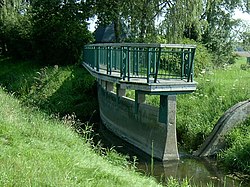
Mühlenbach is a small river of North Rhine-Westphalia, Germany. It is a right tributary of the Werre in Löhne.
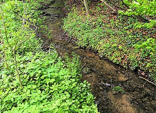
<span class="mw-page-title-main">Rehmerloh-Mennighüffer Mühlenbach</span> River in Germany

Rehmerloh-Mennighüffer Mühlenbach is a river of North Rhine-Westphalia, Germany. It is a left tributary of the Werre. Its source is near the village Oberbauerschaft. It flows generally southeast through the villages Quernheim, Rehmerloh and Ulenburg, and joins the Werre east of Löhne.

<span class="mw-page-title-main">Bassum–Herford railway</span> Railway line in Germany

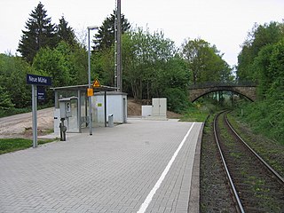
The Bassum–Herford Railway is a now partially disused railway line from Herford in the German state of North Rhine-Westphalia via Bünde to Bassum in Lower Saxony.

The Ems-Leine-Express is the name of a German Regional-Express service in North Rhine-Westphalia that has connected the Emsland city of Rheine, Lower Saxony, the regional centre of Osnabrück, the east Westphalian city of Minden and the Lower Saxony regional centres of Hanover and Braunschweig since 5 November 2000.

The Weser-Bahn is the name used in the German state of North Rhine-Westphalia (NRW) for a Regionalbahn service that connects Bünde in NRW via Löhne, Rinteln, Hamelin, Elze to Hildesheim. The section of the route from Rinteln to Hildesheim lies in the state of Lower Saxony. The service is numbered as RB 77 in NRW.

References