This article needs additional citations for verification .(September 2020) |
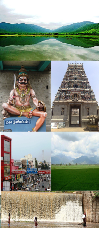
Elumathur is a township in the Indian state of Tamil Nadu. It is located 19 km south of Erode, in the western part of Tamil Nadu.
Contents
The native language is Tamil.
This article needs additional citations for verification .(September 2020) |
Elumathur is a township in the Indian state of Tamil Nadu. It is located 19 km south of Erode, in the western part of Tamil Nadu.
The native language is Tamil.
Elumathur is part of the Modakkurichi constituency. Elections for the legislative assembly are held every five years. It is a part of the Erode constituency that votes for parliamentary elections. It is a part of a gram panchayat . Elections are held every five years for panchayat president.
https://findmygov.in/en/tamil-nadu/erode/modakurichi-block/elumathur
Small villages located in Elumathur panchayat include Mosuvan Palli, Avvalur, Pudhupalayam, Kaarakaattu Valasu, Muthuiayan Valasu, Aathikaattu Valasu, and Mettupalayam.
Cultural practices resemble those in other parts of Tamil Nadu. The majority of the people are Hindus, while Christians and Muslims constitute minor proportions. [1] [ failed verification ]
As of the 2011 Population Census, the population of Elumathur was 8929: 4389 males and 4540 females among a total of 2712 families. 726 children were age 6 and under, comprising 8.13 8.13% of the total population. [2]
The percentage of people below the poverty line is around 3%, much lower than the national average of 29.8% and the state average of 17.1%.
The primary occupation is agriculture. For cultivation, farmers depend on water resources from Bhavani Sagar and Mettur dam. The soil is predominantly black, along with some red loamy soil.

Gobichettipalayam is the Selection grade municipality in the Indian state of Tamil Nadu. It is the administrative headquarters of Gobichettipalayam taluk. It is situated at the center of the South Indian Peninsula, 37 kilometres (23 mi) from the district headquarters Erode ,44 kilometres (27 mi) north of Tiruppur and 80 kilometres (50 mi) east of Coimbatore. Agriculture and textile industries contribute majorly to the economy of the town and is popularly known as the rice bowl of western Tamil Nadu. The town is situated at 213 metres (699 ft) above sea level, surrounded by Western Ghats.

Bhavani is a Municipality in Erode District, Tamil Nadu, India. It is located at the northern periphery of Erode City Municipal Corporation and is around 105 km (65 mi) from Coimbatore and 60 km (37 mi) from Tiruppur and Salem. Bhavani is also known as "Carpet City" as it is known for its carpet industry; blankets and carpets manufactured in the town are known as Bhavani Jamakkalam. As of 2011, the town covers an area of 2.17 square kilometres (0.84 sq mi) and has a population of 39,225. It is a grade II municipality.
Perundurai is a Special Grade Town Panchayat in Erode district in the Indian state of Tamil Nadu. Perundurai is the only special grade town panchayat among 42 in the district. Perundurai has developed as the industrial center with SIPCOT Industrial Estate and SEZ Complex. It is the Asia's Second largest SIPCOT.
Thuvakudi is a town in Tiruchirapalli district in the Indian state of Tamil Nadu. It is an industrial town housing more than 250 industries and is located in the National Highway NH 65 between Tiruchirapalli and Thanjavur. The town has a dry weather, making it suitable for dry crops like cotton, chillies and millets..

Tiruchendur is a municipality located in Thoothukudi District, Tamil Nadu, India. It is home to the Arulmigu Subramaniya Swamy Temple, which is one of the Six Abodes of Murugan.

Karur District is one of the 38 districts in the Indian state of Tamil Nadu. The main town in Karur District is the city of Karur, which is also the district headquarters. The district has a population of 1,064,493 with a sex-ratio of 1,015 females for every 1,000 males, according to 2011 census.
Kilpennathur is a Panchayat Town in Tiruvanamalai district in the Indian state of Tamil Nadu. Kilpennathur is one of the taluks of Tiruvannamalai district and an assembly constituency of Tamil Nadu. The MLA of Kilpennathur assembly constituency is DMK party Mr. K. Pichandi. Vettavalam is the most populous town panchayat in this taluk. Kilpennathur is located a 12.25 degrees latitude and 79.224 degrees longitude. Nearest towns are Avalurpet, Vettavalam, Gingee and Tiruvannamalai, and Chennai is about 177 km away.

Kulithalai is a municipality in Karur district & Sub-urb of Tiruchirapalli City in the Indian state of Tamil Nadu. The recorded history of Kulithalai is known from Cheras, followed by medieval Chola period of the 9th century and has been ruled, at different times, by the Medieval Cholas, Later Cholas, Later Pandyas, Vijayanagar Empire and the British.
Modakurichi is a Panchayat town and Taluk headquarters in Erode district in the Indian state of Tamil Nadu. It is located as a suburb of Erode City, at a distance of 15 km from Erode City Central Bus Terminus and 8 km from Solar Bus Station. Karur main road 2 km from modakurichi (Thurapalayam-panjalingapuram).

Pallipalayam is a Municipality in Namakkal district in Komarapalayam taluk in the Indian state of Tamil Nadu. It is the headquarter of the Pallipalayam block

Papanasam is a panchayat town in Thanjavur district in the Indian state of Tamil Nadu. It is located 25 kilometres (16 mi) from Thanjavur and 15 kilometres (9.3 mi) from Kumbakonam. The name literally translates to "Destruction of Sins" in the Tamil language. It is the suburban region of Kumbakonam.
Peranamallur is a panchayat town in Tiruvanamalai district in the Indian state of Tamil Nadu.
Peravurani is a panchayat town in Thanjavur district in the Indian state of Tamil Nadu. It is the administrative headquarters of the Peravurani Taluk and Peravurani. It is declared as Selection Grade Town Panchayat.

Thiruthuraipoondi is a municipality in Tiruvarur district in the Indian state of Tamil Nadu. Thiruthuraipoondi is an agricultural town located south of Thiruvarur district. The town is located at a distance of 28 km from the district headquarters Thiruvarur.
Vellakovil is a municipal town in Kangeyam taluk of Tirupur District, in the Indian state of Tamil Nadu. It is located on National Highway 81 between Trichy and Coimbatore. The town is spread in an area of 64.75 km2. As of 2011, the town had a population of 40,359. Kannapuram village located near to this town is famous for Kangeyam breed cattle market that happens on every year during Mariyamman temple festival in the month of April. It is an industrialized town with traditional agriculture being the occupation for most of the people. It holds lot of Power looms weaving bedsheets, floor mats and cotton materials being exported to foreign countries via exporters present in Karur.
Pallapalayam is a Town panchayat in Coimbatore district in the Indian state of Tamil Nadu.

Sendamangalam also known as Senthamangalam Taluka is a town panchayat in the Indian state of Tamil Nadu is situated in Namakkal District.

Koothanallur is a town in Tiruvarur district in the South Indian state of Tamil Nadu. The town is located at a distance of 20 km (12 mi) from the district headquarters Tiruvarur and 350 km (220 mi) from the state capital Chennai. Koothanallur is known for the Big Mosque. Sri Ramanatha Swamy Thirukovil, an ancient temple at Tirurameshwaram, is located 7 km (4.3 mi) far to Koothanallur, southerly.
Local bodies in Tamil Nadu constitute the three tier administration set-up in the South Indian state of Tamil Nadu. It is a system of local government which forms the last level from the Centre. Chennai Corporation in the then Madras Presidency, established in 1688, is the oldest such local body not only in India but also in any commonwealth nations outside United Kingdom.

Sendamangalam is a Taluk in the Indian state of Tamil Nadu is situated in Namakkal District.