
North Palm Beach County Airport, also known as North County Airport, is an uncontrolled general aviation airport located 12 nautical miles (22 km) northwest of West Palm Beach off the Bee Line Highway in Palm Beach Gardens, Florida. The airport is owned by Palm Beach County and operated by the Palm Beach County Airports Department.

Columbus Municipal Airport is three miles north of Columbus, in Bartholomew County, Indiana, United States.

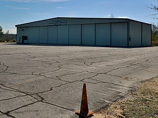
Grayling Army Airfield is a public/military use airport located one nautical mile (1.85 km) northwest of the central business district of Grayling, in Crawford County, Michigan, United States. It is owned by United States Army. The airfield is located 7 miles (11 km) northeast of the main cantonment area of Camp Grayling. It is included in the Federal Aviation Administration (FAA) National Plan of Integrated Airport Systems for 2017–2021, in which it is categorized as a general aviation facility.

Ephrata Municipal Airport is a public use airport located 4 km (2.5 mi) southeast of the central business district of Ephrata, a city in Grant County, Washington, United States. It is included in the National Plan of Integrated Airport Systems for 2011–2015, which categorized it as a general aviation airport.

Elkhart Municipal Airport is a city-owned public-use airport located three nautical miles (6 km) northwest of the central business district of Elkhart, a city in Elkhart County, Indiana, United States.

Allen Army Airfield is a public and military use airport serving Fort Greely and located three miles (5 km) south of the central business district of Delta Junction, a city in the Southeast Fairbanks Census Area of the U.S. state of Alaska. It is owned by the United States Army, which has an agreement with the City of Delta Junction for joint use of the airfield by both military and civilian aircraft.

Florala Municipal Airport is a city-owned public-use airport located three nautical miles northeast of the central business district of Florala, a city in Covington County, Alabama, United States.

Joliet Regional Airport is a public use airport located four nautical miles (7 km) west of the central business district of Joliet, a city in Will County, Illinois, United States. It is owned by the Joliet Park District.

Charleston Executive Airport is a public use airport located in Charleston in Charleston County, South Carolina, United States. It is approximately six nautical miles (11 km) southwest of the central business district of the city. It is owned by the Charleston County Aviation Authority. The airport serves the general aviation community, with no scheduled commercial airline service.

Virgil I. Grissom Municipal Airport is a public use airport located three nautical miles southeast of the central business district of Bedford, a city in Lawrence County, Indiana, United States.

Fairmont Municipal Airport is a city-owned public-use airport located two nautical miles (3.7 km) southeast of the central business district of Fairmont, a city in Martin County, Minnesota, United States.

Stanton Airfield is a public use airport located one nautical mile (1.85 km) east of the central business district of Stanton, in Goodhue County, Minnesota, United States. The airport is privately owned by Stanton Sport Aviation, Inc.
Shelbyville Municipal Airport is a public use airport located four nautical miles (7 km) northwest of the central business district of Shelbyville, in Shelby County, Indiana, United States. The airport is owned by the city of Shelbyville and is controlled by the mayor and an appointed Board of Commissioners. According to the FAA's National Plan of Integrated Airport Systems for 2009–2013, it was classified as a general aviation airport.
Frank Sikes Airport is a city-owned public-use airport located two nautical miles north of the central business district of Luverne, a city in Crenshaw County, Alabama, United States.
Franklin Field is a county-owned public-use airport in Bullock County, Alabama, United States. It is located five nautical miles west of the central business district of Union Springs, Alabama. It is included in the FAA's National Plan of Integrated Airport Systems for 2011–2015, which categorized it as a general aviation facility.
Alexandria Airport is a public use airport located three nautical miles (6 km) southeast of the central business district of Alexandria, a city in Madison County, Indiana, United States.
Jackson Municipal Airport is a city-owned public-use airport located two nautical miles north of the central business district of Jackson, a city in Jackson County, Minnesota, United States. It is included in the FAA's National Plan of Integrated Airport Systems for 2011–2015, which categorized it as a general aviation facility.
Boonville Airport is a city-owned, public-use airport located two nautical miles west of the central business district of Boonville, a city in Warrick County, Indiana, United States.

Warren Municipal Airport is a city-owned, public-use airport located three nautical miles (6 km) south of the central business district of Warren, a city in Bradley County, Arkansas, United States. It is included in the National Plan of Integrated Airport Systems for 2011–2015, which categorized it as a general aviation facility.
Frankfort Municipal Airport is a public airport located 3 miles (4.8 km) west of Frankfort, in Clinton County, Indiana, United States. The airport was founded in December 1960.


