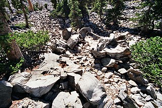
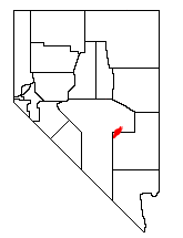
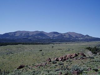
The Ely Range is a mountain range located in Lincoln County, southeastern Nevada. [1]
Ely Range was named after John H. Ely, a businessperson in the local mining industry. [2]
The Ely Range is a mountain range located in Lincoln County, southeastern Nevada. [1]
Ely Range was named after John H. Ely, a businessperson in the local mining industry. [2]

West Wendover is a small city in Elko County, Nevada, United States. The population was 4,512 at the 2020 census. It is part of the Elko micropolitan area. West Wendover is located on the eastern border of Nevada and the western edge of the Great Salt Lake Desert and is contiguous with Wendover, Utah, with which it is sometimes confused. It is home to five casinos and a cannabis dispensary which attract many visitors from neighboring Utah, where both casino gambling and non-medical cannabis are illegal. Interstate 80 runs just north of the cities, while Interstate 80 Business runs through the two cities.

Hawthorne is an unincorporated community and census-designated place (CDP) in Mineral County, Nevada, United States. As of the 2020 census, the population was 3,118. It is the county seat of Mineral County. The nearby Hawthorne Army Depot is the primary economic base of the town.
Prometheus was the oldest known non-clonal organism, a Great Basin bristlecone pine tree growing near the tree line on Wheeler Peak in eastern Nevada, United States. The tree, which was at least 4,862 years old and possibly more than 5,000, was cut down in 1964 by a graduate student and United States Forest Service personnel for research purposes. Those involved did not know of its world-record age before the cutting, and the circumstances and decision-making process remain controversial.

The Pequop Mountains are a mountain range located in eastern Elko County, in northeastern Nevada in the western United States. The range runs generally north-south for approximately 51 miles (82 km) The high point of the range is an unnamed peak located at 40°55.46'N and 114°35.38'W.
The Quinn Canyon Range is a remote group of mountains in northeastern Nye County, and western Lincoln County in central Nevada in the western United States. Adaven is the only settlement in the mountains, now abandoned.

The Toquima Range is a mountain range, located primarily in Nye County with a small extension into Lander County, in Nevada, United States. Most of the range is included within the Humboldt-Toiyabe National Forest. The range reaches a maximum elevation of 11,949 feet (3,642 m) at the southern summit of Mount Jefferson. From Hickison Summit on U.S. Route 50, the range runs for approximately 71 miles (114 km) to the south-southwest. To its west are Big Smoky Valley, scenic State Route 376, and the large Toiyabe Range. To the east are remote Monitor Valley and the Monitor Range. Lying to the south of the range are U.S. Route 6 (Nevada) and the community of Tonopah, while to the north is U.S. Route 50, leading to the small community of Austin.

The Salinian Block or Salinian terrane is a geologic terrane which lies west of the main trace of the San Andreas Fault system in California. It is bounded on the south by the Big Pine Fault in Ventura County and on the west by the Nacimiento Fault. It was named for the Salinas Valley in Monterey County, California.
Crystal is a former unincorporated community in Clark County, Nevada, United States. It lies along the Union Pacific Railroad and had a population of 10 in 1941. It is now the site of a highway rest stop.
Parsnip Peak Wilderness is a 43,693-acre (17,682 ha) wilderness in northeastern Lincoln County, Nevada. Its elevations range from 6,160 to 8,916 feet. It received wilderness status in 2004.
The Antelope Valley adjacent to the Nevada/Utah state line, and located in southeast Elko County and northeast White Pine County, Nevada is a 70 mi (113 km) long endorheic valley. The valley curves around the Dolly Varden and Kinsley Mountains, and the Antelope Range.
Fairview Peak may refer to

Hamlin Valley is a mostly north-south trending valley of the Great Basin located on both sides of the Nevada–Utah state line. It is about 60 miles (97 km) long. Its north-northeast end point adjacent the state line is the southwest start region of the Snake Valley.
Sprucemont is a ghost town in Elko County, in the U.S. state of Nevada. The GNIS classifies it as a populated place.

Shoshone is a rural, unincorporated community in White Pine County, Nevada. It is at the south end of State Route 894, off of U.S. Route 93, just west of Great Basin National Park. The community consists of approximately nine ranches situated one to three miles apart in a long valley. The historic mine site of Minerva is located in Shoshone.
Loray is an extinct town in Elko County in Nevada. The GNIS classifies it as a populated place.
Silver Zone is an extinct town in Elko County, in the U.S. state of Nevada. The GNIS classifies it as a populated place. The town was located at the mountain pass where the Feather River Route and Interstate 80 cross the Toano Range.
South Mountains are a range of mountains primarily in White Pine County, Nevada and partially to the east in Juab County, Utah. The range is sometimes referred to as the Deep Creek Mountains, or the Ibenpah Mountains. The South Mountains are divided from the Kern Mountains to the south by Tippett Canyon on the west and Pleasant Valley to the east. They are divided from the Deep Creek Range to the east in Utah by Johnson Canyon, on the north, and by Water Canyon on the south. The range is bounded on the north by Spring Creek Flat and on the west by Antelope Valley.
Spring Valley is a long north south trending basin, largely in White Pine County, Nevada and a small portion in the extreme south in Lincoln County, Nevada. It extends from 39°59′00″N114°29′33″W in White Pine County to the north to 38°33′57″N114°21′05″W in the south in Lincoln County. The bottom of the basin is at Yelland Dry Lake at an elevation of 5,551 feet. Bahsahwahbee, a grove of Rocky Mountain juniper trees, locally called swamp cedars, where multiple massacres of Western Shoshone people occurred in the 19th century, lies in Spring Valley. The Spring Valley Wind Farm is to its south.
Ferber Hills is a range of hills in Elko County, Nevada and Tooele County, Utah. The range is formed in three parallel ridges of hills trending northwest to southeast. Its highest summit is Utah Peak, in the center of the central ridge of the range, at an elevation of 6,680 feet, just east of the state line in Tooele County, Utah. Its second highest Summit is Ferber Peak, that rises to and elevation of 6,601 feet, at the south end of the southernmost ridge of the range at 40°12′43″N114°03′18″W just west of the state line in Elko County, Nevada. The highest point in the smaller northernmost ridge is an unnamed summit at 40°17′12″N113°59′48″W with an elevation of 5,745 feet in Tooele County.
Pleasant Valley, is a valley in two counties in two states adjacent states, White Pine County, Nevada and Juab County, Utah. Its mouth is located at an elevation of 5,682 feet in Utah. Its head is at 39°44′09″N114°09′53″W at an elevation of 6,965 feet in Nevada. It lies between the Kern Mountains on the south, and South Mountains to the northwest and the Deep Creek Range on the north.
38°26′08″N114°40′45″W / 38.4355095°N 114.6791678°W
| | This Lincoln County, Nevada state location article is a stub. You can help Wikipedia by expanding it. |