The SM Kirov Stadium was a multi-purpose stadium in St. Petersburg, Russia, and was one of the largest stadiums anywhere in the world. The stadium was named after Sergey Kirov.

Toukola is a neighbourhood of Helsinki, Finland, around 4 km north of the town centre, at the port of Vanhankaupunginlahti. Toukola is part of the administrative region of Vanhakaupunki.
Sadowice is a village in the administrative district of Gmina Kondratowice, within Strzelin County, Lower Silesian Voivodeship, in south-western Poland. Prior to 1945 it was in Germany.
Łąki is a village in the administrative district of Gmina Wałcz, within Wałcz County, West Pomeranian Voivodeship, in north-western Poland. It lies approximately 12 kilometres (7 mi) south of Wałcz and 125 km (78 mi) east of the regional capital Szczecin.
Çərəkən is a village in the Jabrayil District of Azerbaijan. It's been uninhabited since the forced exodus of its Azerbaijani population during the First Nagorno-Karabakh war.
Swojczany is a village in the administrative district of Gmina Charsznica, within Miechów County, Lesser Poland Voivodeship, in southern Poland. It lies approximately 2 kilometres (1 mi) west of Charsznica, 11 km (7 mi) north-west of Miechów, and 39 km (24 mi) north of the regional capital Kraków.
Grabówki is a village in the administrative district of Gmina Wieliczka, within Wieliczka County, Lesser Poland Voivodeship, in southern Poland. It lies approximately 4 kilometres (2 mi) south-west of Wieliczka and 12 km (7 mi) south-east of the regional capital Kraków.
Skotniki Dolne is a village in the administrative district of Gmina Wiślica, within Busko County, Świętokrzyskie Voivodeship, in south-central Poland. It lies approximately 8 kilometres (5 mi) north of Wiślica, 9 km (6 mi) south-west of Busko-Zdrój, and 53 km (33 mi) south of the regional capital Kielce.
Kolonia Piaski is a village in the administrative district of Gmina Kunów, within Ostrowiec County, Świętokrzyskie Voivodeship, in south-central Poland. It lies approximately 2 kilometres (1 mi) north of Kunów, 10 km (6 mi) north-west of Ostrowiec Świętokrzyski, and 48 km (30 mi) east of the regional capital Kielce.
Kolonia Lesznowola is a settlement in the administrative district of Gmina Lesznowola, within Piaseczno County, Masovian Voivodeship, in east-central Poland. It lies approximately 3 kilometres (2 mi) east of Lesznowola, 4 km (2 mi) north-west of Piaseczno, and 16 km (10 mi) south of Warsaw.
Trzebieszewo is a village in the administrative district of Gmina Kamień Pomorski, within Kamień County, West Pomeranian Voivodeship, in north-western Poland. It lies approximately 5 kilometres (3 mi) east of Kamień Pomorski and 65 km (40 mi) north of the regional capital Szczecin.
Tessa, Niger is a village and rural commune in Niger.

Donja Bresnica is a village in the municipality of Prokuplje, Serbia. According to the 2002 census, the village has a population of 219 people.
Pickerel is an unincorporated community in Pittsylvania County, in the U.S. state of Virginia.
Purushanda was an ancient city-state in central Anatolia, lying south of the Kızılırmak River in what is now modern Turkey. Its site has yet to be discovered. It may have been situated south-east of Lake Tuz, possibly on the mound of Acemhöyük approximately 6 kilometres (3.7 mi) north-west of the city of Aksaray. Another possible location is the mound of Karahöyük near Konya.

Marceaux is an unincorporated community in Vermilion Parish, Louisiana, United States.
Millport is an unincorporated community in Pickaway County, in the U.S. state of Ohio. The community is located between Ashville, Ohio and South Bloomfield, Ohio on Ohio State Route 316. As of 2019, the Millport has approximately 50 homes and has been incorporated into the Village of South Bloomfield.

Horcajo is an administrative neighborhood (barrio) of Madrid belonging to the district of Moratalaz. It has an area of 0.745503 km2 (0.287840 sq mi). As of 1 February 2020, it has a population of 6,453.
Summit Hills is a range of hills in Hidalgo County, New Mexico. Its tallest summit is 4,862 feet / 1,482 meters at 32°30′19″N108°58′23″W.

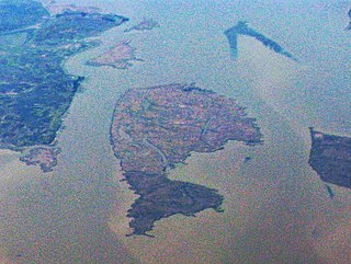
Snag Island is a small island in Suisun Bay, California. It is part of Solano County. Its coordinates are 38°04′22″N121°58′23″W.


