Empel

Last updated
Empel
Plaatsnaambord Empel.JPG
Map NL 's-Hertogenbosch-Empel.png
Country Netherlands
Province North Brabant
Municipality 's-Hertogenbosch
Area
  Total6.63 km2 (2.56 sq mi)
  Land5.72 km2 (2.21 sq mi)
  Water0.91 km2 (0.35 sq mi)
Population
5,160
  Density778/km2 (2,020/sq mi)

Empel is a village and former municipality, which is now a quarter of 's-Hertogenbosch in the Dutch province of North Brabant.

Contents

History

Archaeological evidence shows Celtic and Roman traces in the area. The site of a Roman temple was of special interest.

Sign at the castle park Empel en Meerwijk Castle sign.jpg
Sign at the castle park

In medieval times there were two Lordships (heerlijkheid) in the area. The Lordship of Empel and the Lordship of Meerwijk, but as they were always in one hand, they became known as Lordship of Empel en Meerwijk. The center was in the village now called Oud-Empel. Empel en Meerwijk Castle, the seat of the Lord of Empel en Meerwijk, was in an area called 'Het Slot', Dutch for 'The Castle'. When Empel village was moved later on, it came to lie inside the new Empel village.

During the Eighty Years' War the area suffered greatly, because it was in the frontline from 1579 till 1609, and then again from 1621 to 1629. Empel village was even abandoned for some decades, and the Castle was probably also ruined in these years. In 1585 the Battle of Empel was named for the village now called Oud-Empel.

In the eighteenth century the owner of the castle built a new manor Meerwijk Castle at Dieskant on the Dieze, hastening the decay of the medieval castle. During the French period the lordships were abolished, and the new municipality of Empel en Meerwijk was formed, with Empel village on the Meuse as seat of the municipal government.

In the closing phases of World War II Empel village on the Meuse dyke was heavily damaged. Its Catholic church was subsequently demolished. From about 1949 the village with church was rebuilt as an Angerdorf at the current location. This was southeast of the old village, which was then renamed Oud-Empel. A new townhouse was also built on the new location of Empel.

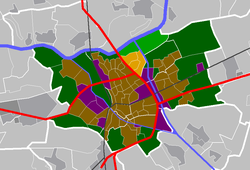
In 1971 the entire municipality of Empel en Meerwijk was absorbed by 's-Hertogenbosch municipality. [1] Empel then grew to a city quarter of 6,505 inhabitants. As a city quarter Empel includes the neighbourhoods: Maasakker, De Koornwaard, Empel-Oost and Empel-Zuid. Oud-Empel became part of Maaspoort.

Points of interest

Former seat of the municipality Empel, voormalig gemeentehuis Empel en Meerwijk.JPG
Former seat of the municipality

Empel was the ancient site of a temple dedicated to Hercules Magusanus . It is one of only a few religious monuments from Germania Inferior that can be interpreted with a fair degree of certainty. Hercules Magusanus was the Latin name of the supreme god of the Batavians. Many votive gifts have been found near the temple. Amongst these, the many used weapons indicate that this temple was indeed dedicated to a non-Roman god. [2] These archaeological traces are not visible for the public.

The Castle Park Kasteelpark Empel is an outdoor activity park. It shows the outline of the motte, keep and outer-bailey of former Empel en Meerwijk Castle. The park has a playground for children, a basketball court, a panna cage, a skatepark and a pétanque court. The park protects the archaeological remains of the castle, as well as those of a medieval brick oven. The latter is covered by the Empel Folly.

The Saint Landelinus Church was inaugurated on 25 December 1949. It replaced the Neogothic Landelinus Church of Oud-Empel which had been destroyed in 1945. The current church is a brick Christocentric church designed by the Tilburg architect N.H. Pontzen (1913-1979). The Stations of the Cross have been painted on the concrete pillars by Egbert Deckers. A cross was made by Albert Termote  [ nl ]. Frans van der Burgt made a sculpture of Anthony the Great. A triptych by Léon Wiegman depicts the Miracle of Empel.

The recently dug Máxima Canal (2014) is just east of Empel. It is sided by bicycle lanes that essentially go nowhere, and are therefore very popular with sport enthusiasts.

Battle of Empel

The Battle of Empel or Miracle of Empel (Milagro de Empel in Spanish) was a battle fought on December 7 and December 8, 1585, as part of the Eighty Years' War, in which a Spanish army miraculously escaped destruction after discovering a hidden Dutch Catholic image of the Immaculate Conception.

The Spanish army was in a desperate situation, under siege by the Dutch Protestant navy and surrounded by the rivers. The story says that in the night following the discovery of the image, the rivers froze and the Spanish army ran over the frozen rivers escaping from the siege, destroying or capturing all the ships in the Dutch fleet stuck in the ice, and overrunning the Dutch army camp. In Spain, the battle is still remembered as it is believed that the Spanish army was saved due to intervention of Mary of the Immaculate Conception. In memory of the battle, the Immaculate Conception is the patroness of the Spanish infantry.

Flags

Empel does not have an official flag. Although there have been previous designs made by citizens, none of them have been classed as official flags. What Empel does have is an official Coat of Arms.

Related Research Articles

<span class="mw-page-title-main">Limburg (Netherlands)</span> Province of the Netherlands

Limburg is the southernmost of the twelve provinces of the Netherlands. It is bordered by Gelderland to the north and by North Brabant to its west. Its long eastern boundary forms the international border with the state of North Rhine-Westphalia in Germany. To the west is the international border with the similarly named Belgian province of Limburg, part of which is delineated by the river Meuse. To the South, Limburg is bordered by the Belgian province of Liège. The Vaalserberg is on the extreme southeastern point, marking the tripoint of the Netherlands, Germany and Belgium.

<span class="mw-page-title-main">'s-Hertogenbosch</span> City in North Brabant, Netherlands

's-Hertogenbosch, French: Bois-le-Duc, ; German: Herzogenbusch, colloquially known as Den Bosch, is a city and municipality in the Netherlands with a population of 157,486. It is the capital of the province of North Brabant and its fourth largest by population. The city is south of the Maas river and near the Waal.

<span class="mw-page-title-main">North Brabant</span> Province of the Netherlands

North Brabant, also unofficially called Brabant, is a province in the south of the Netherlands. It borders the provinces of South Holland and Gelderland to the north, Limburg to the east, Zeeland to the west, and the Flemish provinces of Antwerp and Limburg to the south. The northern border follows the Meuse westward to its mouth in the Hollands Diep strait, part of the Rhine–Meuse–Scheldt delta. North Brabant has a population of 2,562,566 as of November 2019. Major cities in North Brabant are Eindhoven, Tilburg, Breda, its provincial capital 's-Hertogenbosch, and Helmond

<span class="mw-page-title-main">Heusden</span> Municipality in North Brabant, Netherlands

Heusden is a municipality and a town in the South of the Netherlands. It is located between the towns of Waalwijk and 's-Hertogenbosch. The municipality of Heusden, including Herpt, Heesbeen, Hedikhuizen, Doeveren, and Oudheusden, merged with Drunen and Vlijmen in 1997, giving the municipality its current form.

<span class="mw-page-title-main">Heeswijk Castle</span>

Heeswijk Castle is a moated castle near Heeswijk in the Dutch province of North Brabant.

<span class="mw-page-title-main">Dieze</span> River in the Netherlands

The Dieze is a short river in North Brabant, the Netherlands, tributary of the Meuse. It is formed by the confluence of the rivers Aa and Dommel in 's-Hertogenbosch. The part of the Dieze in the centre of 's-Hertogenbosch is called Binnendieze, a partly covered network of canals. The Dieze flows into the Meuse near Hedel.

<span class="mw-page-title-main">Oud-Valkenburg</span> Village in Limburg, Netherlands

Oud-Valkenburg is a village in the Dutch province of Limburg. It is located in the municipality of Valkenburg aan de Geul, and has about 115 inhabitants.

<span class="mw-page-title-main">Empel en Meerwijk</span> Former municipality in North Brabant, Netherlands

Empel en Meerwijk is a former municipality of the Dutch province of North Brabant.

<span class="mw-page-title-main">Battle of Empel</span> Battle

The Miracle of Empel was an unexpected Spanish victory on December 8, 1585, near Empel, in the Netherlands, as part of the Eighty Years' War, in which a surrounded Spanish force won against an enemy who exceeded them largely in number.

Petrus Johannes Josephus Maria (Piet) de Bekker was a Dutch politician.

The following is a timeline of the history of the municipality of 's-Hertogenbosch, Netherlands.

<span class="mw-page-title-main">Fort Crèvecoeur (Netherlands)</span>

Fort Crèvecoeur was a Dutch fortress near 's-Hertogenbosch. It is now used as a military exercise terrain.

<span class="mw-page-title-main">Oud Herlaer</span> Remains of castle in the Netherlands

Oud Herlaer was a castle on the Dommel just east of Vught. All that remains is a farm which incorporates parts of the old castle. While not that much remains of the castle, there are a lot of recent studies about Oud Herlaer and its owners. The farm is planned to be opened as an art center in 2021. The name Oud Herlaer,, signifies that later on Nieuw-Herlaer Castle was built about 1 kilometer upstream.

<span class="mw-page-title-main">Bokhoven Castle</span>

Bokhoven Castle was a big defendable castle in Bokhoven, the Netherlands. A moat and part of the northern wall of the outer bailey are all that reminds of the castle.

<span class="mw-page-title-main">Loon op Zand Castle</span> Castle in the Netherlands

Loon op Zand Castle, is a castle in Loon op Zand, in the Dutch province of North Brabant. The current building looks like a manor, but is actually the keep of a medieval castle.

<span class="mw-page-title-main">Meerwijk Castle</span> Building in s-Hertogenbosch, Netherlands

Meerwijk Castle is a Tudor Revival Style mansion on the east bank of the Dieze river just north of 's-Hertogenbosch. It was preceded by Meerwijk Manor, built on the same location.

<span class="mw-page-title-main">Nieuw-Herlaer Castle</span>

Nieuw-Herlaer Castle is a manor in Sint-Michielsgestel, the Netherlands. It contains a tower which was part of the preceding castle.

<span class="mw-page-title-main">Empel en Meerwijk Castle</span>

Empel en Meerwijk Castle was a medieval castle just north of 's-Hertogenbosch. All that's left is a terrain where the castle outlines have been visualized.

<span class="mw-page-title-main">Sint-Michielsgestel</span> Place in North Brabant, Netherlands

Sint-Michielsgestel is a village in the municipality of Sint-Michielsgestel, Netherlands.

<span class="mw-page-title-main">Cuijk</span> Town in North Brabant, Netherlands

Cuijk is a town in the northeastern part of the province of North Brabant, Netherlands. It is the successor of a Roman settlement on the west bank of the Meuse, 13 km (8.1 mi) south of Nijmegen. Cuijk, which had a population of 18,170 as of 2020, was the centre of an eponymous municipality, which ceased to exist on 1 January 2022, when it was replaced by the larger Land van Cuijk municipality.

References

  1. Ad van der Meer and Onno Boonstra, Repertorium van Nederlandse gemeenten , KNAW, 2011.
  2. "'Empel'. File retrieved 10-02-07" . Retrieved October 25, 2020.

51°43′52″N5°19′38″E / 51.73111°N 5.32722°E / 51.73111; 5.32722