
Lincoln is a cathedral city, a non-metropolitan district, and the county town of Lincolnshire, England. In 2012, the Lincoln district had a population of 94,600. The 2011 census gave the urban area of Lincoln, including North Hykeham and Waddington, a population of 115,000.

The River Witham is a river almost entirely in the county of Lincolnshire in the east of England. It rises south of Grantham close to South Witham at SK8818, passes through the centre of Grantham, passes Lincoln at SK9771 and at Boston, TF3244, flows into The Haven, a tidal arm of The Wash, near RSPB Frampton Marsh. The name "Witham" seems to be extremely old and of unknown origin. Archaeological and documentary evidence shows the importance of the Witham as a navigable river from the Iron Age onwards. From Roman times it was navigable to Lincoln, from where the Fossdyke was constructed to link it to the River Trent. The mouth of the river moved in 1014 following severe flooding, and Boston became important as a port.

The River Ancholme is a river in Lincolnshire, England, and a tributary of the Humber. It rises at Ancholme Head, a spring just north of the village of Ingham and immediately west of the Roman Road, Ermine Street. It flows east and then north to Bishopbridge west of Market Rasen, where it is joined by the Rase. North of there it flows through the market town of Brigg before draining into the Humber at South Ferriby. It drains a large part of northern Lincolnshire between the Trent and the North Sea.

The Foss Dyke, or Fossdyke, connects the River Trent at Torksey to Lincoln, the county town of Lincolnshire, and may be the oldest canal in England that is still in use. It is usually thought to have been built around AD 120 by the Romans, but there is no consensus among authors. It was refurbished in 1121, during the reign of King Henry I, and responsibility for its maintenance was transferred to the city of Lincoln by King James I. Improvements made in 1671 included a navigable sluice or lock at Torksey, and warehousing and wharves were built at Brayford Pool in the centre of Lincoln.

West Lindsey is a local government district in Lincolnshire, England. Its council is based in Gainsborough.

North Kesteven is a local government district in Lincolnshire, England. The district is located to the east of Nottinghamshire, north-east of Leicestershire and south of the city of Lincoln. Its council, North Kesteven District Council, is based in Sleaford in the former offices of Kesteven County Council. Notable towns and villages in the district include Cranwell, Metheringham, North Hykeham, Sleaford and Waddington.
Lincolnshire, England derived from the merging of the territory of the ancient Kingdom of Lindsey with that controlled by the Danelaw borough Stamford. For some time the entire county was called 'Lindsey', and it is recorded as such in the Domesday Book. Later, Lindsey was applied to only the northern core, around Lincoln; it was defined as one of the three 'Parts of Lincolnshire', along with Holland in the south-east and Kesteven in the south west.

Nocton is a village and civil parish in the North Kesteven district of Lincolnshire, England. It is situated on the B1202 road, 7 miles (11 km) south-east from Lincoln city centre. The population of the civil parish at the 2011 census was 819. To the east of the village is Nocton Fen with its small settlement of Wasps Nest. To the west of the village, situated at the junction of Wellhead Lane and the B1188 road, is Nocton Top Cottages consisting of eight further dwellings. At the south of the village are the remains of Nocton Hall, and 1 mile (2 km) to the east the earthwork remains of Nocton Park Priory.
The ceremonial county of Lincolnshire is the second largest of the English counties and one that is predominantly agricultural in character. Despite its relatively large physical area, it has a comparatively small population. The unusually low population density that arises gives the county a very different character from the much more densely populated an urbanised counties of south-east and northern England, and is, in many ways, key to understanding the nature of the county.

The Lincoln Cliff or Lincoln Edge is a portion of a major escarpment that runs north–south through Lindsey and Kesteven in central Lincolnshire and is a prominent landscape feature in a generally flat portion of the county. Towards its northern end, near Scunthorpe, it is sometimes referred to as the Trent Cliff.
Lincolnshire is a large county in England with a sparse population distribution, which leads to problems funding all sorts of transport. The transport history is long and varied, with much of the road network still based on the Roman model, and the once extensive rail network a shadow of its former self.

The Collection is the county museum and gallery for Lincolnshire in England. It is an amalgamation of the Usher Gallery and the City and County Museum. The museum part of the enterprise is housed in a new, purpose-built building close by the Usher Gallery in the city of Lincoln.

South Witham is a village and civil parish in the South Kesteven district of Lincolnshire, England. The population of the civil parish at the 2011 census was 1,533. It is situated 10 miles (16 km) south of Grantham, 10 miles east of Melton Mowbray and 10 miles (16 km) north of Oakham. The village is close to the Leicestershire and Rutland borders.

Dogdyke railway station was a station on the former Great Northern Railway between Boston and Lincoln.

Jews' Court is a Grade I listed building on Steep Hill in Lincoln, England. It houses the headquarters of the Society for Lincolnshire History and Archaeology.
St Catherine's is an area of Lincoln, Lincolnshire, England, at the southern end of the High Street, and centred on a roundabout at its junction with the A15, B1190 and South Park Avenue. The area is bordered by the South Common in the east and the River Witham in the west. It is built over the site of the 12th century Priory of Saint Katherine without Lincoln, a monastic community that ran the Hospital of Saint Sepulchre.

St. Mary Magdalen was a Benedictine priory in Lincoln, England. Along with Sandtoft Priory and Hanes Cell, it was a Lincolnshire cell of St Mary's Abbey in York, England. A surviving building, once owned by the priory, is Monks' Abbey, Lincoln.
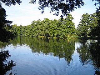
Boultham Park is a public park in Lincoln, Lincolnshire, England. Originally the park for the Boultham Hall, it was purchased in 1929 by the City of Lincoln Council, and opened as a public park for the people of Lincoln. The house was demolished in 1959. The park is Grade II listed.
There are two notable swords known recovered from the River Witham, both kept in the British Museum.
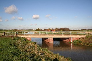
The River Till is a river in the county of Lincolnshire in England and is ultimately a tributary of the River Witham. Its upper reaches drain the land east of Gainsborough. The middle section is embanked, as the water level is higher than that of the surrounding land, and pumping stations pump water from low level drainage ditches into the river. Its lower reaches from the hamlet of Odder near Saxilby into the city of Lincoln were canalised, possibly as early as Roman times, as part of the Foss Dyke.
