
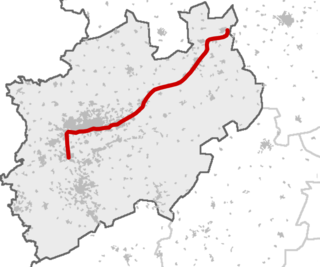
North Rhine-Westphalia is a state of Germany. It is the most-populous of the 16 states of Germany.

The Rhein-Sieg-Kreis is a Kreis (district) in the south of North Rhine-Westphalia, Germany. Neighboring districts are Rheinisch-Bergischer Kreis, Oberbergischer Kreis, Altenkirchen, Neuwied, Ahrweiler, Euskirchen, Rhein-Erft-Kreis, the urban district of Cologne. The federal city of Bonn is nearly completely surrounded by the district.

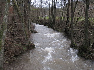
The Sieg is a river in North Rhine-Westphalia and Rhineland-Palatinate, Germany. It is a right tributary of the Rhine.

The Rhine-Ruhr metropolitan region is the largest metropolitan region in Germany with over 10 million inhabitants. A polycentric conurbation with multiple major urban concentrations, the region covers an area of 7,268 square kilometres (2,806 sq mi), entirely within the federal state of North Rhine-Westphalia. The Rhine-Ruhr metropolitan region spreads from Dortmund-Bochum-Essen-Duisburg in the north, to the urban areas of the cities of Mönchengladbach, Düsseldorf, Wuppertal, Leverkusen, Cologne, and Bonn in the south. The location of the Rhine-Ruhr at the heart of the European Blue Banana makes it well connected to other major European cities and metropolitan areas like the Randstad, the Flemish Diamond and the Frankfurt Rhine Main Region.

Ahr is a river in Germany, a left tributary of the Rhine. Its source is at an elevation of approximately 470 metres (1,540 ft) above sea level in Blankenheim in the Eifel, in the cellar of a timber-frame house near the castle of Blankenheim. After 18 kilometres (11 mi) it crosses from North Rhine-Westphalia into Rhineland-Palatinate.

The Wupper is a right tributary of the Rhine in the state of North Rhine-Westphalia, Germany. Rising near Marienheide in western Sauerland it runs through the mountainous region of the Bergisches Land in Berg County and enters the Rhine at Leverkusen, south of Düsseldorf. Its upper course is called the Wipper.

The Düssel is a small right tributary of the river Rhine in North Rhine Westphalia, Germany. Its source is east of Wülfrath. It flows westward through the Neander Valley where the fossils of the first Neanderthal man were found in August 1856. At Düsseldorf it forms a river delta by splitting into four streams, which all join the Rhine after a few kilometres. The Nördliche Düssel flows through the Hofgarten and passes under the Golden Bridge.

The Agger is a river in Germany, a right tributary of the Sieg in North Rhine-Westphalia. It is 69.5 kilometres (43.2 mi) long. Its source is in the Sauerland hills, near Meinerzhagen. It winds through the towns Engelskirchen, Overath and Lohmar. Near Siegburg the Agger flows into the Sieg.

The Swist is a stream, 43.6 kilometres (27.1 mi) long, in the German Rhineland. It rises on the northern edge of the Eifel at 330 metres above sea level and empties rom the right and southeast into the Rhine tributary, the Erft, between Weilerswist and Bliesheim. Occasionally the Swist is also called the Swistbach, and locals often just call it der Bach.

The Große Aue is an 88 kilometres (55 mi) long, southwestern, left tributary of the River Weser in northern North Rhine-Westphalia and central Lower Saxony in Germany.

The Schierenbeke is a 2.4-kilometre (1.5 mi) long, left tributary of the Große Aue, or Neuer Mühlenbach as it is known in its upper reaches in the German state of North Rhine-Westphalia. The stream lies entirely within the East Westphalian parish of Rödinghausen in the district of Herford.
The Rhein-Weser-Express is a Regional-Express service route in the German state of North Rhine-Westphalia, connecting some of the most important cities in Westphalia with the Ruhr. Cologne, Neuss, Düsseldorf and Duisburg lie on the Rhine while Minden lies on the Weser.

The Armuthsbach is an 18.4-kilometre-long, orographically left-hand tributary of the Ahr in the German states of North Rhine-Westphalia and Rhineland-Palatinate.
Holperbach is a river of North Rhine-Westphalia and Rhineland-Palatinate, Germany. It flows into the Sieg near Wissen.

Godesberger Bach is a river in Wachtberg and Bonn, in North Rhine-Westphalia, Germany. It is a left tributary of the Rhine in Bad Godesberg.

Hardtbach is a river of North Rhine-Westphalia, Germany. It is a left tributary of the Rhine near Bonn.

Lollenbach is a stream of North Rhine-Westphalia, Germany. Its source is between Bürenbruch and Letmathe. The stream has a length of 4.03 km (2.50 mi). Near Reingsen, a part of Schwerte, Lollenbach and Reingser Bach merge to form the Elsebach. Lollenbach is used as a supplier of water for a small fish pond.
The Platißbach is a roughly seven-kilometre-long (4.3 mi), southern and orographically right-hand tributary of the River Olef in the municipality of Hellenthal in Germany.

Eltingmühlenbach is a river of Lower Saxony and North Rhine-Westphalia, Germany. It flows into the Glane near Greven. On its course from near Bad Iburg to the southwest, it assumes several names: Glaner Bach, Oedingberger Bach and Aa.

