Enoggera Hill

Last updated
Enoggera Hill The-Gap-3.jpg
Enoggera Hill

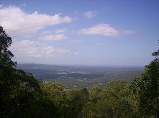
Enoggera Hill is a small mountain of the Taylor Range in Australia in the Brisbane suburb of Enoggera, in Queensland, with a peak of 273 meters (896 feet) above sea level. [1]

Mountain A large landform that rises fairly steeply above the surrounding land over a limited area

A mountain is a large landform that rises above the surrounding land in a limited area, usually in the form of a peak. A mountain is generally steeper than a hill. Mountains are formed through tectonic forces or volcanism. These forces can locally raise the surface of the earth. Mountains erode slowly through the action of rivers, weather conditions, and glaciers. A few mountains are isolated summits, but most occur in huge mountain ranges.

Australia Country in Oceania

Australia, officially the Commonwealth of Australia, is a sovereign country comprising the mainland of the Australian continent, the island of Tasmania and numerous smaller islands. It is the largest country in Oceania and the world's sixth-largest country by total area. The neighbouring countries are Papua New Guinea, Indonesia and East Timor to the north; the Solomon Islands and Vanuatu to the north-east; and New Zealand to the south-east. The population of 25 million is highly urbanised and heavily concentrated on the eastern seaboard. Australia's capital is Canberra, and its largest city is Sydney. The country's other major metropolitan areas are Melbourne, Brisbane, Perth and Adelaide.

Brisbane capital city of Queensland, Australia

Brisbane is the capital of and the most populated city in the Australian state of Queensland, and the third most populous city in Australia. Brisbane's metropolitan area has a population of 2.5 million, and the South East Queensland region, centred on Brisbane, encompasses a population of more than 3.5 million. The Brisbane central business district stands on the historic European settlement and is situated inside a peninsula of the Brisbane River, about 15 kilometres from its mouth at Moreton Bay. The metropolitan area extends in all directions along the floodplain of the Brisbane River Valley between Moreton Bay and the Great Dividing Range, sprawling across several of Australia's most populous local government areas (LGAs)—most centrally the City of Brisbane, which is by far the most populous LGA in the nation. The demonym of Brisbane is "Brisbanite".

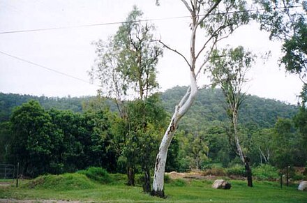
Enoggera Hill is close to Mount Coot-tha and like this peak, it is mostly covered by bushland. The hill is located within the grounds of the Enoggera Barracks. [2] [3]

Mount Coot-tha, Queensland Suburb of Brisbane, Queensland, Australia

Mount Coot-Tha is a mountain and a suburb in the City of Brisbane, Queensland, Australia. In the 2016 census, there were no residents in the suburb.

Bushland

Bushland is a blanket term for land which supports remnant vegetation or land which is disturbed but still retains a predominance of the original floristics and structure.

Enoggera Barracks barracks and airbase in Queensland, Australia

Enoggera Barracks is an Australian Army base in the northwestern Brisbane suburb of Enoggera in Queensland. It was officially established in the early 20th century when the area was used for field training, although the area was used by military units as far back as the mid-19th century. Since then it has been developed into a modern military base, which is now home to units of the 7th and 11th Brigades as well as the headquarters of the 1st Division and the 16th Aviation Brigade.

The hill's coordinates are:

See also

Related Research Articles

Ferny Grove railway line

The Ferny Grove railway line is a 13 kilometres (8.1 mi) suburban railway line in Brisbane, the state capital of Queensland, Australia. It is part of the Queensland Rail City network.

Jindalee, Queensland Suburb of Brisbane, Queensland, Australia

Jindalee is a western suburb of Brisbane, Australia 12 km (7 mi) south-west of the Brisbane CBD, and is a part of the Centenary suburbs. At the 2016 Australian Census, the suburb recorded a population of 5,319. It is bordered by the Brisbane River to the north. The Aboriginal meaning for Jindalee is "bare hills". Jindalee was the first of a series of suburbs originally called the "Centenary" suburbs, as planning for them commenced in 1959, the year of Queensland's centenary.

Mount Nebo (Queensland) Suburb of Moreton Bay Region, Queensland, Australia

Mount Nebo is a mountain approximately 18 km North West of the Brisbane suburb of The Gap in Queensland, Australia. It is part of the D'Aguilar Range which includes other mountains such as Mount Pleasant, Mount Glorious and Mount Mee. The town of Mount Nebo is named after the mountain on which it is located. The mountain is the source of Enoggera Creek.

DAguilar Range mountain in Australia

The D'Aguilar Range is a mountain range near Brisbane, Queensland, Australia. The town of Dayboro is situated on the lower foothills midway along the range and the Sunshine Coast Hinterland town of Mooloolah lies at the northernmost point of the range. Many residential areas line its eastern slopes including the town of Samford and the suburb of Ferny Hills. In the west, numerous ridges and gullies are heavily forested and designated as state forest or national park.

Ashgrove, Queensland Suburb of Brisbane, Queensland, Australia

Ashgrove is an inner suburb in the City of Brisbane in Queensland, Australia. It is located approximately 4 kilometres (2.5 mi) north-west of the Brisbane CBD. Ashgrove is an upmarket, leafy residential suburb characterised by its hilly terrain and characteristic Ashgrovian houses built in the early 20th century. While many of the surrounding suburbs have seen an increase in the number of residential apartments built in the past decade, Ashgrove remains predominantly a suburb of detached single dwelling houses, with many old Queenslander homes in the area. It contains the localities of Dorrington and St Johns Wood.

Bardon, Queensland Suburb of Brisbane, Queensland, Australia

Bardon is an inner suburb of the City of Brisbane, Queensland, Australia. It is located approximately 5 kilometres (3.1 mi) north-west of the Brisbane CBD. Bardon is a leafy residential suburb, much of which nestles into the foothills of Mount Coot-tha. In the 2016 census, Bardon had a population of 9,500 people.

Gaythorne, Queensland Suburb of Brisbane, Queensland, Australia

Gaythorne is a suburb of Brisbane, Queensland, Australia. It is located seven kilometres north-west of the Brisbane central business district. Gaythorne is situated on the slopes of Enoggera Hill. It shares some streets with the neighbouring suburb of Mitchelton. In the late 1990s it was split from Enoggera, a much larger suburb and a suburb it still shares its postcode with. It is a leafy, residential suburb with the dominant architectural style being "Queenslander" architecture. It adjoins the Enoggera Barracks and many of its streets are named after World War I sites.

Brisbane Forest Park Protected area in Queensland, Australia

Brisbane Forest Park, is located on parts of the D'Aguilar Range. The large nature reserve lies on the western boundary of City of Brisbane into the Moreton Bay Region, Queensland, Australia, in Enoggera Reservoir, adjacent to The Gap and between the Mount Coot-tha Reserve on the Taylor Range and higher peaks to the north. Brisbane Forest Park supports plants and animals and is essential to their survival. The main entrance is located in the suburb of The Gap although there are a number of other access points.

Red Hill, Queensland Suburb of Brisbane, Queensland, Australia

Red Hill is an inner suburb of Brisbane, Queensland, Australia 3 kilometres (1.9 mi) north-west of the Brisbane CBD. The suburb is one of the oldest in Brisbane. Red Hill got its name as a description from the steep hills which had lots of red soil and rocks.

Enoggera, Queensland Suburb of Brisbane, Queensland, Australia

Enoggera is a suburb of Brisbane, in Queensland, Australia 6 kilometres (3.7 mi) north-west of the Brisbane CBD. The west of the suburb is dominated by Enoggera Hill.

Kenmore Hills, Queensland Suburb of Brisbane, Queensland, Australia

Kenmore Hills is a suburb of the City of Brisbane, Queensland, Australia approximately 10 kilometres (6.2 mi) south-west of the CBD. At the 2016 Australian Census, the suburb recorded a population of 2,402.

Enoggera Reservoir, Queensland Suburb of Brisbane, Queensland, Australia

Enoggera Reservoir is an outer suburb of City of Brisbane, Queensland, Australia, which is located 8 kilometres (5 mi) north-west of the CBD and bordering the Moreton Bay Region and The Gap. It contains the neighbourhood of Peewee Bend. In the 2011 census, Enoggera Reservoir had a population of 24 people.

Camira, Queensland Suburb of City of Ipswich, Queensland, Australia

Camira is a suburb in the City of Ipswich, Queensland, Australia.

Gailes is a suburb in the City of Ipswich, Queensland, Australia.

Moggill Creek river in Queensland, Australia

Moggill Creek is a creek in Brisbane, the largest city in Queensland, Australia. The creek rises on the Taylor Range and runs in a south-easterly direction from the southern edge of Brisbane Forest Park in Kholo and Pullenvale, flowing through Upper Brookfield, Brookfield and joining the Brisbane River at Kenmore. Before entering the Brisbane River the creek is crossed by Moggill Road and winds through Rafting Ground Reserve.

Ithaca is a former suburb of Brisbane, Australia. Since 1975, Ithaca has been designated a neighbourhood within the suburb of Red Hill in Brisbane.

Jones Hill is a suburb of Gympie, Queensland, Australia 7 kilometres (4 mi) south of Gympie's central business district on the south-western bank of the Mary River. It is for the most part sparsely populated, although a settlement on Mary Valley Road contains a primary school and park.

Enoggera Creek river in Queensland, Australia

Enoggera Creek is a stream that rises on the D'Aguilar Range and flows into the Brisbane River. The creek's headwaters form on the southern slopes of Mount Nebo in Brisbane Forest Park.

Shire of Enoggera

The Shire of Enoggera is a former local government area of Queensland, Australia, located in north-western Brisbane.

Hills District, Queensland group of suburbs in Moreton Bay, Queensland, Australia

The Hills District is the name of group of suburbs in the Moreton Bay Region, Queensland, Australia. Although informally defined, the term traditionally refers to Ferny Hills, Arana Hills, and Everton Hills.

References

  1. 1 2 "Enoggera Hill". Mapcarta. Retrieved 2018-08-01.
  2. MapMyFitness. "Enoggera Hill". MapMyRun. Retrieved 2018-08-01.
  3. "A little bit about the suburb of Enoggera". Early Education Centres. Retrieved 2018-08-01.

Coordinates: 27°25′25.74″S152°57′35.81″E / 27.4238167°S 152.9599472°E / -27.4238167; 152.9599472

Geographic coordinate system Coordinate system

A geographic coordinate system is a coordinate system that enables every location on Earth to be specified by a set of numbers, letters or symbols. The coordinates are often chosen such that one of the numbers represents a vertical position and two or three of the numbers represent a horizontal position; alternatively, a geographic position may be expressed in a combined three-dimensional Cartesian vector. A common choice of coordinates is latitude, longitude and elevation. To specify a location on a plane requires a map projection.