
The Great Lakes, also called the Great Lakes of North America, are a series of large interconnected freshwater lakes in the mid-east of North America that connect to the Atlantic Ocean via the Saint Lawrence River. There are five lakes, which are Superior, Michigan, Huron, Erie, and Ontario and are in general on or near the Canada–United States border. Hydrologically, lakes Michigan and Huron are a single body joined at the Straits of Mackinac. The Great Lakes Waterway enables modern travel and shipping by water among the lakes.

Lake Erie ( "eerie") is the fourth-largest lake by surface area of the five Great Lakes in North America and the eleventh-largest globally. It is the southernmost, shallowest, and smallest by volume of the Great Lakes and therefore also has the shortest average water residence time. At its deepest point Lake Erie is 210 feet (64 m) deep.

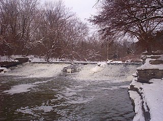
The Maumee River is a river running in the United States Midwest from northeastern Indiana into northwestern Ohio and Lake Erie. It is formed at the confluence of the St. Joseph and St. Marys rivers, where Fort Wayne, Indiana has developed, and meanders northeastwardly for 137 miles (220 km) through an agricultural region of glacial moraines before flowing into the Maumee Bay of Lake Erie. The city of Toledo is located at the mouth of the Maumee. The Maumee was designated an Ohio State Scenic River on July 18, 1974. The Maumee watershed is Ohio's breadbasket; it is two-thirds farmland, mostly corn and soybeans. It is the largest watershed of any of the rivers feeding the Great Lakes, and supplies five percent of Lake Erie's water.

The Watersheds of Indiana consist of six distinct Indiana watershed regions that drain into five major bodies of water.

The Great Black Swamp was a glacially fed wetland in northwest Ohio, sections of lower Michigan, and extreme northeast Indiana, United States, that existed from the end of the Wisconsin glaciation until the late 19th century. Comprising extensive swamps and marshes, with some higher, drier ground interspersed, it occupied what was formerly the southwestern part of proglacial Lake Maumee, a Holocene precursor to Lake Erie. The area was about 25 miles (40 km) wide and 100 miles (160 km) long, covering an estimated 1,500 square miles (4,000 km2). Gradually drained and settled in the second half of the 19th century, it is now highly productive farmland. However, this development has been detrimental to the ecosystem as a result of agricultural runoff. This runoff, in turn, has contributed to frequent toxic algal blooms in Lake Erie.

Lake St. Clair is a freshwater lake that lies between the Canadian province of Ontario and the U.S. state of Michigan. It was named in 1679 by French Catholic explorers after Saint Clare of Assisi, on whose feast day they first saw the lake.

The Huron River is a 130-mile-long (210 km) river in southeastern Michigan, rising out of the Huron Swamp in Springfield Township in northern Oakland County and flowing into Lake Erie, as it forms the boundary between present-day Wayne and Monroe counties. Thirteen parks, game areas, and recreation areas are associated with the river, which passes through the cities of Dexter, Ann Arbor, Ypsilanti, Belleville, Flat Rock and Rockwood that were developed along its banks.

The River Raisin is a river in southeastern Michigan, United States, that flows through glacial sediments into Lake Erie. The area today is an agricultural and industrial center of Michigan. The river flows for almost 139 miles (224 km), draining an area of 1,072 square miles (2,780 km2) in the Michigan counties of Lenawee, Washtenaw, Jackson, Hillsdale, and Monroe County, where its mouth at Lake Erie is located. French settlers named it as La Rivière aux Raisins because of the wild grapes growing along its banks, the French word for grape being raisin. The French term for "raisin" is raisin sec.

The Kankakee River is a tributary of the Illinois River, approximately 133 miles (214 km) long, in the Central Corn Belt Plains of northwestern Indiana and northeastern Illinois in the United States. At one time, the river drained one of the largest wetlands in North America and furnished a significant portage between the Great Lakes and the Mississippi River. Significantly altered from its original channel, it flows through a primarily rural farming region of reclaimed cropland, south of Lake Michigan.
The River Rouge is a 127-mile river in the Metro Detroit area of southeastern Michigan. It flows into the Detroit River at Zug Island, which is the boundary between the cities of River Rouge and Detroit.
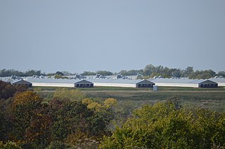
In animal husbandry, a concentrated animal feeding operation, as defined by the United States Department of Agriculture (USDA), is an intensive animal feeding operation (AFO) in which over 1,000 animal units are confined for over 45 days a year. An animal unit is the equivalent of 1,000 pounds of "live" animal weight. A thousand animal units equates to 700 dairy cows, 1,000 meat cows, 2,500 pigs weighing more than 55 pounds (25 kg), 10,000 pigs weighing under 55 pounds, 10,000 sheep, 55,000 turkeys, 125,000 chickens, or 82,000 egg laying hens or pullets.

The Detroit River International Wildlife Refuge is the only international wildlife refuge in North America. Established in 2001 and managed jointly by the United States Fish and Wildlife Service and the Canadian Wildlife Service, it is located in a major metropolitan area. The Detroit River International Wildlife Refuge is one of over 540 National Wildlife Refuges managed by the U.S. Fish and Wildlife Service within the Department of the Interior. It occupies 7.88 square miles (20.41 km2) of scattered property but has drawn boundaries for further expansion.

Lake Michigan–Huron is the body of water combining both Lake Michigan and Lake Huron, which are joined through the 5-mile-wide (8.0 km), 295-foot-deep (90 m), open-water Straits of Mackinac. Huron and Michigan are hydrologically a single lake because the flow of water through the straits keeps their water levels in overall equilibrium. Although the flow is generally eastward, the water moves in either direction depending on local conditions. Combined, Lake Michigan–Huron is the largest freshwater lake by area in the world. Lake Superior is larger than either individually, so it is counted as the largest of the Great Lakes when Lake Michigan and Lake Huron are considered separately.
An anaerobic lagoon or manure lagoon is a man-made outdoor earthen basin filled with animal waste that undergoes anaerobic respiration as part of a system designed to manage and treat refuse created by concentrated animal feeding operations (CAFOs). Anaerobic lagoons are created from a manure slurry, which is washed out from underneath the animal pens and then piped into the lagoon. Sometimes the slurry is placed in an intermediate holding tank under or next to the barns before it is deposited in a lagoon. Once in the lagoon, the manure settles into two layers: a solid or sludge layer and a liquid layer. The manure then undergoes the process of anaerobic respiration, whereby the volatile organic compounds are converted into carbon dioxide and methane. Anaerobic lagoons are usually used to pretreat high strength industrial wastewaters and municipal wastewaters. This allows for preliminary sedimentation of suspended solids as a pretreatment process.

Lake Algonquin was a prehistoric proglacial lake that existed in east-central North America at the time of the last ice age. Parts of the former lake are now Lake Huron, Georgian Bay, Lake Superior, Lake Michigan, Lake Nipigon, and Lake Nipissing.

Great Lakes Areas of Concern are designated geographic areas within the Great Lakes Basin that show severe environmental degradation. There are a total of 43 areas of concern within the Great Lakes, 26 being in the United States, 17 in Canada, with five shared by the two countries.
Lynn Henning is a farmer and environmentalist from Michigan, United States. She was awarded the Goldman Environmental Prize in 2010 for her focus on water quality and for fighting pollution from concentrated animal feeding facilities. She exposed the polluting practices of livestock factory farms in rural Michigan, gaining the attention of the federal EPA and prompting state regulators to issue hundreds of citations for water quality violations. Henning currently works for the Socially Responsible Agricultural Project (SRAP). She also won the Planet Defender Award 2012 for her advocacy and her work.

Lake Kankakee formed 14,000 years before present (YBP) in the valley of the Kankakee River. It developed from the outwash of the Michigan Lobe, Saginaw Lobe, and the Huron-Erie Lobe of the Wisconsin glaciation. These three ice sheets formed a basin across Northwestern Indiana. It was a time when the glaciers were receding, but had stopped for a thousand years in these locations. The lake drained about 13,000 YBP, until reaching the level of the Momence Ledge. The outcropping of limestone created an artificial base level, holding water throughout the upper basin, creating the Grand Kankakee Marsh.

The Erie Plain is a lacustrine plain that borders Lake Erie in North America. From Buffalo, New York, to Cleveland, Ohio, it is quite narrow, but broadens considerably from Cleveland around Lake Erie to Southern Ontario, where it forms most of the Ontario peninsula. The Erie Plain was used in the United States as a natural gateway to the North American interior, and in both the United States and Canada the plain is heavily populated and provides very fertile agricultural land.

Butternut Creek is a stream in the greater Syracuse, New York area and a tributary of Limestone Creek, part of the Oneida Lake watershed. The creek is about 16 miles (26 km) long.