Related Research Articles

The Global Positioning System (GPS), originally Navstar GPS, is a satellite-based radio navigation system owned by the United States Space Force and operated by Mission Delta 31. It is one of the global navigation satellite systems (GNSS) that provide geolocation and time information to a GPS receiver anywhere on or near the Earth where there is an unobstructed line of sight to four or more GPS satellites. It does not require the user to transmit any data, and operates independently of any telephone or Internet reception, though these technologies can enhance the usefulness of the GPS positioning information. It provides critical positioning capabilities to military, civil, and commercial users around the world. Although the United States government created, controls and maintains the GPS system, it is freely accessible to anyone with a GPS receiver.

The ionosphere is the ionized part of the upper atmosphere of Earth, from about 48 km (30 mi) to 965 km (600 mi) above sea level, a region that includes the thermosphere and parts of the mesosphere and exosphere. The ionosphere is ionized by solar radiation. It plays an important role in atmospheric electricity and forms the inner edge of the magnetosphere. It has practical importance because, among other functions, it influences radio propagation to distant places on Earth. It also affects GPS signals that travel through this layer.

A satellite or artificial satellite is an object, typically a spacecraft, placed into orbit around a celestial body. They have a variety of uses, including communication relay, weather forecasting, navigation (GPS), broadcasting, scientific research, and Earth observation. Additional military uses are reconnaissance, early warning, signals intelligence and, potentially, weapon delivery. Other satellites include the final rocket stages that place satellites in orbit and formerly useful satellites that later become defunct.

The High-frequency Active Auroral Research Program (HAARP) is a University of Alaska Fairbanks program which researches the ionosphere – the highest, ionized part of Earth's atmosphere. The most prominent instrument at HAARP is the Ionospheric Research Instrument (IRI), a high-power radio frequency transmitter facility operating in the high frequency (HF) band. The IRI is used to temporarily excite a limited area of the ionosphere. Other instruments, such as a VHF and a UHF radar, a fluxgate magnetometer, a digisonde, and an induction magnetometer, are used to study the physical processes that occur in the excited region. Work on the HAARP facility began in 1993. Initially HAARP was jointly funded by the U.S. Air Force, the U.S. Navy, the University of Alaska Fairbanks, and the Defense Advanced Research Projects Agency (DARPA). It was designed and built by BAE Advanced Technologies. Its original purpose was to analyze the ionosphere and investigate the potential for developing ionospheric enhancement technology for radio communications and surveillance. Since 2015 it has been operated by the University of Alaska Fairbanks.

Space weather is a branch of space physics and aeronomy, or heliophysics, concerned with the varying conditions within the Solar System and its heliosphere. This includes the effects of the solar wind, especially on the Earth's magnetosphere, ionosphere, thermosphere, and exosphere. Though physically distinct, space weather is analogous to the terrestrial weather of Earth's atmosphere. The term "space weather" was first used in the 1950s and popularized in the 1990s. Later, it prompted research into "space climate", the large-scale and long-term patterns of space weather.

A geomagnetic storm, also known as a magnetic storm, is a temporary disturbance of the Earth's magnetosphere caused by a solar wind shock wave.

The plasmasphere, or inner magnetosphere, is a region of the Earth's magnetosphere consisting of low-energy (cool) plasma. It is located above the ionosphere. The outer boundary of the plasmasphere is known as the plasmapause, which is defined by an order of magnitude drop in plasma density. In 1963 American scientist Don Carpenter and Soviet astronomer Konstantin Gringauz proved the plasmasphere and plasmapause's existence from the analysis of very low frequency (VLF) whistler wave data. Traditionally, the plasmasphere has been regarded as a well behaved cold plasma with particle motion dominated entirely by the geomagnetic field and, hence, co-rotating with the Earth.

Canadian Geospace Monitoring (CGSM) is a Canadian space science program that was initiated in 2005. CGSM is funded primarily by the Canadian Space Agency, and consists of networks of imagers, meridian scanning photometers, riometers, magnetometers, digital ionosondes, and High Frequency SuperDARN radars. The overarching objective of CGSM is to provide synoptic observations of the spatio-temporal evolution of the ionospheric thermodynamics and electrodynamics at auroral and polar latitudes over a large region of Canada.
An ionospheric heater, or an ionospheric HF pump facility, is a powerful radio wave transmitter with an array of antennas which is used for research of plasma turbulence, the ionosphere and upper atmosphere.

C/NOFS, or Communications/Navigation Outage Forecasting System was a USAF satellite developed by the Air Force Research Laboratory (AFRL) Space Vehicles Directorate to investigate and forecast scintillations in the Earth's ionosphere. It was launched by an Orbital Sciences Corporation Pegasus-XL launch vehicle at 17:02:48 UTC on 16 April 2008 and decayed on 28 November 2015.

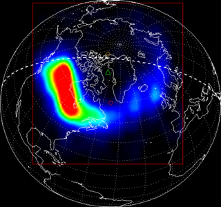
Ionospheric storms are storms which contain varying densities of energised electrons in the ionosphere as produced from the Sun. Ionospheric storms are caused by geomagnetic storms. They are categorised into positive and negative storms, where positive storms have a high density of electrons and negative storms contain a lower density. The total electron content (TEC) is used to measure these densities, and is a key variable used in data to record and compare the intensities of ionospheric storms.

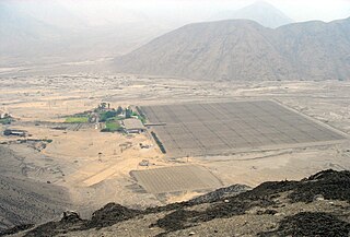
The Jicamarca Radio Observatory (JRO) is the equatorial anchor of the Western Hemisphere chain of Incoherent Scatter Radar (ISR) observatories extending from Lima, Peru to Søndre Strømfjord, Greenland. JRO is the premier scientific facility in the world for studying the equatorial ionosphere. The observatory is about half an hour drive inland (east) from Lima and 10 km from the Central Highway. The magnetic dip angle is about 1°, and varies slightly with altitude and year. The radar can accurately determine the direction of the Earth's magnetic field (B) and can be pointed perpendicular to B at altitudes throughout the ionosphere. The study of the equatorial ionosphere is rapidly becoming a mature field due, in large part, to the contributions made by JRO in radio science.
Satya Prakash is an Indian plasma physicist and a former senior professor at the Physical Research Laboratory. He is known for his studies on Langmuir probes and other contributions in space and plasma sciences. A protégé of Vikram Sarabhai, Satya Prakash is an elected fellow of all the three major Indian science academies such as Indian Academy of Sciences, Indian National Science Academy and National Academy of Sciences, India as well as the Gujarat Science Academy and is a recipient of the Hari Om Ashram Prerit Senior Scientist Award. The Government of India honored him with Padma Shri, the fourth highest Indian civilian award for his contributions to the discipline of Physics, in 1982.
Dual Segmented Langmuir Probe (DSLP) is an instrument developed primarily by Czech researchers and engineers to study the magnetospheric background plasma flown on board the spacecraft of the European Space Agency (ESA) Proba 2.

Radio Aurora Explorer (RAX) is the first National Science Foundation sponsored CubeSat mission. The RAX mission is a joint effort between SRI International in Menlo Park, California and the University of Michigan in Ann Arbor, Michigan. The chief scientist at SRI International, Dr. Hasan Bahcivan, led his team at SRI to develop the payload while the chief engineer, Dr. James Cutler, led a team of students to develop the satellite bus in the Michigan Exploration Laboratory. There are currently two satellites in the RAX mission.
Ionospheric Connection Explorer (ICON) was a satellite designed to investigate changes in the ionosphere of Earth, the dynamic region high in the atmosphere where terrestrial weather from below meets space weather from above. ICON studies the interaction between Earth's weather systems and space weather driven by the Sun, and how this interaction drives turbulence in the upper atmosphere. It is hoped that a better understanding of this dynamic will mitigate its effects on communications, GPS signals, and technology in general. It is part of NASA's Explorer program and is operated by University of California, Berkeley's Space Sciences Laboratory. In July of 2024, the mission was declared lost after a loss of contact.

RAX-2 is a CubeSat satellite built as a collaboration between SRI International and students at the University of Michigan College of Engineering. It is the second spacecraft in the RAX mission. The RAX-1 mission ended after approximately two months of operation due to a gradual degradation of the solar panels that ultimately resulted in a loss of power. RAX team members applied the lessons learned from RAX-1 to the design of a second flight unit, RAX-2, which performs the same mission concept of RAX-1 with improved bus performance and additional operational modes. Science measurements are enhanced through interactive experiments with high power ionospheric heaters where FAI will be generated on demand.
Electron precipitation is an atmospheric phenomenon that occurs when previously trapped electrons enter the Earth's atmosphere, thus creating communications interferences and other disturbances. Electrons trapped by Earth's magnetic field spiral around field lines to form the Van Allen radiation belt. The electrons are from the solar wind and may remain trapped above Earth for an indefinite period of time. When broadband very low frequency (VLF) waves propagate the radiation belts, the electrons exit the radiation belt and "precipitate" into the ionosphere where the electrons will collide with ions. Electron precipitation is regularly linked to ozone depletion. It is often caused by lightning strikes.

Global-scale Observations of the Limb and Disk (GOLD) is a heliophysics Mission of Opportunity (MOU) for NASA's Explorers program. Led by Richard Eastes at the Laboratory for Atmospheric and Space Physics, which is located at the University of Colorado Boulder, GOLD's mission is to image the boundary between Earth and space in order to answer questions about the effects of solar and atmospheric variability of Earth's space weather. GOLD was one of 11 proposals selected, of the 42 submitted, for further study in September 2011. On 12 April 2013, NASA announced that GOLD, along with the Ionospheric Connection Explorer (ICON), had been selected for flight in 2017. GOLD, along with its commercial host satellite SES-14, launched on 25 January 2018.

A space hurricane is a huge, funnel-like, spiral geomagnetic storm that occurs above the polar Ionosphere of Earth, during extremely quiet conditions. They are related to the aurora borealis phenomenon, as the electron precipitation from the storm's funnel produces gigantic, cyclone-shaped auroras. Scientists believe that they occur in the polar regions of planets with magnetic fields.
References
- 1 2 Carter, Brett (5 December 2014). "Predicting daily space weather will help keep your GPS on target" . Retrieved 5 December 2014.
- 1 2 3 Kelly, Michael (23 Sep 2014). "'Space bubbles' may have aided enemy in fatal Afghan battle" . Retrieved 5 December 2014.
- ↑ "China's Powerful LARID Radar Detects Plasma Bubble Over Egyptian Pyramids".