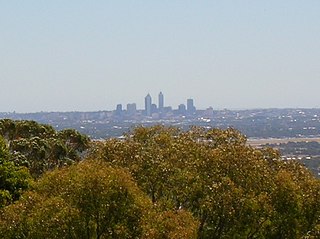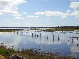
The Swan River is a major river in the southwest of Western Australia. The river runs through the metropolitan area of Perth, Western Australia's capital and largest city.

Wolli Creek is an urban watercourse of the Cooks River catchment located in the southern suburbs of Sydney, in New South Wales, Australia.

Mount Eliza is a hill that overlooks the city of Perth, Western Australia and forms part of Kings Park. It is known as Kaarta Gar-up and Mooro Katta in the local Noongar dialect.

The Canning River is a major tributary of the Swan River in the South West Land Division of Western Australia. It is home to much wildlife including dolphins, pelicans, swans and many other bird species.

Ellenbrook is a northeastern suburb of Perth, Western Australia, about 30 km (19 mi) from Perth's central business district (CBD), located within the City of Swan. Ellenbrook, and its neighbouring suburbs of The Vines and Aveley, are unusual for Perth in being a significant distance from neighbouring suburbs. Given this relative isolation and the distance from the CBD, Ellenbrook has been designed and developed as a self-sustainable community. Since the upgrade of Gnangara Road and the completion of the Tonkin Highway Northlink, access to Ellenbrook has improved. The Morley–Ellenbrook railway line is well underway as at June 2021 and this will enable better public transport. At the time of the 2016 census there were 22,681 people living in the gazetted suburb, by June 2018, it was estimated that the urban population for Ellenbrook and surrounds had grown to 41,382. It is envisioned that Ellenbrook will eventually become a satellite city, with a population of 80,000.

The Swan Coastal Plain in Western Australia is the geographic feature which contains the Swan River as it travels west to the Indian Ocean. The coastal plain continues well beyond the boundaries of the Swan River and its tributaries, as a geological and biological zone, one of Western Australia's Interim Biogeographic Regionalisation for Australia regions. It is also one of the distinct physiographic provinces of the larger West Australian Shield division.

Whiteman Park is a 4,000-hectare bushland area located 22 km (14 mi) north of Perth, Western Australia. The park is in the suburb of Whiteman, in the Swan Valley in the upper reaches of the Swan River.

Mount Henry Peninsula is a land feature and reserve located 11 km (6.8 mi) south of Perth, Western Australia, on the north bank of the Canning River near the Mount Henry Bridge in Salter Point, Western Australia. It covers 11.9 hectares, and includes both Banksia attenuata and Banksia menziesii woodland, and a muddy and desert biome. The peninsula features limestone slopes, shoreline vegetation, wetlands, and contains the most inland vegetated knoll of the Spearwood dunes on the Swan-Canning estuary, as well as a significant variety of natural conditions for birds and other fauna. The Mount Henry Peninisula is a designated Bush Forever Site, number 227.

Bayswater is a suburb 6 kilometres (4 mi) north-east of the central business district (CBD) of Perth, the capital of Western Australia. It is just north of the Swan River, within the City of Bayswater local government area. It is predominantly a low-density residential suburb consisting of single-family detached homes. However, there are several clusters of commercial buildings, most notably in the suburb's town centre, around the intersection of Whatley Crescent and King William Street and a light industrial area in the suburb's east.

The Vasse-Wonnerup Estuary is an estuary in the South West region of Western Australia close to the town of Busselton. The estuary is listed with DIWA. It was also recognised as a wetland of international importance under the Ramsar Convention on 7 June 1990 when an area of 1,115 ha was designated Ramsar Site 484 as an important dry-season habitat for waterbirds. It is also the main part of the 2,038 ha (5,040-acre) Busselton Wetlands Important Bird Area.

Marievale Bird Sanctuary is a protected area in Gauteng, South Africa. It is about 15 km2 in size, and situated on the East Rand on the southern half of the Blesbokspruit wetland, a Ramsar site. The Blesbokspruit is a major perennial river in Gauteng which is flanked by extensive floodplains on either side. Nearby is the Suikerbosrand Nature Reserve.

The Whangamarino Wetland in the Waikato District is the second largest wetland complex of the North Island of New Zealand. Encompassing a total area of more than 7200 hectares, the Department of Conservation Te Papa Atawhai manages 5,923 hectares of peat bog, swamp, mesotrophic lags, open water and river systems listed as a wetland of international importance under the Ramsar Convention. Fish and Game New Zealand are the second largest landowner, managing 748 hectares of the wetland primarily as gamebird hunting habitat.

The Perth Wetlands, also known as the Perth Great Lakes or the Great Lakes District, was a collection of fresh-water wetlands, swamps and lakes located on the Swan Coastal Plain north of the city of Perth in Western Australia. Over a period of 80 years from the first British settlement in Western Australia in 1829 most of the wetlands were reclaimed for use as housing, parks and market gardens.

Benger Swamp is a wetland located on the Swan Coastal Plain, in south-west Western Australia.
The Interlaken Lakeside Reserve is a wetland reserve at subalpine Interlaken, lying at the north-western end of Lake Crescent on the Interlaken isthmus between the reservoirs of Lakes Sorell and Crescent, about 20 km west of Tunbridge, in the Central Highlands of Tasmania, Australia. In 1982 it was designated a wetland of international importance under the Ramsar Convention.

Kensington bushland reserve is a significant remnant of Swan Coastal Plain vegetation, that has been reserved in the suburb of Kensington, in Perth, Western Australia, by the state government.

Benara Road is an east–west road in the north-eastern suburbs of Perth, Western Australia.

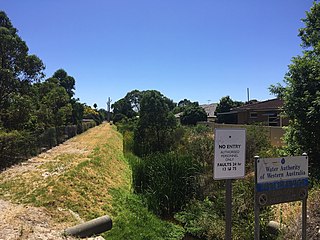
Bayswater Brook was a natural brook in the north-eastern suburbs of Perth, Western Australia, which discharges into the Swan River in the suburb of Bayswater. In the 1920s, due to urban development, the brook was turned into a network of drainage channels, which are partially covered and partially open. The brook's water source is runoff and groundwater. In the 1970s, the Eric Singleton Bird Sanctuary was built near the mouth of the brook. Water from the Bayswater Brook flows through the wetlands at the bird sanctuary before continuing to the Swan River. It has an average annual flow of 7.5 gigalitres.

Lightning Swamp Bushland is a 71.3-hectare (176-acre) area of natural bush and wetlands in Noranda, Western Australia, a suburb of Perth. It is bounded by Reid Highway to the north, Malaga Drive to the west and south, Matthews Close to the south and Lightning Park Recreation Centre to the east. It is classified as an A class reserve.


