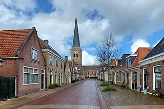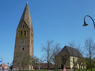
Heeswijk is a Dutch village. It is located in the province of North Brabant, in the south of the Netherlands.

Kerkwerve is a village in the Dutch province of Zeeland. It is a part of the municipality of Schouwen-Duiveland, and lies about 24 km southwest of Hellevoetsluis.

Haamstede is a village in the Dutch province of Zeeland. It is a part of the municipality of Schouwen-Duiveland. The village is known for Haamstede Castle.

Renesse is a village in the Dutch province of Zeeland. It is a part of the municipality of Schouwen-Duiveland, and lies about 28 km west of Hellevoetsluis.

Ursem is a village in the Dutch province of North Holland. It is a part of the municipality of Koggenland, and lies about 7 kilometres (4.3 mi) east of Alkmaar and 30 kilometres (19 mi) north of Amsterdam and 10 kilometres (6.2 mi) west from Hoorn. A part of the village is located in the municipality of Alkmaar.

Amstenrade is a village in the municipality of Beekdaelen, in the Netherlands. It is located about 7 km northwest of Heerlen. The Amstenrade Castle is located in the village.

Oudkarspel is a village in the Dutch province of North Holland. It is located in the municipality of Dijk en Waard, north of Noord-Scharwoude.

Roden is a town in the Dutch province of Drenthe. It is located in the municipality of Noordenveld, about 16 km southwest of Groningen.

Kloosterburen is a village in the Dutch province of Groningen. It is located in the municipality of Het Hogeland. The village developed around a monastery. Kloosterburen was a separate municipality until 1990, when it was merged with Leens, Ulrum and Eenrum. During the combining of the four municipalities they were called 'de LEUK gemeenten'. In 2019, it became part of Het Hogeland.

Stedum is a village in the Dutch province of Groningen. It is located in the municipality of Eemsdelta, about 15 km (9 mi) northeast of the city of Groningen.

Diepenveen is a village in the eastern Netherlands. It is located in the municipality of Deventer, Overijssel, about 4 km north of the city centre.

's Gravenmoer is a village in the Dutch province of North Brabant. It is located in the municipality of Dongen, about 3 km north of the town of Dongen. The village has a population of about 2190 inhabitants, including the farmlands to the north of the village.

Halsteren is a town in the Dutch province of North Brabant. It is located in the municipality of Bergen op Zoom, about 1 km north of that city. Halsteren has an old church from the 14th century and a new church, built in 1919. A little village called Polder was located between Halsteren and Tholen in the Middle Ages.

Nistelrode is a village in the Dutch province of North Brabant. It is located in the municipality of Bernheze, about 8 km south of Oss.

Velp is a village in the Dutch province of North Brabant. It is located in the former municipality of Grave, about 2 km southwest of the city. Until 1794, it was part of the Land van Ravenstein, a Catholic enclave of Palatinate-Neuburg within the Dutch Republic.

Pingjum is a village in the municipality of Súdwest-Fryslân in Friesland, in the northern Netherlands and lies 6.6 kilometres (4.1 mi) southwest of Harlingen. It had a population of around 585 in January 2017.

Reitsum is a village in Noardeast-Fryslân municipality in the province of Friesland, the Netherlands. It had a population of around 133 in January 2017. Before 2019, the village was part of the Ferwerderadiel municipality.

Tzum is a village in Waadhoeke municipality in the province of Friesland, the Netherlands. It had a population of around 1,110 in 2023. Tzum is known for its 72 metre tall church tower.

Blauwhuis is a village in Súdwest-Fryslân municipality in the province of Friesland, the Netherlands. It had a population of around 585 in January 2017.

Schildwolde is a village in the Dutch province of Groningen. It is part of the municipality of Midden-Groningen. It is known for its detached church tower from the 13th century.


