
Bağcılar is a municipality and district of Istanbul Province, Turkey. Its area is 23 km2, and its population is 740,069 (2022). It is located on the European side of Istanbul, near the city centre, just north of Bahçelievler, between the two major ring roads, TEM and D100. The district is the fourth most populous in the Istanbul Municipality. Bağcılar developed rapidly between the 1970s and 1990s and is primarily residential in nature. The neighborhood is served by the Istanbul Metro and the T1 line of the Istanbul Tram. The mayor is Abdullah Özdemir from the Justice and Development Party, elected in April 2022.

The Istanbul Metro is a rapid transit railway network that serves the city of Istanbul, Turkey. Apart from the M11 line, which is operated by TCDD Taşımacılık, the system is operated by Metro Istanbul, a public enterprise controlled by the Istanbul Metropolitan Municipality. The oldest section of the metro is the M1 line, which opened in 1989. As of March 2024, the system now includes 158 stations in service, with 36 more under construction. With 243.3 kilometers, Istanbul has the 22nd longest metro line in the world and the 5th in Europe.

Line M1, officially referred to as the M1 Yenikapı–Atatürk Airport/Kirazlı metro line, also known as the Istanbul Light Metro, is a rapid transit line of the Istanbul Metro. It is colored red on the maps and route signs. Opened in 1989, it was the first rapid transit line in Istanbul and Turkey and its opening started the revival of mass-transit in Turkish cities.
Halkapınar Transfer Center, commonly referred to as Halkapınar Metro or just Halkapınar, is a multi-modal transportation complex in İzmir, Turkey. Located in northeast Konak, it is the largest transportation complex in İzmir, as well as the Aegean Region. The complex offers connections between İZBAN commuter rail service, İzmir Metro rapid transit service, Tram İzmir tram service and ESHOT city bus service. Halkapınar Transfer Center was originally opened in 1865 as a railway station. The transfer center opened on 22 May 2000 together with a new metro station and bus terminals and was the first complex to offer direct connection between heavy rail and rapid transit service in Turkey.

Esenler Coach Terminal is the central and largest bus terminus for intercity bus service in Istanbul, Turkey. Although the terminus is located in Bayrampaşa district, it is named after Esenler district, which is closer.

The M3, officially referred to as the M3 Bakırköy Sahil–Kayaşehir Merkez Metro Line, is a 26.7-kilometre (16.6 mi), 19-station rapid transit line of the Istanbul Metro system on the European part of Istanbul, Turkey. It operates between Bakırköy Sahil and Kayaşehir Merkez. The M3-line is colored light blue on station signs, route signs and the official rapid transit network map.

Yenikapı Transfer Center, referred to as Yenikapı, is an underground transportation complex in Istanbul. It is located in south-central Fatih in the neighborhood of Yenikapı, hence the name of the hub. The complex is right next to the Yenikapı railway station serving the T6 light rail line and a short walk away from the Yenikapı Ferry Terminal and İDO ferry service. Yenikapı complex links two stations of Istanbul Metro to a railway station of the Turkish State Railways on the trans-Bosphorus Marmaray tunnel. Yenikapı is the largest rapid transit station in Turkey.
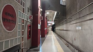
Kirazlı, or Kirazlı-Bağcılar, is an underground rapid transit complex of the Istanbul Metro and is serviced by lines M1B and M3.
Bayrampaşa—Maltepe is a rapid transit station on the M1 line of the Istanbul Metro. It is located in southern Eyüp, adjacent to the O-3 highway. An out-of-system connection Demirkapı station on the T4 light rail line is available as well as İETT buses.
Sağmalcılar is a rapid transit station on the M1 line of the Istanbul Metro. It is located in central Bayrampaşa, adjacent to the O-3 highway. Sağmalcılar was opened on 3 September 1989 as part of the first rapid transit line in Istanbul as well as Turkey and is one of the six original stations of the M1 line.
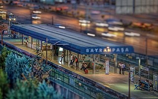
Kocatepe is a rapid transit station on the M1 line of the Istanbul Metro. It is located in central Bayrampaşa in the southern part of the neighborhoods Kocatepe. The station is on the north side of the Forum Istanbul Shopping Mall and has direct access to the mall. Kocatepe was opened on 3 September 1989 as part of the first rapid transit line in Istanbul as well as Turkey and is one of the six original stations of the M1 line. The station briefly served as the western terminus of the M1 between September and December 1989 until the line was extended to Esenler.

Otogar is a rapid transit station on the M1 line of the Istanbul Metro. It is located in southwestern Bayrampaşa in the center of the Esenler Bus Terminal.
Terazidere is a rapid transit station on the M1 line of the Istanbul Metro located in southern Esenler. It was opened on 31 January 1994 as part of the Otogar-Zeytinburnu extension and is one of the five stations of this extension.

Davutpaşa—YTÜ is a rapid transit station on the M1 line of the Istanbul Metro located in southern Esenler, close to the entrance of Yıldız Technical University or YTÜ. It was opened on 31 January 1994 as part of the Otogar-Zeytinburnu extension and is one of five stations of this extension.

Bakırköy—İncirli is an underground rapid transit complex of the Istanbul Metro and served by lines M1A and M3. It is located in north-eastern Bakırköy district next to the E80 motorway.
Menderes is an underground rapid transit station on the M1B line of the Istanbul Metro. It was opened on 14 June 2013 as part of the four new stations of the M1B extension to Kirazlı.

Üçyüzlü is an underground rapid transit station on the M1B line of the Istanbul Metro. It was opened on 14 June 2013 as part of the four new stations of the M1B extension to Kirazlı.
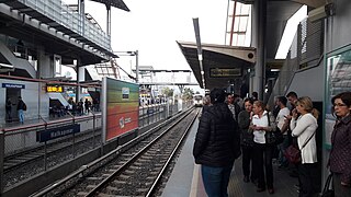
Bağcılar Meydan is an underground rapid transit station on the M1B line of the Istanbul Metro. It was opened on 14 June 2013 as part of the four new stations of the M1B extension to Kirazlı. The station is in the vicinity of the Bağcılar tram station, which is serviced by the T1 line to Zeytinburnu and Kabataş.

Yenibosna is a station on the M1 line of the Istanbul Metro in Bakırköy, Istanbul. The station was opened on 25 July 1995 and was the western terminus of the M1 until 2002, when the line was extended towards Atatürk Airport.
DTM—İstanbul Fuar Merkezi is a station on the M1 line of the Istanbul Metro in Bakırköy, Istanbul. The station consists of an elevated island platform servicing two tracks within the Istanbul World Trade Center.