| Ankara Esertepe Park | |
|---|---|
 Esertepe Park | |
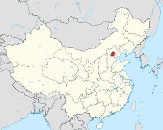
| Location | Ankara, Turkey |
| Coordinates | 39°59′17.16″N32°49′53.00″E / 39.9881000°N 32.8313889°E |
| Area | 18.3 ha (45 acres) |
| Created | 2015 |
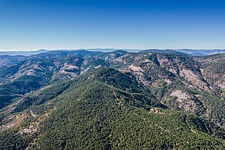
Esertepe Park (literally Esertepe Park) is a public park in Ankara, Turkey.
| Ankara Esertepe Park | |
|---|---|
| Esertepe Park | |
| Location | Ankara, Turkey |
| Coordinates | 39°59′17.16″N32°49′53.00″E / 39.9881000°N 32.8313889°E |
| Area | 18.3 ha (45 acres) |
| Created | 2015 |
Esertepe Park (literally Esertepe Park) is a public park in Ankara, Turkey.
The 18.3 ha (45 acres) park is at the northern part of Ankara. Its altitude changes between 985 m (3,232 ft) and 1,055 m (3,461 ft), which makes it one of the highest points in Ankara. It is surrounded by high density residential buildings of Etlik.
During the early years of the Turkey, the site was used as an open air range by the Turkish Military. As the growth of the city of Ankara step by step site surrounded by the high density residential buildings. In 1970, Turkish Military stop using site as an open air range due to the safety precautions and left area unused. In 2013, Municipality of Ankara took the site and established Esertepe Park [1] and opened to the public on 19 May 2015, the National Youth Day.

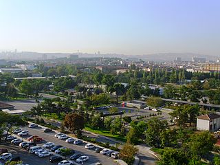
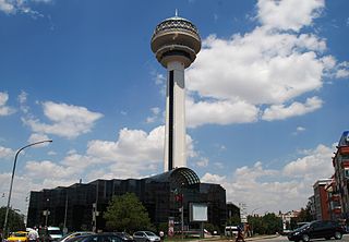
Ankara is the capital city of Turkey. Located in the central part of Anatolia, the city has a population of 5.1 million in its urban center and 5.8 million in Ankara Province. Ankara is Turkey's second-largest city after Istanbul by population, first by urban area (4,130 km2), and third by metro area (25,632 km2).

Transport in Turkey is road-dominated and mostly fuelled by diesel. Transport consumes a quarter of energy in Turkey, and is a major source of air pollution in Turkey and greenhouse gas emissions by Turkey. The World Health Organization has called for more active transport such as cycling. As of 2023 health impact assessment is not done in Turkey.
Beijing is a municipality located in North China at the northern tip of the North China Plain, near the meeting point of the Xishan and Yanshan mountain ranges. The city itself lies on flat land that opens to the east and south. The municipality's outlying districts and counties extend into the mountains that surround the city from the southwest to the northeast. The highest peaks are over 2,000 m (6,600 ft).

Anıtkabir is a mausoleum complex located in the Çankaya district of Ankara, Turkey. It serves as the resting place of Mustafa Kemal Atatürk, founder and first President of the Turkish Republic. Designed by architects Emin Onat and Orhan Arda, the construction of Anıtkabir began in 1944 and was completed in 1953. In addition to the mausoleum, the complex consists of various structures and monuments, as well as a wooded area known as the Peace Park.
Yenimahalle is a municipality and metropolitan district of Ankara Province, Turkey. Its area is 219 km2, and its population is 704,652 (2022). It is a fast-growing urban residential district of the city of Ankara, Turkey's capital. Its elevation is 861 m (2,825 ft).

Altındağ is a municipality and district of Ankara Province, Turkey. Its area is 123 km2, and its population is 413,994 (2022). It covers the northeastern part of the city of Ankara. Its elevation is 900 m (2,953 ft).

Beypazarı is a municipality and district of Ankara Province, Turkey. Its area is 1,697 km2, and its population is 48,357 (2022). It is approximately 100 km northwest of the city of Ankara. The elevation in the center is 675 m (2,215 ft). It used to be an important city in Asia Minor in ancient times.
The Cinnah Caddesi is a major road located in the city of Ankara, the capital of Turkey. It is one of the most important arteries of traffic and commerce in the city. It is named after the founder of Pakistan, Muhammad Ali Jinnah.

The Theodosius Cistern is one of many ancient cisterns of Constantinople that lie beneath the city of Istanbul, Turkey. The modern entrance is in Piyer Loti Caddesi, Fatih.

Gençlik Parkı is a public park in Ankara, Turkey.
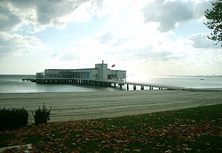
Florya Atatürk Marine Mansion, is a historic presidential residence located offshore in the Sea of Marmara in the Florya neighborhood of the Bakırköy district in Istanbul, Turkey.

The Öküz Mehmed Pasha Caravanserai is a caravanserai located in Kuşadası, Aydın Province, western Turkey, built by Ottoman statesman and military commander "Öküz" Mehmed Pasha. After its renovation, the building is used as a hotel today.

Sunay Erdem is a Turkish landscape architect and self-taught architect. He is one of Turkey's most prolific and best Landscape architects of his generation. Sunay Erdem founded Erdem Architects with his brother, Günay Erdem, in 1998.
Elazığ Culture Park is a public park in Elazığ, a city in the Eastern Anatolia region of Turkey. The park is counted as one of the largest parks in the region.
Elazığ Botanical Park is the first botanical park at the central and eastern parts of Turkey.
Elazığ Gazi Caddesi is the first urban design project in Elazığ, Turkey.

Güvenpark or Güven Park, is an urban public park located adjacent to the Liberty Square in the Kızılay neighborhood of Ankara in Turkey. Established in the 1930s as part of the green belts proposed in the urban plan of the rapid growing capital, the park is noted for the Security Monument. In mid-March 2016, a bomb explosion close to it caused the death of more than 30 people while over 100 were injured.
Soğuksu National Park, established on February 19, 1959, is a national park in central Anatolia, Turkey. It is located in the Kızılcahamam district of Ankara Province.

Ankara Aviation Museum is a military-based museum for aviation, owned and operated by the Turkish Air Force. The museum is located in Etimesgut district of Ankara, Turkey. The area of the museum is 64,321 m2 (692,350 sq ft).
Tosun is a remote controlled armored wheel loader developed in Turkey for combat engineering missions. It is manufactured by Best Group and used by the Turkish Army and Turkish Police.
| | This geographical article about a location in Ankara Province, Turkey is a stub. You can help Wikipedia by expanding it. |