Esquilinchuche

Last updated
Sign on the road to Esquilinchuche Esquilinchuche sign.JPG
Sign on the road to Esquilinchuche

El Esquilinchuche is a small village in the municipality of Juticalpa, Olancho, Honduras.

Contents

Topography and access

El Esquilinchuche sits on a low rise that forms the banks of the flood plain of the Guayape river that lies approximately 2 km to the south during the dry season, but comes to within 400 m during the annual monsoon floods.

Esquilinchuche is connected to the main Olancho highway from Jutiquile, via a loop consisting of 10 km of dirt road, passing through the other small towns of San Marcos de Jutiquile, and El Portrero de Casas, then through Esquilinchuche, continuing to loop back to the main highway via the highway junction closer to Catacamas leading through the small town of Arimis, by 6 km of dirt road. The villages of Las Tablas and La Pusunca can also be accessed through a connecting road junction in San Marcos de Jutiquile.

A temporary wooden toll bridge is set up every year during the dry season south of Esquilinchuche crossing the Guayape River and taken down during the wet season when the river grows from one that can be waded to a torrent that is often over 1 km in width.

Government

Esquilinchuche is loosely governed by a local group of village elders known as the 'patronato'. There are no governmental offices of any kind to be found in Esquilinchuche or the surrounding small towns.

Main Street in Esquilinchuche with the school in the background - right. Esquilinchuche streets & school.JPG
Main Street in Esquilinchuche with the school in the background - right.

The name

El Esquilinchuche is known by its residents to be named for a large tree with sparse long leaves (approximately 1.5 x 8 inch) and prominent white five petaled flowers that once grew in abundance in the town. The Esquilinchuche tree has a very soft wood and is identifiable by the milky sap that oozes out when any branch is cut. Today there are no Esquilinchuche trees in El Esquilinchuche. The tree is said to be named for Esquiline Hill, one of the famous seven hills of Ancient Rome.

Residents and town amenities

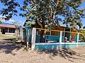
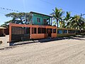
The residents of this mostly agricultural community for the most part dedicate themselves to agricultural pursuits. The several small stores ("pulperias") are set in the living rooms of houses. There are no lodging or other amenities to be found other than freshly prepared foods occasionally offered by some pulperias. El Esquilinchuche boasts a fine Catholic church, an elementary school, a large soccer field, and good quality residential freshwater from a water tower or "pila" set on a low hill next to the Rivera ranch. Electricity first came to the community in the early 1990s. Cell phones now are in common use among the residents of this town that in 2005 boasted one telephone.

During Hurricane Mitch in 1998 the Guayape river lapped at the edges of the town, swallowing three residences that had been built a few feet below the level of the rest of the town. Other than some livestock, there were no fatalities.

Related Research Articles

Interstate 10 (I-10) is the southernmost cross-country highway in the American Interstate Highway System. I-10 is the fourth-longest Interstate in the United States at 2,460.34 miles (3,959.53 km), following I-90, I-80, and I-40. This freeway is part of the originally planned network that was laid out in 1956, and its last section was completed in 1990.

Hurricane Mitch

Hurricane Mitch is the second-deadliest Atlantic hurricane on record, causing over 11,000 fatalities in Central America in 1998, including approximately 7,000 in Honduras and 3,800 in Nicaragua due to catastrophic flooding from the slow motion of the storm. It was the deadliest hurricane in Central American history, surpassing Hurricane Fifi–Orlene, which killed slightly fewer people there in 1974.

Olancho Department Department of Honduras

Olancho is the largest of all the 18 departments into which Honduras is divided. The department covers a total surface area of 24,057 km² and has an estimated 2015 population of 537,306 inhabitants.

Tela Municipality in Atlántida, Honduras

Tela is a town, with a population of 38,030, and a municipality in Honduras on the northern Caribbean coast. It is located in the department of Atlantida.

Getafe Municipality in Community of Madrid, Spain

Getafe is a city in the Community of Madrid, Spain. As of 2018, it has a population of 180,747, the region's sixth most populated municipality.

La Esperanza, Honduras Place in Intibucá, Honduras

La Esperanza is the capital city and a municipality of the same name of the department of Intibucá, Honduras. La Esperanza is famous for having the coolest climate in Honduras. It is considered the heart of the Ruta Lenca, a region of Lenca ethnic influence that spans Honduras from Santa Rosa de Copan to Choluteca. Sites on the Lenca Trail have been designated by the government and United Nations development in order to encourage more cultural tourism, and help create new markets for the traditional crafts, such as pottery, practiced by the Lenca, in order to preserve their culture.

Duyure Place in Choluteca, Honduras

Duyure is a municipality located in the Honduran department of Choluteca.

Concepción, Intibucá Municipality in Intibucá, Honduras

Concepción is a municipality in the Honduran department of Intibucá.

Olanchito Municipality in Yoro, Honduras

Olanchito is a town, with a population of 45,270, and a municipality in the Honduran department of Yoro. The municipality was founded in 1530 and today comprises 70 villages, over 300 hamlets, and around 100,000 inhabitants. It is located 107 miles (172 km) North-East of Tegucigalpa, the country's capital. Olanchito is in the Central Time Zone, with a UTC offset of -6 hours. The city is the birthplace of many exponents of Honduran literature, such as Ramón Amaya Amador. Olanchito has his manuscripts, his collection of books, the table at which he wrote, and even his ashes. Known locally as the Civic City, Olanchito's main industry is based around agriculture.

Campamento, Honduras Municipality in Olancho, Honduras

Campamento is a municipality in the south west of the Honduran department of Olancho, south of Concordia and west of Juticalpa. The municipality of Campamento is located at the entrance to Olancho, along the main highway from Tegucigalpa. The town of Campamento is located near the center of the municipality, just north of the main highway.

Catacamas Municipality in Olancho, Honduras

Catacamas is a city, with a population of 59,990, and a municipality in the Olancho Department of Honduras.

Juticalpa, Olancho Municipality in Olancho, Honduras

Juticalpa is the capital of Olancho Department in Honduras, with a population of 69,850, and the municipal seat of Juticalpa Municipality. Situated in a broad river valley alongside the Rio Juticalpa, the town is a commercial centre for much of Olancho's ranching and agricultural economy.

La Unión, Olancho Municipality in Olancho, Honduras

La Unión is a municipality in the northwest of the Olancho Department of Honduras.

Interstate 10 (I-10) is the major east–west Interstate Highway in the Southern United States. In the U.S. state of Texas, it runs east from Anthony, at the border with New Mexico, through El Paso, San Antonio and Houston to the border with Louisiana in Orange, Texas. At just under 880 miles (1,420 km), the Texas segment of I-10, maintained by the Texas Department of Transportation, is the longest continuous untolled freeway in North America that is operated by a single authority. It is also the longest stretch of Interstate Highway with a single designation within a single state. Mile marker 880 and its corresponding exit number in Orange, Texas, are the highest numbered mile marker and exit on any freeway in North America. After widening was completed in 2008, a portion of the highway west of Houston is now also believed to be the widest in the world, at 26 lanes when including feeders.

Highway 9 is a provincial paved undivided highway in the Canadian province of Saskatchewan. It runs from North Dakota Highway 8 at the US border near Port of Northgate until it transitions into Provincial Road 283 at the Manitoba provincial boundary.

The Saskota Flyway is known as the International Road to Adventure, because it takes you from Hudson Bay, Saskatchewan, all the way south to Bismarck, North Dakota.

Vermont Route 58 (VT 58) is a 30.908-mile (49.742 km) east–west state highway in Franklin and Orleans counties in northern Vermont, United States. The western terminus of the route is at VT 118 in Montgomery. The eastern terminus of VT 58 is at VT 5A north of Westmore and Lake Willoughby. In Orleans, VT 58 runs concurrent to U.S. Route 5 for a short distance, interchanging with Interstate 91 (I-91) at exit 26 during that interval. The portion of VT 58 west of VT 100 in Lowell is town-maintained. This section is a dirt road and is closed during the winter months because it goes through Hazens Notch.

Old Albany Post Road Oldest dirt road in the United States

Old Albany Post Road is a 6.6-mile (10.6 km) dirt road in Philipstown, New York, one of the oldest unpaved roads still in use in the United States. It runs mostly north-south through the southeastern corner of the town, near the Putnam Valley town line. Starting from an intersection with Sprout Brook Road at Continental Village just north of the Putnam-Westchester county line, it ends at an oblique junction with US 9 east of Garrison.

October 2008 Central America floods

The October 2008 Central America floods were caused by a series of low-pressure areas including Tropical Depression Sixteen, a short-lived tropical cyclone in the 2008 Atlantic hurricane season that made landfall in Honduras. Heavy rainfall began in early October 2008 while a tropical wave passed through the region. On October 14, Tropical Depression Sixteen formed just off the northeast coast of Honduras, and at the same time a low pressure system was on the Pacific coast. Both systems increased rainfall across the region, although the depression dropped heavy rainfall close to its center when it moved ashore on October 15. Although Tropical Depression Sixteen quickly dissipated over land, its remnants persisted for several days. Another low pressure area interacted with a cold front on October 21, adding to the rainfall in the region.

Guayape River

The Guayape River is a major river that drains much of the Department of Olancho and central Honduras. The largest tributary to the Guayape is the Río Jalán, which joins it at El Plomo, not far from the town of Juticalpa. From there the river passes many small towns, including El Esquilinchuche. The largest bridge over the Guayape is the Puente del Burro, a modern cement structure that replaced the huge steel suspension bridge that had stood for decades after being built by the US Army Corps of Engineers, and was destroyed by Hurricane Mitch in 1998. Far downriver from the bridge, the Guayape joins with the Guayambre River, from then on the waterway is known as the Río Patuca.

The network of highways in Honduras is managed by the Secretariat of public works, transport and housing (SOPTRAVI), through the General Directorate of Roads, which is responsible for planning construction and maintenance work on the country's roads. Honduras has more than 15,400 kilometres (9,600 mi) of roads. Up to 1999, only 3,126 kilometres (1,942 mi) had been paved.