The Esschestroom is also called Essche Stroom, which is a mere matter of spelling. Another name is 'Run' which is a very common name for brooks. This can lead to confusion with the Run near Veldhoven. In medieval times the Esschestroom and some of the upstream water was called Dieze.
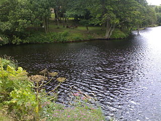
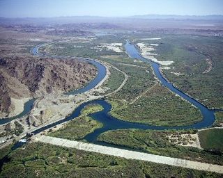
The river was canalized in 1965. Many meanders and kolks that used to store excess water were filled up during this operation. The clock kolk (Klockwiel) was filled up with waste from the village (which?). In time the river got the nickname 'Dirty Stream' because of all the local industry that polluted the river.
Ecology
In the first decade of the 21st century there was a plague of the floating pennywort in the Esschestroom. In the Netherlands it is foreign, invasive, and tends to clog up waterways.
In 2005 a plan was made to restore the water storage capacity, the ecological and the recreational values of the Essche Stroom. It became a very large project that is still active in 2020. Some of the constituent projects have already been completed. Some of these projects led to re-opening filled meanders of the Esschestroom. Other projects targeted the migration of fish and frogs.
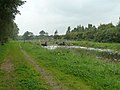
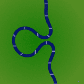
One of these projects was the project Halsche Beemden, finished in 2014. It brought back about three kilometers of meanders between the highway A2 and the railway from Boxtel to 's-Hertogenbosch. Furthermore, ponds were created for amphibian life. The canalized Esschestroom stayed in place for storing excess water, and the area east of the new meanders would be allowed to flood in case of emergency. The new natural reserve that was thus created soon attracted plants, fish and wildlife. The project also created facilities for hiking and canoeing.[1]
Further north the project Levendig Bleijendijk was finished in 2015. Here the canalized Esschestroom itself was rerouted, so it meandered again over 2.5 km. The dykes were moved further from the shore, and made place for lower waterlines which were allowed to flood. From 2015 visitors were welcomed to the area.[2]
↑ "LEVENDIG BLEIJENDIJK"[Lively Bleijendijk]. Essche Stroom in Beweging. Retrieved 26 October 2020.
Related Research Articles
The Aller is a 215-kilometre-long (134 mi) river in the states of Saxony-Anhalt and Lower Saxony in Germany. It is a right-hand, and hence eastern, tributary of the Weser and is also its largest tributary. Its last 117 kilometres (73 mi) form the Lower Aller federal waterway. The Aller was extensively straightened, widened and, in places, dyked during the 1960s to provide flood control of the river. In a 20-kilometre-long (12 mi) section near Gifhorn, the river meanders in its natural river bed.
The River Foss is in North Yorkshire, England. It is a tributary of the River Ouse. It rises in the Foss Crooks Woods near Oulston Reservoir close to the village of Yearsley and runs south through the Vale of York to the Ouse in the centre of York. The name most likely comes from the Latin word Fossa, meaning ditch. It is mentioned in the Domesday Book. The York district was settled by Norwegian and Danish people, so parts of the place names could be old Norse. Referring to the etymological dictionary "Etymologisk ordbog", ISBN 82-905-2016-6 deals with the common Danish and Norwegian languages – roots of words and the original meaning. The old Norse word Fos (waterfall) means impetuous. The River Foss was dammed, and even though the elevation to the River Ouse is small, a waterfall was formed. This may have led to the name Fos which became Foss.
Lake Austin, formerly Lake McDonald, is a water reservoir on the Colorado River in Austin, Texas. The reservoir was formed in 1939 by the construction of Tom Miller Dam by the Lower Colorado River Authority. Lake Austin is one of the seven Highland Lakes created by the LCRA, and is used for flood control, electrical power generation, and recreation.
The Cowlitz River is a river in the state of Washington in the United States, a tributary of the Columbia River. Its tributaries drain a large region including the slopes of Mount Rainier, Mount Adams, and Mount St. Helens.
The Jubilee River is a hydraulic channel in southern England. It is 11.6 km (7.2 mi) long and is on average 45 metres wide. It was constructed in the late 1990s and early 2000s to take overflow from the River Thames and so alleviate flooding to areas in and around the towns of Maidenhead, Windsor, and Eton in the counties of Berkshire and Buckinghamshire. It achieves this by taking water from the left bank of the Thames upstream of Boulter's Lock near Maidenhead and returning it via the north bank downstream of Eton. Although successful in its stated aims, residents of villages downstream, such as Wraysbury, claim it has increased flooding in those locations.
The Dommel is a small river in Belgium and the Netherlands, left tributary of the Dieze. It is 120 km long, of which 85 km are in the Netherlands. The Dommel takes in water from the Keersop, Tongelreep, Run, Gender and Kleine Dommel streams and merges at 's-Hertogenbosch with the Aa stream to form the river Dieze, which subsequently flows towards the Meuse. The main cities and towns along the Dommel's course are Peer, Neerpelt, Valkenswaard, Dommelen, Eindhoven, Son en Breugel, Sint-Oedenrode, Boxtel, Sint-Michielsgestel and 's-Hertogenbosch.
The River Leven in North Yorkshire, England is a tributary of the River Tees. It rises on Warren Moor, part of Kildale Moor, in the North York Moors and flows to the north of the moors to join the River Tees at Yarm.
The Aa is a small river in the Netherlands. It rises near Nederweert in the southeastern province of Limburg, in the Peel region. It flows northwest through the province of North Brabant towards 's-Hertogenbosch, roughly along the Zuid-Willemsvaart canal. In 's-Hertogenbosch, at the confluence of the Aa and the Dommel, the river Dieze is formed, which flows into the Meuse a few km further. The main cities and towns along the Aa's course are Asten, Helmond, Veghel and 's-Hertogenbosch.
A kolk is an underwater vortex causing hydrodynamic scour by rapidly rushing water past an underwater obstacle. High-velocity gradients produce a high-shear rotating column of water, similar to a tornado. Kolks can pluck multiple-ton blocks of rock and transport them in suspension for kilometres.
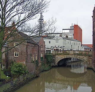
The Dieze is a short river in North Brabant, the Netherlands, tributary of the Meuse. It is formed by the confluence of the rivers Aa and Dommel in 's-Hertogenbosch. The part of the Dieze in the centre of 's-Hertogenbosch is called Binnendieze, a partly covered network of canals. The Dieze flows into the Meuse near Hedel.
Binnendieze is the common name for the river and canal system within the city walls of 's-Hertogenbosch, the Netherlands. It is a tourist attraction. Near the north-west tip of the city walls, the confluence of the Binnendieze with the rivers Aa and Dommel forms the short river Dieze, tributary of the Meuse.
A rock-cut basin is a natural cylindrical depression cut into stream or river beds, often filled with water. Such plucked-bedrock pits are created by kolks; powerful vortices within the water currents which spin small boulders around, eroding out these rock basins by their abrasive action. These basins are frequently found in streams and rivers with a relatively soft rock substrates such as limestones and sandstones. The rather unusual and man-made appearance of such depressions has led to various folk-tales becoming associated with them, such as their identification as petrosomatoglyphs, including knee prints, elbow prints, etc. of saints, heroes, kings or supernatural beings.
A river is a natural freshwater stream that flows on land or inside caves towards another body of water at a lower elevation, such as an ocean, lake, or another river. A river may run dry before reaching the end of its course if it runs out of water, or only flow during certain seasons. Rivers are regulated by the water cycle, the processes by which water moves around the Earth. Water first enters rivers through precipitation, whether from rainfall, the runoff of water down a slope, the melting of glaciers or snow, or seepage from aquifers beneath the surface of the Earth.
A bar in a river is an elevated region of sediment that has been deposited by the flow. Types of bars include mid-channel bars, point bars, and mouth bars. The locations of bars are determined by the geometry of the river and the flow through it. Bars reflect sediment supply conditions, and can show where sediment supply rate is greater than the transport capacity.
The Yuma Project is a U.S. Bureau of Reclamation project built to irrigate over 68,000 acres (280 km2) of land in Yuma County, Arizona and parts of Imperial County, California. The project is designed to exploit year-round farming conditions and water from the Colorado River. It consists of the Laguna Diversion Dam, pumping plants, a power plant, a 53-mile (85 km) system of canals, 218 miles (351 km) of lateral canals, levees and drains. The project began in 1903 and the majority of the work was completed by 1915. It was the first dam and reclamation project on the Colorado River and workers had to overcome many natural and logistical obstacles to build and maintain it. The Laguna Diversion Dam was replaced by the Imperial Dam as the Project's water source between 1941 and 1948. Today, it serves 275 farms and over 94,000 people.
A meander cutoff is a natural form of a cutting or cut in a river occurs when a pronounced meander (hook) in a river is breached by a flow that connects the two closest parts of the hook to form a new channel, a full loop. The steeper drop in gradient (slope) causes the river flow gradually to abandon the meander which will silt up with sediment from deposition. Cutoffs are a natural part of the evolution of a meandering river. Rivers form meanders as they flow laterally downstream.
The Speyerbach is a left tributary of the Rhine in the Palatinate part of Rhineland-Palatinate. In Speyer, the river split into Gießhübelbach and Woogbach. The Woogbach changes its name to Nonnenbach, then flows into Gießhübelbach shortly before the latter flows into the Rhine.
Sint-Michielsgestel is a village in the municipality of Sint-Michielsgestel, Netherlands.
The Kleine Dommel or Rul is a brook in the Campine and Meierij van 's-Hertogenbosch, Netherlands.
Welton Beck is a small local stream which originates from Old Man's Head Spring in the west of Welton civil parish and flows eastwards through Welton and Dunholme in the West Lindsey district of Lincolnshire for approximately 10 km (6.2 mi) to a confluence with Barlings Eau near Reasby, which goes on to join the River Witham. The beck is fed from groundwater springs of the Lincolnshire limestone aquifer, with clear freshwater and aquatic plant growth typical of calcareous conditions. The channel of the beck has been largely modified from its original state, having been widened, straightened, and its course significantly altered.
This page is based on this Wikipedia article Text is available under the CC BY-SA 4.0 license; additional terms may apply. Images, videos and audio are available under their respective licenses.