Calabarzon, sometimes referred to as Southern Tagalog and designated as Region IV‑A, is an administrative region in the Philippines. The region comprises five provinces: Batangas, Cavite, Laguna, Quezon, and Rizal; and one highly urbanized city, Lucena. It is the most populous region in the Philippines, according to the Philippine Statistics Authority (PSA), having over 16.1 million inhabitants in 2020, and is also the country's second most densely populated after the National Capital Region. It is situated southeast of Metro Manila, and is bordered by Manila Bay and South China Sea to the west, Lamon Bay and the Bicol Region to the east, Tayabas Bay and the Sibuyan Sea to the south, and Central Luzon to the north. It is home to places like Mount Makiling near Los Baños, Laguna, and Taal Volcano in Batangas. Calamba City is the regional center while Antipolo is the most populous city in the region.

The president of the Philippines is the head of state, head of government and chief executive of the Philippines. The president leads the executive branch of the Philippine government and is the commander-in-chief of the Armed Forces of the Philippines.

Malacañang Palace, officially known as Malacañan Palace, is the official residence and principal workplace of the president of the Philippines. It is located in the Manila district of San Miguel, along Jose P. Laurel Street though it is commonly associated with Mendiola Street nearby. The term Malacañang is often used as a metonym for the president, their advisers, and the Office of the President of the Philippines. The sprawling Malacañang Palace complex includes numerous mansions and office buildings designed and built largely in the bahay na bato and neoclassical styles. Among the presidents of the present Fifth Republic, only Gloria Macapagal Arroyo actually lived in the main palace as both her office and her residence, with all others residing in nearby properties that form part of the larger palace complex. The palace has been seized several times as a result of protests starting with the People Power Revolution of 1986, the 1989 coup attempt, the 2001 Manila riots, and the EDSA III riots.

San Miguel is a primarily middle-class residential area of the City of Manila and is one of the city's sixteen traditional districts.
Lakandula was the title of the last lakan or paramount ruler of pre-colonial Tondo when the Spaniards first conquered the lands of the Pasig River delta in the Philippines in the 1570s.

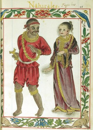
In early Philippine history, the Tagalog settlement at Tondo, sometimes referred to as the Kingdom of Tondo, was a major trade hub located on the northern part of the Pasig River delta on Luzon island. Together with Maynila, the polity (bayan) that was also situated on the southern part of the Pasig River delta, Tondo had established a shared monopoly on the trade of Chinese goods throughout the rest of the Philippine archipelago, making it an established force in trade throughout Southeast Asia and East Asia.

In early Philippine history, the rank of lakan denoted a "paramount ruler" of one of the large coastal barangays on the central and southern regions of the island of Luzon.

Namayan, also called Sapa, Maysapan, and sometimes Lamayan, was an independent indigenous polity on the banks of the Pasig River in the Philippines. It is believed to have achieved its peak in 1175, and to have gone into decline sometime in the 13th century, although it continued to be inhabited until the arrival of European colonizers in the 1570s.

The Battle of Bangkusay, on June 3, 1571, was a naval engagement that marked the last resistance by locals to the Spanish Empire's occupation and colonization of the Pasig River delta, which had been the site of the indigenous polities of Rajahnate of Maynila and Tondo.

In Philippine history, the Tagalog bayan of Maynila was one of the most cosmopolitan of the early historic settlements on the Philippine archipelago. Fortified with a wooden palisade which was appropriate for the predominant battle tactics of its time, it lay on the southern part of the Pasig River delta, where the district of Intramuros in Manila currently stands, and across the river from the separately-led Tondo polity.

In early Philippine history, barangay is the term historically used by scholars to describe the complex sociopolitical units that were the dominant organizational pattern among the various peoples of the Philippine archipelago in the period immediately before the arrival of European colonizers. Academics refer to these settlements using the technical term "polity", but they are usually simply called "barangays".

The earliest recorded history of Manila, the capital of the Philippines, dates back to the year 900 AD, as recorded in the Laguna Copperplate Inscription. By the thirteenth century, the city consisted of a fortified settlement and trading quarter near the mouth of the Pasig River, the river that bisects the city into the north and south.

The 1570 Battle of Manila was fought in Manila between Luzonians, led by Prince Sulayman, and Spaniards, led by field marshal Martin de Goiti, on 24 May 1570. Goiti's forces eventually besieged the fort of Manila, destroyed Manila, and won the battle, with the site of the fort falling to the Kingdom of the Spains and the Indies. The Spaniards then founded a Spanish city of Manila making it the capital of the Spanish East Indies.

Mel Lopez Boulevard, formerly known as President Ferdinand E. Marcos Highway or simply as Marcos Road, is a 6.2-kilometer (3.9 mi), six-to-ten lane divided highway in northern Manila, Philippines, connecting Bonifacio Drive in Port Area and Intramuros in the south with Radial Road 10 (R-10) in Navotas in the north. The highway is the main component of the R-10 network, which runs north of the Pasig River until Anda Circle, and is an extension of Bonifacio Drive, running north–south through the Manila North Port area serving the coastal districts of Tondo and Port Area, as well as San Nicolas and Intramuros.
The following is a timeline of the history of the city and metropolitan area of Manila, the capital city of the Philippines.

The term Paramount Ruler, or sometimes Paramount Datu, is a term used by historians to describe the highest ranking political authorities in the largest lowland polities or inter-polity alliance groups in early Philippine history, most notably those in Maynila, Tondo, Pangasinan, Cebu, Bohol, Butuan, Cotabato, and Sulu.

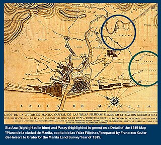
The Estero de Sunog Apog is one of the rivulets, known as esteros, which delineated the small islands which historically constituted the City of Manila and its predecessors, the Tagalog polities of Maynila and Tondo. These esteros, along with the larger rivers of Manila Bay and the Pasig River delta, originally formed an important connecting network which allowed the precolonial polities of that Tagalog and Kapampangan peoples. It currently runs along part of the boundaries of Manila's 1st and 2nd legislative districts.

In early Philippine history, the Tagalog bayan of Cainta was a fortified upriver polity that occupied both shores of an arm of the Pasig River. It was located not far from where the Pasig River meets the Lake of Ba-i and is presumed to be the present site of the municipality of Cainta, Rizal.


