Executive Order 13754

Last updated
Bering Strait Region, a portion of the region protected under the Climate Resilience executive order 2016 Bering Strait.jpeg
Bering Strait Region, a portion of the region protected under the Climate Resilience executive order 2016
USCG ice cutters navigating through the Bering Sea ice Icebreakers Louis S. St-Laurent and Healy in the Arctic Ocean.jpg
USCG ice cutters navigating through the Bering Sea ice

The Bering Strait has become vulnerable to climatic changes, trans Arctic shipping, and resource exploitation. The Obama administration's Executive Order 13754 of December 9, 2016 [1] defines a Northern Bering Sea Climate Resilience Area that gives protection to the indigenous coastal communities that rely on the strait for subsistence hunting, and the surrounding marine ecosystem's vitality. [2] It exists within the U.S exclusive economic zone and within maritime boundaries agreed upon between the Soviet Union and the U.S. [3] The ecosystem, civilization, and international trade all rely on each other, thus encouraging the establishment of the sensitive marine areas in the Bering Strait. The executive order was upheld by international climate goals, and environmental management standards. Since the location is of international interest, it became vital to protect this area from further exploitation in the oil and shipping industry. [3]

Contents

Background

A map of the sanctioned resilience area, and lease withdrawal region Northern Bering Sea Climate Resilience Area - Executive Order Map.pdf
A map of the sanctioned resilience area, and lease withdrawal region

This executive order was a response to delegates from the Bering Sea Elders Group who sought advice from the administration. Considering Arctic biodiversity preservation, a sustainable economy, ecosystem coordination, and proper stewardship, international efforts from environmental managers and climate sciences became recently concerned with the Northern Bering Sea area. [1] The Bering Sea is of particular significance and value due to it being the habitat of multiple large marine mammal migration paths . [4] Anthropogenic factors have become a threat to the benthic habitat and overall Arctic ecosystem which has had an effect on indigenous tribes such as the Yup’ik, Cup’ik and Inupiaq peoples. To ensure the functioning of the human-environment interaction in the Northern Bering Sea, resilience government methods were implemented by the Obama Administration. [2]

Arctic Climate Change Issues

Sea Ice recession

Due to abnormal weather patterns and warming temperatures in the Arctic and Northern Bering Sea region, sea ice has receded making larger areas of navigable waters available to shipping vessels. [3] The heavy reliance of the indigenous people on the marine environment is now vulnerable with the lack of sea ice during critical points in the seasons. [5] The sea ice loss not only affects the surrounding marine ecosystem but also the local coastal communities making the shoreline vulnerable to storm surges and increased erosion. [6] This has created a double hazard for the marine species populations in the region, with their environment slowly disappearing and also increased ship traffic increasing marine casualties from ship strikes. [5]

Policy Breakdown

Lease Withdrawal

I hereby withdraw from disposition by leasing for a time period without specific expiration the following areas of the Outer Continental Shelf: (1) the area currently designated by the Bureau of Ocean Energy Management as the Norton Basin Planning Area; and (2) the Outer Continental Shelf lease blocks within the Bureau of Ocean Energy Management's St. Matthew-Hall Planning Area lying within 25 nautical miles of St. Lawrence Island. The boundaries of the withdrawn areas are more specifically delineated in the attached map and, with respect to the St. Matthew-Hall Planning Area, the accompanying table of withdrawn Outer Continental Shelf lease blocks. Both the map and table form a part of this order, with the table governing the withdrawal and withdrawal boundaries within the St. Matthew-Hall Planning Area. This withdrawal prevents consideration of these areas for future oil or gas leasing for purposes of exploration, development, or production. This withdrawal furthers the principles of responsible public stewardship entrusted to this office and takes due consideration of the importance of the withdrawn area to Alaska Native tribes, wildlife, and wildlife habitat, and the need for regional resiliency in the face of climate change. Nothing in this withdrawal affects rights under existing leases in the withdrawn areas. [3]

The above quote states word for word from the executive order the details of the withdrawal of oil exploration and exploitation to prevent further anthropogenic harm to the Northern Bering Sea marine region. This withdrawal will also prevent further oil spill damage to the surrounding areas by reducing the exploitation of oil and benthic habitat disturbance. The USCG (U.S Coast Guard) was said to have been working in compliance with the National Contingency Plan to prepare the village first responders with the best possible means. [1] [ clarification needed ]

Traditional knowledge in decision making

The functioning of the surrounding Bering Sea ecosystem has a reciprocating relationship from the perspective of the coastal Alaskan tribe communities who rooted their culture around the ecosystem. The Obama Administration included traditional knowledge and Alaskan NGO outreach in the executive decision. [6] The Intergovernmental Tribal Advisory Council was the first of its kind established to ensure traditional knowledge of the indigenous communities was included in federal decision making for the continuation in the Bering Sea Resilience Area protection initiatives. [7]

Sea ice seasonal variations. In recent years the amount of sea ice that survives the summer warming period has become smaller, and the warming periods have been increasing in length. Arctic melt trends graph.png
Sea ice seasonal variations. In recent years the amount of sea ice that survives the summer warming period has become smaller, and the warming periods have been increasing in length.

Related Research Articles

<span class="mw-page-title-main">Arctic</span> Polar region of the Earths northern hemisphere

The Arctic is a polar region located at the northernmost part of Earth. The Arctic region, from the IERS Reference Meridian travelling east, consists of parts of northern Norway, northernmost Sweden, northern Finland, Russia, the United States (Alaska), Canada, Danish Realm (Greenland), and northern Iceland, along with the Arctic Ocean and adjacent seas. Land within the Arctic region has seasonally varying snow and ice cover, with predominantly treeless permafrost under the tundra. Arctic seas contain seasonal sea ice in many places.

<span class="mw-page-title-main">Bering Sea</span> Sea of the northern Pacific Ocean off the coast of Alaska and Russia

The Bering Sea is a marginal sea of the Northern Pacific Ocean. It forms, along with the Bering Strait, the divide between the two largest landmasses on Earth: Eurasia and the Americas. It comprises a deep water basin, which then rises through a narrow slope into the shallower water above the continental shelves. The Bering Sea is named after Vitus Bering, a Danish navigator in Russian service, who, in 1728, was the first European to systematically explore it, sailing from the Pacific Ocean northward to the Arctic Ocean.

<span class="mw-page-title-main">Arctic National Wildlife Refuge</span> Protected area in Alaska

The Arctic National Wildlife Refuge or Arctic Refuge is a national wildlife refuge in northeastern Alaska, United States, on traditional Iñupiaq and Gwich'in lands. The refuge is 19,286,722 acres (78,050.59 km2) of the Alaska North Slope region, with a northern coastline and vast inland forest, taiga, and tundra regions. ANWR is the largest national wildlife refuge in the country, slightly larger than the Yukon Delta National Wildlife Refuge. The refuge is administered from offices in Fairbanks. ANWR is home to a diverse range of endemic mammal species; notably, it is one of the few North American locations with all three endemic American ursids—the polar bear, grizzly bear, and American black bear, each of which resides predominantly in its own ecological niche. Besides the bears, other mammal species include the moose, caribou, wolves, red and Arctic fox, Canada lynx, wolverine, pine marten, American beaver, and North American river otter. Further inland, mountain goats may be seen near the slope. Hundreds of species of migratory birds visit the refuge yearly, and it is a vital, protected breeding location for them. Snow geese, eiders and snowy owls may be observed as well.

<span class="mw-page-title-main">Chukchi Sea</span> Marginal sea of the Arctic Ocean north of the Bering Strait

The Chukchi Sea, sometimes referred to as the Chuuk Sea, Chukotsk Sea or the Sea of Chukotsk, is a marginal sea of the Arctic Ocean. It is bounded on the west by the Long Strait, off Wrangel Island, and in the east by Point Barrow, Alaska, beyond which lies the Beaufort Sea. The Bering Strait forms its southernmost limit and connects it to the Bering Sea and the Pacific Ocean. The principal port on the Chukchi Sea is Uelen in Russia. The International Date Line crosses the Chukchi Sea from northwest to southeast. It is displaced eastwards to avoid Wrangel Island as well as the Chukotka Autonomous Okrug on the Russian mainland.

<i>Chionoecetes</i> Genus of crabs

Chionoecetes is a genus of crabs that live in the northern Pacific and Atlantic Oceans.

<span class="mw-page-title-main">Marine ecosystem</span> Ecosystem in saltwater environment

Marine ecosystems are the largest of Earth's aquatic ecosystems and exist in waters that have a high salt content. These systems contrast with freshwater ecosystems, which have a lower salt content. Marine waters cover more than 70% of the surface of the Earth and account for more than 97% of Earth's water supply and 90% of habitable space on Earth. Seawater has an average salinity of 35 parts per thousand of water. Actual salinity varies among different marine ecosystems. Marine ecosystems can be divided into many zones depending upon water depth and shoreline features. The oceanic zone is the vast open part of the ocean where animals such as whales, sharks, and tuna live. The benthic zone consists of substrates below water where many invertebrates live. The intertidal zone is the area between high and low tides. Other near-shore (neritic) zones can include mudflats, seagrass meadows, mangroves, rocky intertidal systems, salt marshes, coral reefs, lagoons. In the deep water, hydrothermal vents may occur where chemosynthetic sulfur bacteria form the base of the food web.

<span class="mw-page-title-main">Arctic realm</span> Group of marine ecoregions in the Arctic zone

The Arctic realm is one of the planet's twelve marine realms, as designated by the WWF and Nature Conservancy. It includes the coastal regions and continental shelves of the Arctic Ocean and adjacent seas, including the Arctic Archipelago, Hudson Bay, and the Labrador Sea of northern Canada, the seas surrounding Greenland, the northern and eastern coasts of Iceland, and the eastern Bering Sea.

<span class="mw-page-title-main">Chukchi Shelf</span> Continental shelf

The Chukchi Shelf or Chukchi Sea Shelf is the westernmost part of the continental shelf of the United States and the easternmost part of the continental shelf of Russia. In the west it merges with the Russian Siberian Shelf. Within this shelf, the 50-mile Chukchi Corridor acts as a passageway for one of the largest marine mammal migrations in the world.
<span class="mw-page-title-main">Arctic Ocean</span> Ocean in the north polar region

The Arctic Ocean is the smallest and shallowest of the world's five major oceans. It spans an area of approximately 14,060,000 km2 (5,430,000 sq mi) and is known as one of the coldest of oceans. The International Hydrographic Organization (IHO) recognizes it as an ocean, although some oceanographers call it the Arctic Mediterranean Sea. It has also been described as an estuary of the Atlantic Ocean. It is also seen as the northernmost part of the all-encompassing World Ocean.

<span class="mw-page-title-main">Hotspot Ecosystem Research and Man's Impact On European Seas</span> International multidisciplinary project that studies deep-sea ecosystems

Hotspot Ecosystem Research and Man's Impact On European Seas (HERMIONE) is an international multidisciplinary project, started in April 2009, that studies deep-sea ecosystems. HERMIONE scientists study the distribution of hotspot ecosystems, how they function and how they interconnect, partially in the context of how these ecosystems are being affected by climate change and impacted by humans through overfishing, resource extraction, seabed installations and pollution. Major aims of the project are to understand how humans are affecting the deep-sea environment and to provide policy makers with accurate scientific information, enabling effective management strategies to protect deep sea ecosystems. The HERMIONE project is funded by the European Commission's Seventh Framework Programme, and is the successor to the HERMES project, which concluded in March 2009.

<span class="mw-page-title-main">Arctic policy of the United States</span>

The Arctic policy of the United States is the foreign policy of the United States in regard to the Arctic region. In addition, the United States' domestic policy toward Alaska is part of its Arctic policy.
<span class="mw-page-title-main">Hanna Shoal</span>

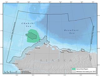
Hanna Shoal is a shallow, natural shoal located off the coast of northwest Alaska in the Chukchi Sea. The region around Hanna Shoal is one of the Chukchi Sea’s most biologically productive areas.

<span class="mw-page-title-main">Barrow Canyon</span> Submarine canyon

Barrow Canyon is a submarine canyon that straddles the boundary between the Beaufort and Chukchi seas. Compared to other nearby areas and the Canada Basin, the highly productive Barrow Canyon supports a diversity of marine animals and invertebrates.

Herald Shoal is a region of high benthic productivity on the Chukchi Sea shelf. It serves as rich foraging habitat for many species of marine mammals and birds.
<span class="mw-page-title-main">Northern Bering Sea Climate Resilience Area</span>

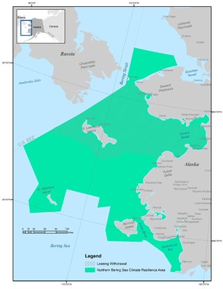
The Northern Bering Sea Climate Resilience Area, encompassing 291,000 square kilometers, is a protected area within the Bering Sea, established by President Obama on December 9, 2016 by Executive Order 13754. It represents a hugely productive, high-latitude marine ecosystem and supports one of the largest seasonal marine mammal migrations in the world, including thousands of bowhead and beluga whales, hundreds of thousands of walruses and ice seals, and millions of migratory birds. Moreover, it is home to more than 40 tribes of coastal Yup’ik and Inupiaq peoples whose way of life has been linked with the marine environment for thousands of years.
<span class="mw-page-title-main">Arctic resources race</span> Competition over resources in the Arctic

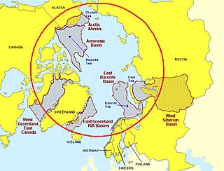
The Arctic resources race is the competition between global entities for newly available natural resources of the Arctic. Under the United Nations Convention of the Law of the Sea, five nations have the legal right to exploit the Arctic's natural resources within their exclusive economic zones: Canada, Russia, Denmark, Norway, and the United States.

<span class="mw-page-title-main">Arctic policy of Barack Obama</span>

Early on in his campaign for election, former president Barack Obama made it clear that climate change was a priority for his administration. Soon after becoming President Elect in November 2008, he reiterated this positing stating: “Now is the time to confront this challenge once and for all. Delay is no longer an option. Denial is no longer an acceptable response.” Contradictory to his 2008 campaign promises on the Offshore drilling debate, Obama felt obliged to open coastal areas off the Alaskan coast to exploratory assessments for oil and gas as a means to continue to stimulate economic growth. This decision in March 2010 was abruptly reversed in May 2010 after the catastrophic failure of the Deep Water Horizon drilling operation, which led to the six-month moratorium on deep water drilling in the United States territorial waters.

<span class="mw-page-title-main">Marine policy of the Barack Obama administration</span>

The Marine Policy of the Barack Obama administration comprises several significant environmental policy decisions for the oceans made during his two terms in office from 2009 to 2017. By executive action, US President Barack Obama increased fourfold the amount of protected marine space in waters under United States control, setting a major precedent for global ocean conservation. Using the U.S. president's authority under the Antiquities Act of 1906, he expanded to 200 nautical miles the seaward limits of Papahānaumokuākea Marine National Monument in Hawaiʻi and the Pacific Remote Islands Marine National Monument around the U.S. island possessions in the Central Pacific. In the Atlantic, Obama created the Northeast Canyons and Seamounts Marine National Monument, the first marine monument in the U.S. exclusive economic zone (EEZ) in the Atlantic.
Jacqueline M. Grebmeier is an American ecologist who specializes in polar biological oceanography.

<span class="mw-page-title-main">Sue Moore (scientist)</span> American marine scientist

Sue E. Moore is a scientist at the University of Washington known for her research on marine mammals in the Arctic.

References

  1. 1 2 3 "Northern Bering Sea Climate Resilience". Federal Register. 2016-12-14. Retrieved 2017-03-08.
  2. 1 2 Hillmer-Pegram, Robards, Kevin, Martin (January 2015). ""Relevance of a Particularly Sensitive Sea Area to the Bering Strait Region: a Policy Analysis Using Resilience-Based Governance Principles."". Ecology and Society. 26: 12.{{cite journal}}: CS1 maint: multiple names: authors list (link)
  3. 1 2 3 4 "Executive Order -- Northern Bering Sea Climate Resilience". whitehouse.gov. 2016-12-09. Retrieved 2017-05-02.
  4. Jones, Jenny (2016-11-04). "Northern Bering Sea Climate Resilience Area". Oceana USA. Retrieved 2017-03-09.
  5. 1 2 Grebmeier, Jacqueline (March 2006). "A major ecosystem shift in the northern Bering Sea". Science. 311 (5766): 1461–1464. doi:10.1126/science.1121365. PMID   16527980. S2CID   23505224.
  6. 1 2 Lincoln, Harry (December 2016). "President Obama Signs Executive Order to Protect the Northern Bering Sea". Bering Sea Elders Group.
  7. Hillmer-Pegram, K., Robards, M. D (2015). "Relevance of a Particularly Sensitive Sea Area to the Bering Strait Region: a Policy Analysis Using Resilience-Based Governance Principles". Ecology and Society. 20 (1 > Art. 26). doi:10.5751/ES-07081-200126. hdl: 10535/9786 via Google scholar.{{cite journal}}: CS1 maint: multiple names: authors list (link)