The Exploits River is a river in the province of Newfoundland and Labrador, Canada. It flows through the Exploits Valley in the central part of Newfoundland.

Peterview is a town located in the Exploits Valley area of central Newfoundland and Labrador, Canada, where Peters River empties into the Bay of Exploits, just south of Botwood, off Route 350.
Triton is a town that lies on Triton Island just off the coast of northeastern Newfoundland, in the Canadian province of Newfoundland and Labrador. Triton is the economic center of Green Bay South. According to Statistics Canada, Triton's population fell from 983 in 2016 to 896 in 2021.
Plate Cove East is a small community located in Bonavista Bay, Newfoundland and Labrador. It is part of the federal electoral riding of Bonavista—Gander—Grand Falls—Windsor. It was officially a town from 1960 until 2004. In 1966 it had a population of 237. In 2011 there were 89 inhabitants.
Little Burnt Bay is a small coastal community outside Embree and Lewisporte. In 2021, the population was 238, down 15.3 percent from 2016.

La Scie is a town in the Canadian province of Newfoundland and Labrador. The town had a population of 820 in the Canada 2021 Census, down from 872 in 2016.
Woodstock is a town in the Canadian province of Newfoundland and Labrador. The town had a population of 195 in 2021, up from 190 in the Canada 2016 Census.
O'Donnells is a local service district and designated place in the Canadian province of Newfoundland and Labrador. It is southeast of Placentia. The first postmistress was Mrs. Theresa M. Hanlon on July 16, 1951. By 1956 there was a population of 244.
Philips Head, or Phillips Head, is a local service district and designated place in the Canadian province of Newfoundland and Labrador. It is in the north-central portion of the island of Newfoundland. It is in the Bay of Exploits, west of Lewisporte and north of Botwood.
Plum Point is a local service district and designated place in the Canadian province of Newfoundland and Labrador. It is west of Anchor Point.
Harbour Round is a designated place in the Canadian province of Newfoundland and Labrador. It is east of Baie Verte.
Fortune Harbour or Fortune Harbor is a designated place in the Canadian province of Newfoundland and Labrador.

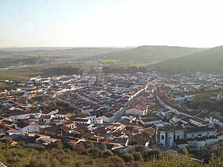
Alconchel is a Spanish municipality in the province of Badajoz, Extremadura. It has a population of 1,970 (2007) and an area of 294.9 km².
Laurenceton is a local service district and designated place in the Canadian province of Newfoundland and Labrador. It is southwest of Lewisporte.
Snook's Arm is a designated place in the Canadian province of Newfoundland and Labrador. The community was entirely resettled in 2018.
Smith's Harbour is a local service district and designated place in the Canadian province of Newfoundland and Labrador.
St. Patricks is a local service district and designated place in the Canadian province of Newfoundland and Labrador.
Cottrell's Cove is a local service district and designated place in the Canadian province of Newfoundland and Labrador.
Brown's Arm is a local service district and designated place in the Canadian province of Newfoundland and Labrador
Division No. 1, Subdivision E is an unorganized subdivision on the Avalon Peninsula in Newfoundland and Labrador, Canada. It is in Division 1 and contains the unincorporated communities of Broad Cove, Dildo, Green's Harbour, Harnum Point, Hopeall, New Harbour and Reids Room.


