Related Research Articles

In agriculture, a milpa is a field for growing food crops and a crop-growing system used throughout Mesoamerica, especially in the Yucatán Peninsula, in Mexico. The word milpa derives from the Nahuatl words milli and pan. Based on the agronomy of the Maya and of other Mesoamerican peoples, the milpa system is used to produce crops of maize, beans, and squash without employing artificial pesticides and artificial fertilizers.

The Maya are an ethnolinguistic group of indigenous peoples of Mesoamerica. The ancient Maya civilization was formed by members of this group, and today's Maya are generally descended from people who lived within that historical region. Today they inhabit southern Mexico, Guatemala, Belize, and westernmost El Salvador and Honduras.

El Mirador is a large pre-Columbian Middle and Late Preclassic Maya settlement, located in the north of the modern department of El Petén, Guatemala. It is part of the Mirador-Calakmul Karst Basin of northern Guatemala.

The Maya Mountains are a mountain range located in Belize and eastern Guatemala, in Central America.

The Usumacinta River is a river in southeastern Mexico and northwestern Guatemala. It is formed by the junction of the Pasión River, which arises in the Sierra de Santa Cruz and the Salinas River, also known as the Rio Chixoy, or the Rio Negro, which descends from the Sierra Madre de Guatemala. It defines part of the border between Guatemala and the Mexican state of Chiapas, then continues its northwesterly course, meandering through the Mexican state of Tabasco to the Gulf of Mexico.
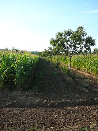
Agroforestry is a land use management system that integrates trees with crops or pasture. It combines agricultural and forestry technologies. As a polyculture system, an agroforestry system can produce timber and wood products, fruits, nuts, other edible plant products, edible mushrooms, medicinal plants, ornamental plants, animals and animal products, and other products from both domesticated and wild species.

The Lacandon Jungle is an area of rainforest which stretches from Chiapas, Mexico, into Guatemala. The heart of this rainforest is located in the Montes Azules Biosphere Reserve in Chiapas near the border with Guatemala in the Montañas del Oriente region of the state. Although much of the jungle outside the reserve has been cleared, the Lacandon is still one of the largest montane rainforests in Mexico. It contains 1,500 tree species, 33% of all Mexican bird species, 25% of all Mexican animal species, 56% of all Mexican diurnal butterflies and 16% of all Mexico's fish species.

Brosimum alicastrum, commonly known as breadnut, Maya nut or ramon, and many others, is a tree species in the family Moraceae of flowering plants, whose other genera include figs and mulberries.

The Maya Biosphere Reserve is a nature reserve in Guatemala managed by Guatemala's National Council of Protected Areas (CONAP). The Maya Biosphere Reserve covers an area of 21,602 km2, one-fifth of the country's total land area.
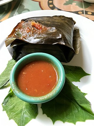
Ancient Maya cuisine was varied and extensive. Many different types of resources were consumed, including maritime, flora, and faunal material, and food was obtained or produced through strategies such as hunting, foraging, and large-scale agricultural production. Plant domestication concentrated upon several core foods, the most important of which was maize.

El Pilar is an ancient Maya city center located on the Belize-Guatemala border. The site is located 12 kilometres (7.5 mi) north of San Ignacio, Belize and can be accessed through the San Ignacio and Bullet Tree Falls on the Belize River. The name "El Pilar" is Spanish for "watering basin", reflecting the abundance of streams around the site and below its escarpment, which is rare in the Maya area.
The Mirador Basin is a hypothesized geological depression found in the remote rainforest of the northern department of Petén, Guatemala. Mirador Basin consists of two true basins, consisting of shallowly sloping terrain dominated by low-lying swamps called bajos; one draining into the San Pedro River and the other into the Candelaria River. The basin is surrounded by rugged karstic limestone hills on the east and south, forming a triangular geographical "trough" covering more than 2,169 km2 (837 sq mi). The geological formation of the landscape, as well as the significance of the formation, are the subject of some controversy in Northern Guatemala. NASA Shuttle Radar Topography Mission (SRTM) data indicate no depression in the area.
Carol Miller is an American-Mexican sculptor and author. She has been a sculptor for over 50 years, with some 200 exhibits to her credit. She has been a writer for the entirety her professional life.
Archaeology Under the Canopy is a conservation strategy developed by Dr. Anabel Ford for the preservation of pre-Columbian Maya monuments at the archeological site El Pilar, an ancient Maya center on the border of Belize and Guatemala. This style of conservation encourages the conservation of Maya forest foliage for the protection of monuments and the strategic exposure of ancient structures.

Vitis tiliifolia is a New World liana in the grape family commonly known as Caribbean grape. Other names include West Indian grape, water vine, Agrá and Bejuco de Agua and water tie-tie and water-wise.

Maya cities were the centres of population of the pre-Columbian Maya civilization of Mesoamerica. They served the specialised roles of administration, commerce, manufacturing and religion that characterised ancient cities worldwide. Maya cities tended to be more dispersed than cities in other societies, even within Mesoamerica, as a result of adaptation to a lowland tropical environment that allowed food production amidst areas dedicated to other activities. They lacked the grid plans of the highland cities of central Mexico, such as Teotihuacán and Tenochtitlan. Maya kings ruled their kingdoms from palaces that were situated within the centre of their cities. Cities tended to be located in places that controlled trade routes or that could supply essential products. This allowed the elites that controlled trade to increase their wealth and status. Such cities were able to construct temples for public ceremonies, thus attracting further inhabitants to the city. Those cities that had favourable conditions for food production, combined with access to trade routes, were likely to develop into the capital cities of early Maya states.
The Foundation for Maya Cultural and Natural Heritage (PACUNAM) is an organization of visionary corporations committed to the preservation of Guatemala's natural and cultural heritage through sustainable development for the benefit of future generations. One of PACUNAM's priorities is the conservation of the Maya Biosphere Reserve.

Tourism accounts for a large part of El Salvador's economy. El Salvador has many natural attractions including beaches with some of the best surfing breaks on the Pacific Coast. El Salvador offers many lush forests shrouded in cool temperatures with abundant wildlife and scenic mountain-top vistas. El Salvador also has great potential in the field of cultural tourism; with over 2,000 known archaeological sites, mostly of the Maya and Olmec cultures. These sites are of international interest for their easy access and well-preserved remains.
Anabel Ford is an American archaeologist specializing in the study of Mesoamerica, with a focus on the lowland Maya of Belize and Guatemala. She is recognized for her discovery of the ancient Maya city El Pilar. Ford is currently affiliated with the Institute of Social Behavioral and Economic Research (ISBER) and is the director of the MesoAmerican Research Center (MARC) at the University of California, Santa Barbara.
Ronald Nigh is an American ecological anthropologist focusing on Caribbean areas and the Maya region in Mesoamerica. Nigh is a professor and researcher at Centro de Investigaciones y Estudios Superiores en Anthropologia Social (CIESAS), where he continues his research on ecological anthropology.
References
- ↑ "Achievements". Exploring Solutions Past. 2 August 2013. Retrieved 16 October 2015.
- ↑ "About". Exploring Solutions Past. 11 July 2013. Retrieved 16 October 2015.
- ↑ "About our President". Exploring Solutions Past. 12 July 2013. Retrieved 16 October 2015.
- 1 2 Kettmann, Matt (11 October 2007). "The Mayas' Ancient Eco-Wisdom: UCSB Archaeologist Anabel Ford Brings the El Pilar Forest Gardners to Town". Santa Barbara Independent Inc. Santa Barbara Independent. Retrieved 16 October 2015.
- ↑ "What is at stake?". Exploring Solutions Past. 12 July 2013. Retrieved 16 October 2015.
- ↑ "Archaeology Under the Canopy". Exploring Solutions Past. 2 August 2013. Archived from the original on February 10, 2015. Retrieved 16 October 2015.
- ↑ "Ecotourism at El Pilar". MesoAmerican Research Center. Retrieved 16 October 2015.
- ↑ "Home". El Pilar Forest Garden Network. Retrieved 16 October 2015.
- ↑ Ford, Anabel. "Maya forestry for future generations". Rolex: Awards for Enterprise. Archived from the original on 18 October 2012. Retrieved 16 October 2015.
- ↑ Kurosaka, Lillian; Schlotter, Bill. "UCSB Archaeologist Says Innovative Plan for Maya Research Site is Making Major Strides". Science Blog. Retrieved 16 October 2015.
- ↑ Estrada, Andrea (9 October 2008). "Agreement Between UCSB and Guatemala Paves the Way for Archaeological Peace Park". UC Santa Barbara. The Current. Retrieved 16 October 2015.
- ↑ Castaneda, Adrian (28 October 2008). "Landmark El Pilar Peace Park Agreement Signed". Santa Barbara Independent, Inc. Santa Barbara Independent. Retrieved 16 October 2015.