
Glynn County is located in the southeastern part of the U.S. state of Georgia. As of the 2020 census, the population was 84,499. The county seat is Brunswick. Glynn County is part of the Brunswick, Georgia Metropolitan Statistical Area.

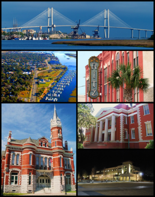
Brunswick is a city in and the county seat of Glynn County in the U.S. state of Georgia. As the primary urban and economic center of the lower southeast portion of Georgia, it is the second-largest urban area on the Georgia coastline after Savannah and contains the Brunswick Old Town Historic District. At the 2020 U.S. census, the population of the city proper was 15,210; the Brunswick metropolitan area's population as of 2020 was 113,495.

St. Simons Island is a barrier island and census-designated place (CDP) located on St. Simons Island in Glynn County, Georgia, United States. The names of the community and the island are interchangeable, known simply as "St. Simons Island" or "SSI", or locally as "The Island". St. Simons is part of the Brunswick metropolitan statistical area, and according to the 2020 U.S. census, the CDP had a population of 14,982. Located on the southeast Georgia coast, midway between Savannah and Jacksonville, St. Simons Island is both a seaside resort and residential community. It is the largest of Georgia's renowned Golden Isles. Visitors are drawn to the Island for its warm climate, beaches, variety of outdoor activities, shops and restaurants, historical sites, and natural environment.
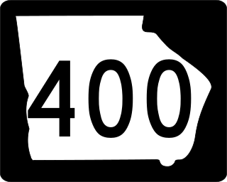
Georgia State Route 400 is a freeway and state highway in the U.S. state of Georgia serving parts of Metro Atlanta. It is concurrent with U.S. Route 19 from exit 4 until its northern terminus south-southeast of Dahlonega, linking the city of Atlanta to its north-central suburbs and exurbs. SR 400 travels from the Lindbergh neighborhood in the Buckhead district of Atlanta, at Interstate 85 (I-85), to just south-southeast of Dahlonega. Like the Interstate highways, it is a limited-access road, but unlike the interstates, the exit numbers are not mileage-based, they are sequential. Once SR 400 passes exit 18 (SR 369), it changes from a limited-access freeway into an at-grade divided highway with traffic lights, but still with a high speed limit of 65 miles per hour (105 km/h), and ends at the J. B. Jones Intersection at SR 60/SR 115 in Lumpkin County.

State Road 528 (SR 528), alternatively named the Martin Andersen Beachline Expressway, is a partially-tolled freeway in the U.S. state of Florida; it is maintained by the Florida's Turnpike Enterprise (FTE), the Central Florida Expressway Authority (CFX), and the Florida Department of Transportation (FDOT). Spanning approximately 53 miles (85 km) along a west–east axis, it connects Interstate 4 (I-4) in Orlando with I-95, Titusville, and Cape Canaveral on the Space Coast. It passes close to the tourist areas of Orlando, including SeaWorld and Universal Orlando, and serves the north entrance to Orlando International Airport. Near its east end, it passes over the Intracoastal Waterway on the Emory L. Bennett Causeway, and ends at SR A1A and SR 401 near Port Canaveral.
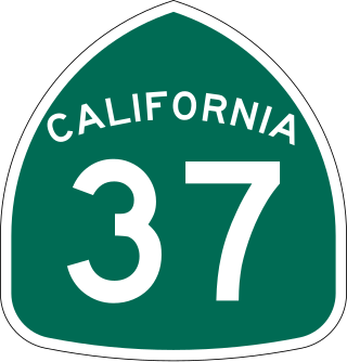
State Route 37 is a state highway in the U.S. state of California that runs 21 miles (34 km) along the northern shore of San Pablo Bay. It serves as a vital connection in the North Bay region of the San Francisco Bay Area, running from U.S. Route 101 in Novato, through northeastern Marin County, and the southern tips of both Sonoma and Solano Counties to Interstate 80 in Vallejo. Sonoma Raceway and Six Flags Discovery Kingdom are accessible from Highway 37.

The Lake Pontchartrain Causeway, also known simply as The Causeway, is a fixed link composed of two parallel bridges crossing Lake Pontchartrain in southeastern Louisiana, United States. The longer of the two bridges is 23.83 miles (38.35 km) long. The southern terminus of the causeway is in Metairie, Louisiana, and the northern terminus is in Mandeville, Louisiana. Both are in the New Orleans metropolitan area.

The Robert Moses Causeway is an 8.10-mile (13.04 km) state parkway in Suffolk County, New York on Long Island. It is named for the master builder and urban planner Robert Moses. The parkway, originally known as the Captree Causeway, connects West Islip on Long Island to the barrier beach islands, such as Captree Island, Jones Beach Island, and the western tip of Fire Island, to the south. It is designated New York State Route 908J (NY 908J), an unsigned reference route.
The Golden Isles of Georgia consist of barrier islands, and the mainland port cities of Brunswick and Darien on the 100-mile-long coast of the U.S. state of Georgia on the Atlantic Ocean. They include St. Simons Island, Sea Island, Jekyll Island, Little St. Simons Island, Sapelo Island, and Blackbeard Island. The islands are part of a long chain of barrier islands known as the "Sea Islands", located along the coasts of South Carolina, Georgia and northern Florida.
The Causeway is an arterial traffic crossing in Perth, Western Australia, linking the inner-city suburbs of East Perth and Victoria Park. It is carried over the Swan River at the eastern end of Perth Water by two bridges on either side of Heirisson Island. The current Causeway is the third structure to have been built across the river at this point.

Interstate 95 (I-95) is the main Interstate Highway of Florida's Atlantic Coast. It begins at a partial interchange with US Highway 1 (US 1) just south of downtown Miami and heads north through Jacksonville, and to the Georgia state line at the St. Marys River near Becker. The route also passes through the cities of Fort Lauderdale, West Palm Beach, Port St. Lucie, Titusville, and Daytona Beach.

U.S. Highway 17 (US 17) is a 124.20-mile-long (199.88 km) United States Numbered Highway in the U.S. state of Georgia. It travels south–north near the Atlantic Ocean, serving the Brunswick and Savannah metropolitan areas on its path from Florida at the St. Marys River to South Carolina at the Savannah River. Except for part of the highway in Savannah, which is concurrent with Interstate 16 and SR 404 Spur to the Talmadge Memorial Bridge to Hutchinson Island, US 17 is concurrent with SR 25. SR 25 uses an older western alignment of US 17 into South Carolina.

State Route 25 (SR 25) is a state highway in the eastern part of the U.S. state of Georgia. It travels south-to-north near the Atlantic Ocean, serving the Brunswick and Savannah metropolitan areas on its path from the Florida state line at the St. Marys River to the South Carolina state line at the Little Back River, a channel of the Savannah River. Except for the northern part of the highway, from Savannah to Port Wentworth, it is concurrent with U.S. Route 17 (US 17) for its entire length.

U.S. Route 1 (US 1) is a major north–south U.S. Route in the state of Massachusetts, traveling through Essex, Middlesex, Suffolk, Norfolk, and Bristol counties. The portion of US 1 south of Boston is also known as the Boston–Providence Turnpike, Washington Street, or the Norfolk and Bristol Turnpike, and portions north of Boston are known as the Northeast Expressway and the Newburyport Turnpike.
WBGA is a radio station broadcasting a mainstream urban format. Licensed to Brunswick, Georgia, United States, the station serves the Brunswick area. The station is owned by iHeartMedia, Inc., through licensee iHM Licenses, LLC.
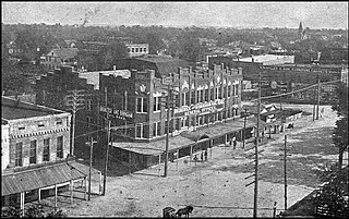
The recorded History of Brunswick, Georgia dates to 1738, when a 1,000-acre (4 km2) plantation was established along the Turtle River. By 1789, the city was recognized by President George Washington as having been one of five original ports of entry for the American colonies. In 1797, Brunswick's prominence was further recognized when it became the county seat of Glynn County, a status it retains to this day. During the later stages of the Civil War, with the approach of the Union Army, much of the city was abandoned and burned. Economic prosperity eventually returned, when a large lumber mill was constructed in the area.

The Brunswick River is a 6-mile-long (10 km) tidal river in Glynn County, Georgia. It begins at the confluence of the South Brunswick River with the Turtle River southeast of Brunswick and flows east to St. Simons Sound, the strait between Saint Simons Island to the north and Jekyll Island to the south.
The Mackay River is a 13.4-mile-long (21.6 km) tidal river in Glynn County, Georgia. It flows between Saint Simons Island to the east and the mainland, including the city of Brunswick, to the west, and connects to Buttermilk Sound at its north end and St. Simons Sound and the Brunswick River at its south end. It runs parallel to and west of the Frederica River. The Mackay River is crossed by the F.J. Torras Causeway traveling between Brunswick and Saint Simons. It is part of the Intracoastal Waterway.

U.S. Highway 67 (US 67) is a U.S. Highway in extreme eastern Iowa. The route begins in Davenport at the Rock Island Centennial Bridge where it crosses the Mississippi River and ends at an intersection with US 52 and Iowa Highway 64 (Iowa 64) west of Sabula. It passes through Bettendorf, Le Claire, and Clinton. Except for Folletts, every community which US 67 enters sits along the Mississippi River. As such, most of the route is part of the Great River Road, an All-American Road.

U.S. Route 60 and U.S. Route 62 (US 60/US 62) run for a very short distance within the state of Illinois. The highways run concurrently for their entire existence within the state. The joint highway runs around Fort Defiance in Cairo, from the Cairo Mississippi River Bridge over the Mississippi River east to the Cairo Ohio River Bridge over the Ohio River; the Ohio River Bridge also carries US 51. The bridges cross the two rivers just north of the mouth of the Ohio.


