
Sgurr a' Choire Ghlais is a mountain in the North-west Highlands of Scotland. It lies between Glen Strathfarrar and Glen Orrin and it is an excellent viewpoint, being the highest mountain in its group - a group which includes the Munros of Sgurr na Ruaidhe, Sgurr Fhuar-thuill and Carn nan Gobhar. Northwards there is no higher ground apart from the Fannaichs.

The River Conon is a river in the Highlands of Scotland. It begins at Loch Luichart, and flows in a south-easterly direction to be joined by the River Meig at Scatwell before passing through Loch Achonachie. It is joined by the Black Water at Moy Bridge, and the River Orrin at Urray, before flowing past Conon Bridge and into the Cromarty Firth.
Townend is a moderate to large housing suburb (area) in Dumbarton, Scotland. It stretches from Dumbarton Central Station to Barloan roundabout, and to Round Riding Rd to the east. It has a mix of residential houses, private and council lets. In the area is the set of River City, a BBC Television Drama. Dumbarton Common (Park) is situated in Townend, as is the BroadMeadow Industrial Estate and BroadMeadow Fitness Centre.
Badger Fall is a waterfall of Scotland.

Corrimony Falls is a waterfall on the River Enrick, near Corrimony in Glenurquhart, in the Highland council area of Scotland. It is a local tourist attraction in the spring and summer.
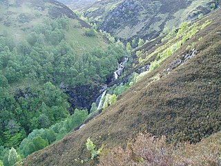
Culachy Falls is a waterfall of Scotland.

Dog Falls is a series of waterfalls on the River Affric, in Glen Affric in the Highlands of Scotland. The falls are within the Glen Affric National Nature Reserve, managed by Forestry Commission Scotland. There are several way-marked paths to the falls.
Eas a’ Chait is a waterfall in Scotland.
Eas a’ Mhuillidh is a waterfall of Scotland.
Eas Charron is a waterfall of Scotland.
Eas Cnoc na Morrar is a waterfall of Scotland.
Eas Dubh, Glen Urquhart is a waterfall of Scotland.
White Falls is a waterfall of Scotland.
Kilfinnan Fall is a waterfall of Scotland.
Eas Maol Mhairi is a waterfall of Scotland. Just east of this waterfall is the River Cannich.
Eas na Baintighearna is a waterfall of Scotland.
Easan nan Toll Dubha is a waterfall of Scotland.
Enarg Falls is a waterfall of Scotland.
Putney is an unincorporated community in Brown County, in the U.S. state of South Dakota.


