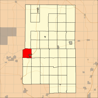
Scott County is a county in the U.S. state of Minnesota. As of the 2010 census, the population was 129,928. Its county seat is Shakopee. The county was organized in 1853 and named in honor of General Winfield Scott. Scott County is part of the Minneapolis-St. Paul-Bloomington, MN-WI Metropolitan Statistical Area. It is a member of the Metropolitan Council, and shares many of the council's concerns about responsible growth management, advocating for progressive development concepts such as clustering, open-space design, and the preservation of open space and rural/agricultural land.

Brown County is a county in the U.S. state of Minnesota. As of the 2010 United States Census, the population was 25,893. Its county seat is New Ulm. The county was formed in 1855 and organized in 1856.

Aitkin Township is a township in Aitkin County, Minnesota, United States. The population was 856 as of the 2010 census.

Farm Island Township is a township in Aitkin County, Minnesota, United States. The population was 1,099 as of the 2010 census.

Hazelton Township is a township in Aitkin County, Minnesota, United States. The population was 844 as of the 2010 census.

Nordland Township is a township in Aitkin County, Minnesota, United States. The population was 972 as of the 2010 census.

Spencer Township is a township in Aitkin County, Minnesota, United States. The population was 518 as of the 2010 census.

Wealthwood Township is a township in Aitkin County, Minnesota, United States. The population was 268 as of the 2010 census.

White Earth Township is a township in Becker County, Minnesota, United States. The population was 799 at the 2000 census.

Lakeville is a city in Dakota County, Minnesota, United States. It is a suburb of Minneapolis-Saint Paul, approximately 20 miles (32 km) south of both downtown Minneapolis and downtown St. Paul. Lakeville is one of the fastest-growing cities in the Twin Cities area. The U.S. Census Bureau estimated its population to be 65,877 in 2018.

The Red River Valley is a region in central North America that is drained by the Red River of the North; it is part of both Canada and the United States. Forming the border between Minnesota and North Dakota when these territories were admitted as states in the United States, this fertile valley has been important to the economies of these states and to Manitoba, Canada.

Central Minnesota is the region consisting of the central portion of the state of Minnesota. Although no specific boundaries of the region exist, most definitions of what makes up the region would generally consist of the vast swath of land north of Interstate 94, east of U.S. Highway 59, south of U.S. Highway 2, and west of U.S. Highway 169.

Eagle Mountain is the highest natural point in Minnesota, United States, at 2,301 feet (701 m). It is in northern Cook County, in the Boundary Waters Canoe Area Wilderness and Superior National Forest in the Misquah Hills, northwest of Grand Marais. It is a Minnesota State Historic Site.

Fairbanks is an unincorporated community in Fairbanks Township, Saint Louis County, Minnesota, United States; located within the Superior National Forest.

Maple Springs is an unincorporated community in Pepin Township, Wabasha County, Minnesota, United States, along the Mississippi River and Lake Pepin. The Mississippi River and King Creek meet at Maple Springs.

Island Lake is an unincorporated community in Beltrami County, in the U.S. state of Minnesota.

Mills Lake is a lake in Blue Earth County, Minnesota, in the United States.

Wall Lake is an unincorporated community in Otter Tail County, in the U.S. state of Minnesota.

Farm Island Lake is a lake in the U.S. state of Minnesota, located in Aitkin County north of Mille Lacs Lake. It is just west of U.S. Route 169.

The Rum River State Forest is a state forest located in Kanabec, Mille Lacs and Morrison counties in central Minnesota. The forest is nearby the city of Onamia and is along the Rum River, just downstream (south) of Mille Lacs Lake. The forest is managed by the Minnesota Department of Natural Resources. The forest is home to many Northern hardwoods such as maple, oak, ash, elm and basswood that occupy most of the upland areas while tamarack and black spruce are found in lowland and marshy areas.


