
The St. Lawrence Seaway is a system of locks, canals, and channels in Canada and the United States that permits oceangoing vessels to travel from the Atlantic Ocean to the Great Lakes of North America, as far inland as Duluth, Minnesota, at the western end of Lake Superior. The seaway is named for the St. Lawrence River, which flows from Lake Ontario to the Atlantic Ocean. Legally, the seaway extends from Montreal, Quebec, to Lake Erie, and includes the Welland Canal. Ships from the Atlantic Ocean are able to reach ports in all five of the Great Lakes.

Central Frontenac is a township in eastern Ontario, Canada in the County of Frontenac.
This article lists extreme locations on Earth that hold geographical records or are otherwise known for their geophysical or meteorological superlatives. All of these locations are Earth-wide extremes; extremes of individual continents or countries are not listed.

This is a list of the extreme points of North America: the points that are highest and lowest, and farther north, south, east or west than any other location on the continent. Some of these points are debatable, given the varying definitions of North America.

Wellesley Island in Jefferson County, New York, United States is partially in the Town of Orleans and partially in the Town of Alexandria.

The Door Peninsula is a peninsula in eastern Wisconsin, separating the southern part of the Green Bay from Lake Michigan. The peninsula includes northern Kewaunee County, northeastern Brown County, and the mainland portion of Door County. It is on the western side of the Niagara Escarpment. Well known for its cherry and apple orchards, the Door Peninsula is a popular tourism destination. With the 1881 completion of the Sturgeon Bay Ship Canal, the northern half of the peninsula became an island.

Lake Memphremagog is a fresh water glacial lake located between Newport, Vermont, United States and Magog, Quebec, Canada. The lake spans both Quebec and Vermont, but is mostly in Quebec. Most of the watershed that feeds the lake is located in Vermont, and is a source for accumulated phosphorus, sediments, and other pollutants. Cleanup efforts since the late 1980s have improved the water quality. The lake furnishes potable water for 200,000 people.
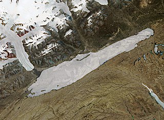
Lake Hazen is a freshwater lake in the northern part of Ellesmere Island, Nunavut, Canada, north of the Arctic Circle. It is the largest lake north of the Arctic Circle by volume. By surface area it is third largest, after Lake Taymyr in Russia and Lake Inari in Finland.
The White Bear Forest is an old growth forest, located in Temagami, Ontario, Canada. The forest is named after Chief White Bear, who was the last chief of the Teme-Augama Anishnabai before Europeans appeared in the region. In some parts of the White Bear Forest trees commonly reach 200 to 300 years in age, while the oldest tree accurately aged in White Bear Forest was a red pine that was 400 years old in 1999. The White Bear Forest contains one of Canada's oldest portages, dating back some 3,000 years. Today, more than 17 km (11 mi) of trails access the White Bear Forest. A trail guide is available online at http://ancientforest.org/whitebear.html.

Stock Windmill is a grade II* listed tower mill at Stock, Essex, which has been restored.
Saqajaa {Inuktitut syllabics: ᓴᖃᔮ) formerly Sakkiak Island is one of the uninhabited Canadian arctic islands located in Hudson Strait, Nunavut, Canada. It is a Baffin Island offshore island in the Qikiqtaaluk Region, separated by deep water from Cape Dorset 64°10′40″N76°29′00″W, 1.5 mi (2.4 km) to the south-southwest. The island is approximately 6 km2 (2.3 sq mi) in size, 2.25 mi (3.62 km) long, and 1 mi (1.6 km) wide. The elevation is approximately 65 m (213 ft) above sea level.

Dorset Island or Cape Dorset Island is one of the Canadian Arctic islands located in Hudson Strait, Nunavut, Canada. It lies off the Foxe Peninsula area of southwestern Baffin Island in the Qikiqtaaluk Region. It is serviced by an airport and a harbour.

Jones Falls Dam is a dam on the Rideau Canal located in Rideau Lakes, Leeds and Grenville United Counties, Ontario, Canada, that was built between 1828 and 1831 to tame the mile-long series of rapids and falls that flowed from Sand Lake and into the White Fish River.
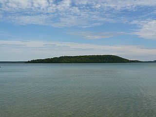
Treasure Island, also known as Mindemoya, is a large island in Lake Mindemoya, on Manitoulin Island, which is in Lake Huron. Aside from being Manitoulin's largest island at approximately 0.4 km2 (0.2 sq mi) in area, it is also notable for being the world's largest natural island in a lake on an island in a lake.

This is the outline of the geography of the city of Ottawa, the capital of Canada. Ottawa's current borders were formed in 2001, when the former city of Ottawa amalgamated with the ten other municipalities within the former Regional Municipality of Ottawa–Carleton. Ottawa is now a single-tiered census division, home to 1,017,449 people.
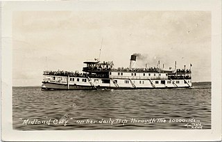
SS Midland City was originally a Canadian side-wheel steamboat that provided passenger and cargo transportation on the Great Lakes from 1871 until 1955. Originally named Maud, then America, she underwent several extensive refits over her 84-year service, and saw several owners. The ship was intentionally run aground and burnt to the waterline in 1955 near the mouth of the Wye River in Midland Bay. The wreck is intact and visible above the water to this day, where it acts as a breakwater for the Wye Heritage Marina and local attraction.