
Millard County is a county in the U.S. state of Utah. As of the 2020 United States Census, the population was 12,975. Its county seat is Fillmore, and the largest city is Delta.
The Escalante Desert is a geographic Great Basin region and arid desert ecoregion, in the deserts and xeric shrublands biome, located in southwestern Utah.
The Tule Desert is located in southeastern Nevada in Lincoln County, near the Utah state line. The desert lies northeast of the Mormon Mountains, south of the Clover Mountains and west of the Tule Springs Hills.

Eskdale is an unincorporated community in western Millard County, Utah, United States, just east of the Nevada border.
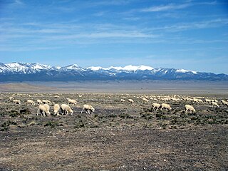
Snake Valley is a north-south trending valley that straddles the Nevada–Utah border in the central Great Basin. It is bound by the Snake Range and the Deep Creek Mountains to the west and the Confusion Range to the east. The valley is the gateway to Great Basin National Park and Lehman Caves, which are located in the western part of the valley and on the southern Snake Range.
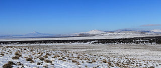
The Confusion Range is a north-south trending mountain range in west-central Utah, United States. It is bounded by Snake Valley to the west, Tule Valley to the east, the Great Salt Lake Desert to the north, and the Ferguson Desert to the south. The range trends into the Burbank Hills, Mountain Home Range, and the Wah Wah Mountains to the south. In the central part of the range, an offshoot of the mountains to the west is known as the Conger Range. The Confusion Range is named for its "rugged isolation and confusing topography."

Tule Valley is a valley in Millard County, Utah, United States.
Trout Creek is an unincorporated community, in far western Juab County, Utah, United States.

The Mountain Home Range is a north-south trending mountain range in western Beaver County in southwest Utah, United States. It is part of the Basin and Range Province. It is bound by Hamlin Valley to the west, Snake Valley to the north, Pine Valley to the east, and trends into the Indian Peak Range to the south. Collectively, the Mountain Home Range and Indian Peak Range are known as the Needle Mountains due to their jagged nature.

The Burbank Hills are a small northwest-southeast mountain range in western Utah, United States that lie entirely within the Hamlin-Snake Watershed, between the Snake Range and the Ferguson Desert. It is bounded by Snake Valley to the north, west, and south; and trends into the Tunnel Springs Mountains, to the southeast, opposite the Antelope Valley on its southeast border. It was named after the settlement of Burbank, Utah, and Margie Burbank Clay, the wife of local Judge E. W. Clay in the 1870s.
The Antelope Valley adjacent to the Nevada/Utah state line, and located in southeast Elko County and northeast White Pine County, Nevada is a 70 mi (113 km) long endorheic valley. The valley curves around the Dolly Varden and Kinsley Mountains, and the Antelope Range.

The Sevier Desert is a large arid section of central-west Utah, United States, and is located in the southeast of the Great Basin. It is bordered by deserts north, west, and south; its east border is along the mountain range and valley sequences at the perimeter of the Great Basin, with the large north–south Wasatch Range and its associated mountainous landforms. Its eastern border is specifically, the East Tintic, Gilson, and Canyon Mountains; also the massive Pahvant Range.
The Antelope Valley of southwest Millard County, Utah, United States, is a small 25-mile (40 km) long valley, adjacent the Ferguson Desert and 40 miles (64 km) southwest of Sevier Lake. The valley is just east of the Nevada border, with Snake Valley and the Burbank Hills. The other Antelope Valley of Utah occurs 165 miles (266 km) east in the Great Basin, in southeast Emery County and extending into adjacent Wayne County.
Hamlin Valley is a mostly north-south trending valley of the Great Basin located on both sides of the Nevada–Utah state line. It is about 60 miles (97 km) long. Its north-northeast end point adjacent the state line is the southwest start region of the Snake Valley.

Pine Valley is a 50-mile (80 km) long valley in southwestern Utah, United States. Most of the valley lies in western Beaver and Millard counties; the extreme south of the valley arises in two mountain range regions in northwestern Iron County.

The U.S. state of Utah has the solar potential to provide all of the electricity used in the United States. Utah is one of the seven states with the best potential for solar power, along with California, Nevada, Arizona, New Mexico, Colorado, and Texas. Utah's only investor owned utility currently allows partial net metering for residential systems up to 25 kW and up to 2 MW for non-residential users. In the past RMP allowed full net metering, and partial net metering. Neither of these Schedules allows for new customers to sign up any longer. Utah's municipal utilities and electric cooperatives set their own net metering policies.
The Davis Knolls is a system of semi-arid desert hills, situated 9.5 nautical miles (17.6 km) southeast of Dugway, Utah in Skull Valley (Utah). It was extensively studied and mapped by the University of Utah in 1962, under the direction of James Harrill.
Crystal Spring is a spring in northern Beaver County, Utah, United States.
Frisco Peak is a summit near the north‑center edge of Beaver County, Utah, United States.
