
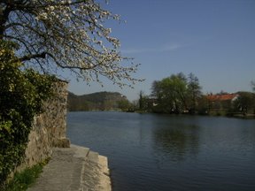
The Breg is a river, 46 kilometres long, in Baden-Württemberg, Germany, and the primary headstream of the Danube.

The Fichtel Mountains is a mountain range in Germany and the Czech Republic. They extend from the valley of the Red Main River in northeastern Bavaria to the Karlovy Vary Region in western Czech Republic. The Fichtel Mountains contain an important nature park, the Fichtel Mountain Nature Park. The Elster Mountains are a part of the Fichtel Mountains.

The Brigach is the shorter of two streams that jointly form the river Danube in Baden-Württemberg, Germany. The Brigach has its source at 925 m (3,035 ft) above sea level within St. Georgen in the Black Forest. The Brigach crosses the city Villingen-Schwenningen. 40.4 km (25.1 mi) from the source, the Brigach joins the Breg in Donaueschingen to form the Danube River.

The White Main, is the larger and shorter of the two headstreams of the river Main. It rises in the Fichtel Mountains and merges near Steinenhausen, southwest of Kulmbach, with the left-hand, southern headstream, the Red Main, to form the Main. The length of the White Main is 51.7 km. The source of the White Main lies on light granite rock, which lends it its white colouration.
Tirschenreuth is a Landkreis (district) in the northeastern part of Bavaria, Germany. Neighboring districts are Neustadt an der Waldnaab, Bayreuth and Wunsiedel. To the east are the Czech districts of Tachov (Plzeň) and Cheb.

The Hamme is a 48 km (30 mi) long river in Germany, Lower Saxony, north-east of Bremen. Its source is north of Osterholz-Scharmbeck. It flows through the moors north-east of Bremen called Teufelsmoor, and meets the river Wümme in Ritterhude. From this junction, the river is called Lesum. The Lesum flows into the river Weser in Bremen-Vegesack.
The Naab is a river in Bavaria, Germany.

The Fichtelberg is a mountain with two main peaks in the middle of the Ore Mountains in the east German state of Saxony, near the Czech border. At 1,214.6 m (3,985 ft) above sea level, the Fichtelberg is the highest mountain in Saxony, the second highest in the Ore Mountains and used to be the highest mountain in East Germany. Its subpeak is 1,206 m (3,957 ft) high.
Oberwiesenthal is a town and a ski resort in the district of Erzgebirgskreis in Saxony in Germany. It is situated in the Ore Mountains, on the border with the Czech Republic, 19 km south of Annaberg-Buchholz, and 23 km northeast of Karlovy Vary. At 914 metres (2,999 ft), it is the highest town in Germany. The Olympic and World Championships goldmedalist in ski jumping Jens Weißflog competed for SC Tractor Oberwiesenthal and Oberwiesenthaler SV.

The Zschopau is a 130-kilometre-long river in Saxony, Germany, and a left tributary of the Freiberger Mulde. The origin of the name is not precisely documented, possibly Slavic skapp; rock, cliff or sorb. Šučici; the rushing, roaring). The Zschopau drains a catchment area of 1847 km².
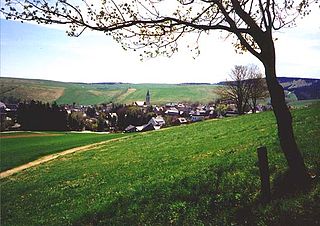
Fichtelberg is a municipality in the district of Bayreuth in Bavaria in Germany. It is a state-recognised climatic spa (Luftkurort).

The Red Main is a river in southern Germany. It is the southern, left headstream of the river Main. It rises in the hills of Franconian Switzerland, near Haag and flows generally northwest through the towns Creußen, Bayreuth, Heinersreuth and Neudrossenfeld. It merges with the White Main near Kulmbach to form the Main. The Red Main is 72 kilometres (45 mi) long and descends a total of 283 metres (928 ft).
The Neusorg–Fichtelberg railway was a German branch line northern Bavaria. It linked the town of Fichtelberg in the Upper Franconian county of Bayreuth with Neusorg station in the Upper Palatine county of Tirschenreuth on the main line from Nuremberg to Cheb. This standard gauge, single-track Lokalbahn was 14.7 km long and was opened on 20 December 1890 by the Royal Bavarian State Railways.

The Ochsenkopf is the second-highest mountain in the Fichtel Mountains with a height of 1,024 metres (3,360 ft). On its summit is an observation tower and a transmission tower for VHF and TV programmes by Bayerischer Rundfunk.

The Waldnaab is the left-hand, eastern and longest headstream of the River Naab in the Upper Palatinate. At its confluence with the Haidenaab near Luhe-Wildenau, the Naab is formed. The Waldnaab is 99.1 km long; combined with the Naab, the total length is 196.6 kilometres (122.2 mi).

The Haidenaab is the right and western headstream of the River Naab in the Upper Palatinate in the south German state of Bavaria. At its confluence with the Waldnaab near Luhe-Wildenau, the Naab is formed.

The Zorge is a tributary of the Helme in central Germany. It is about 40 km (25 mi) long and flows from the state of Lower Saxony into Thuringia. In many sources the name Zorge is translated as "wild river".
The Krähenbach is a tributary of the Danube on the Baar plateau in Tuttlingen in the Upper Danube Nature Park, Baden-Württemberg, Germany.

The Püttlach is a left tributary of the River Wiesent. It is about 27 km (17 mi) long and flows through the Bavarian region of Franconian Switzerland in Germany.
Kaltenmühlbach is a 6.8-kilometre-long (4.2 mi) left tributary of the Waldnaab in the Upper Palatinate in Bavaria, Germany. It rises in the High Thaner Forest and flows to the Waldnaab.

