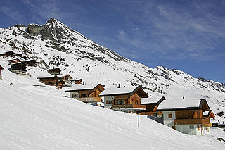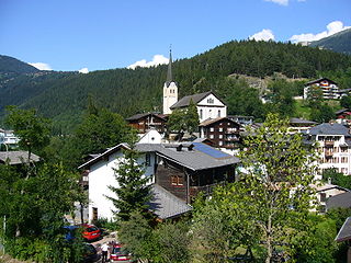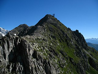
The Alpine region of Switzerland, conventionally referred to as the Swiss Alps, represents a major natural feature of the country and is, along with the Swiss Plateau and the Swiss portion of the Jura Mountains, one of its three main physiographic regions. The Swiss Alps extend over both the Western Alps and the Eastern Alps, encompassing an area sometimes called Central Alps. While the northern ranges from the Bernese Alps to the Appenzell Alps are entirely in Switzerland, the southern ranges from the Mont Blanc massif to the Bernina massif are shared with other countries such as France, Italy, Austria and Liechtenstein.

An aerial tramway, sky tram,cable car, ropeway or aerial tram is a type of aerial lift which uses one or two stationary ropes for support while a third moving rope provides propulsion. With this form of lift, the grip of an aerial tramway cabin is fixed onto the propulsion rope and cannot be decoupled from it during operations.

Sankt Anton am Arlberg, commonly referred to as St. Anton, is a village and ski resort in the Austrian state of Tyrol. It lies in the Tyrolean Alps, with aerial tramways and chairlifts up to 2,811 m (9,222 ft), yielding a vertical drop of 1,507 m (4,944 ft). It is also a popular summer resort among hikers, trekkers and mountaineers.

The Palm Springs Aerial Tramway in Palm Springs, California, is the largest rotating aerial tramway in the world. It was opened in September 1963 as a way of getting from the floor of the Coachella Valley to relatively near the top of San Jacinto Peak and was constructed in rugged Chino Canyon. Before its construction, the only way to the top of the mountain was to hike hours from Idyllwild. The rotating cars were added in 2000.

The Glacial Aerial Tramway Kaprun III is the third section of the aerial tramway on the Kitzsteinhorn mountain at Kaprun, Austria. It was placed in service on 26 November 1966. It is currently branded Gipfelbahn.

The Gornergrat Railway is a mountain rack railway, located in the Swiss canton of Valais. It links the resort village of Zermatt, situated at 1,604 m (5,262 ft) above mean sea level, to the summit of the Gornergrat. The Gornergrat railway station is situated at an altitude of 3,089 m (10,135 ft), which makes the Gornergrat Railway the second highest railway in Europe after the Jungfrau, and the highest open-air railway of the continent. The line opened in 1898, and was the first electric rack railway to be built in Switzerland.

Weggis is a municipality in the district of Lucerne in the canton of Lucerne in Switzerland.

Matt is a village, and former municipality, in the municipality of Glarus Süd and canton of Glarus in Switzerland. Matt lies in the valley of the Sernf river, and consists of the village of Matt itself, and the mountain hamlet of Weissenberge.

The Wengen–Männlichen aerial cableway is a cable car linking Wengen with the Männlichen in Switzerland. It is owned and operated by the Luftseilbahn Wengen–Männlichen AG.
Feldmoos-Chli-Titlis Aerial Tramway was an aerial tramway in Switzerland. It was built in 1979 by the Swiss company Habegger between Feldmoos and Chli Titlis for the erection of a communication facility on Chli Titlis. The aerial tramway was used for transporting goods with a weight up to 3.8 tons also for transporting up to 20 people. It used only a single vehicle. After completion of the facility the aerial tramway, which remained property of Habegger, was dismantled in 1986.

The Adliswil-Felsenegg cable car is a cable car in the canton of Zürich in Switzerland. The lower station is located in Adliswil in the Sihl Valley, whilst the upper station is located on the Felsenegg hill on the Albis ridge near the Felsenegg-Girstel TV-tower. The upper station at Felsenegg forms one end of a panoramic walk to the Uetliberg mountain, whilst the lower station is some 400 metres (1,300 ft) from Adliswil railway station.
Gibraltar Cable Car is an aerial tramway in Gibraltar. The base station of the cable car is located near the southern end of Main Street, next to Alameda Gardens.

The Riffelalp tram is a high altitude tramway line located in the Swiss canton of Valais near the resort of Zermatt. The line links the Riffelalp Resort to Riffelalp station, on the Gornergrat railway, and via that line to Zermatt and beyond.

Lauchernalp is an alp and resort area in the Swiss Alps, located in the canton of Valais. It sits on a sunny terrace, between 1,900 and 2,100 metres above sea level, overlooking the Lötschental above Wiler. Lauchernalp mainly belongs to the municipality of Wiler, with a small part belonging to the municipality of Kippel.

The Bursa Uludağ Gondola, or simply Teleferik as called locally, is an aerial lift line in Bursa Province connecting the city of Bursa with the nearby ski resort area and national park at mountain Uludağ. Initially as an aerial tramway line, it went in service in 1963, and served fifty-years long until it was replaced by a modern system of gondola lift and extended into ski resort area. The installation of a new line became unavoidable due to increased demand by tourists.

Arosa Lenzerheide is a ski area located in Arosa, Lenzerheide, Valbella, Parpan and Churwalden, Graubünden/Switzerland. It originated 2013/14 by connecting the existing ski areas of Arosa and Lenzerheide. With a total of 225 kilometers of ski slopes and 41 cable cars it is the largest contiguous ski area in Graubünden.


