Fili Fort

Last updated
Fili Fort
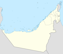
Near Al Madam in  Sharjah, United Arab Emirates
Fili Fort.jpg
United Arab Emirates location map.svg
Red pog.svg
Coordinates 25°00′19.2″N55°55′24″E / 25.005333°N 55.92333°E / 25.005333; 55.92333
Site information
ConditionRestored
Site history
Built1850
MaterialsRock, mudbrick, gypsum

Fili Fort (Al Hisn Fili) is a late Islamic fortification located to the east of the town of Madam, in the United Arab Emirates' emirate of Sharjah.

There are in fact two forts at Hili, Fili west fort and Fili east fort. The west fort is built on a hill at a distance of some 875 metres from the east fort. However, Fili east fort is uniquely referred to as Fili Fort and is a later building dating to the C19th. [1] Fili west fort, located on a small hill in the Madam plain, was established around a watchtower, or Muraba'a, and is said locally to be 500 years old, [2] a dating not supported by archaeologists, who estimate both forts as C19th constructions. [2]

The two forts are connected by a network of two underground waterways, or aflaj , which themselves connect to aflaj running from the Hajar Mountains. [2] Fili Fort was at one stage used as a police station and a more modern, smooth-walled section attached to the square fortification (on the opposite corner to the two-story tower) attests to this later use. [2]

The ruin of an old souq, a four-roomed flat-roofed structure, stands nearby Fili Fort. A number of Islamic era burials dot the plain around the fort. Finds of ceramics in the area date from Iron Age to C19th Chinese trade ware. [2]

Fili Fort formed part of Sharjah's 2018 bid for UNESCO World Heritage Status, under the heading 'Sharjah, Gateway to the Trucial States', [3] which also included the Heart of Sharjah; Sharjah Fort; the former barracks of the Trucial Oman Scouts in Mirgab; Al Mahatta Fort, the first airport in the Gulf; the coastal town of Khor Fakkan; the oasis and settlement of Wadi Helo, all following the theme of a return to the simplicity and natural lifestyles of the late 1950s. [4]
Related Research Articles

<span class="mw-page-title-main">History of the United Arab Emirates</span>

The United Arab Emirates is a country in the eastern part of the Arabian Peninsula located on the southeastern coast of the Persian Gulf and the northwestern coast of the Gulf of Oman. The UAE consists of seven emirates and was founded on 2 December 1971 as a federation, after UK armed forces left the region. Six of the seven emirates declared their union on 2 December 1971. The seventh, Ras al Khaimah, joined the federation on 10 February 1972. The seven sheikdoms were formerly known as the Trucial States, in reference to the truce treaties established with the British in the 19th century.

<span class="mw-page-title-main">Emirate of Sharjah</span> Constituent Emirate of the United Arab Emirates

The Emirate of Sharjah is one of the emirates of the United Arab Emirates, which covers 2,590 square kilometres (1,000 sq mi) and has a population of over 1,400,000 (2015). It comprises the capital city of Sharjah, after which it is named, and other minor towns and exclaves such as Kalba', Al Dhaid, Dibba Al-Hisn and Khor Fakkan.

<span class="mw-page-title-main">Al Ain</span> City in Abu Dhabi, UAE

Al Ain is a border city on the eastern side of Tawam oasis and the seat of the administrative division, the Al Ain Region, in the Emirate of Abu Dhabi, United Arab Emirates. The city is bordered to the east by the Omani town of Al-Buraimi in the Al Buraimi Governorate. It is the largest inland city in the Emirates, the fourth-largest city, and the second-largest in the Emirate of Abu Dhabi. The freeways connecting Al-Ain, Abu Dhabi, and Dubai form a geographic triangle in the country, each city being roughly 130 kilometres (81 mi) from the other two.

<span class="mw-page-title-main">Emirate of Umm Al Quwain</span> Emirate, one of the constituents of the United Arab Emirates

The Emirate of Umm Al Quwain is one of the seven constituent emirates of the United Arab Emirates, located in the north of the country. It is the second smallest and least populous emirate in the UAE and borders the Persian Gulf. Umm Al Quwain lies between Ras Al Khaimah and Sharjah/Ajman on the west coast, with a location along the vital trade route between the Middle East and India. It has a coastline stretching to 24 km.

<span class="mw-page-title-main">Flag of the United Arab Emirates</span> National flag

The flag of the United Arab Emirates contains the Pan-Arab colors red, green, white, and black. It was designed in 1971 by Abdullah Mohammed Al Maainah, who was 19 years old at that time, and was adopted on 2 December 1971 after winning a nationwide flag design contest. The main theme of the flag's four colors is the sovereignty and unity of the Arab states.

<span class="mw-page-title-main">Dhaid</span> Place in Sharjah, United Arab Emirates

Dhaid, or Al Dhaid, is the capital of the Central Region of the Emirate of Sharjah in the United Arab Emirates. An oasis town, it has extensive irrigated date palm plantations with water channelled from the nearby Hajar mountains, at least in part through ancient tunnels dug for that purpose, known as aflāj in Arabic.

<span class="mw-page-title-main">Kalba</span> City in Sharjah, United Arab Emirates

Kalba is a city in the Emirate of Sharjah in the United Arab Emirates (UAE). It is an exclave of Sharjah lying on the Gulf of Oman coast north of Oman. Khor Kalba, an important nature reserve and mangrove swamp, is located south of the town by the Omani border.

<span class="mw-page-title-main">Sharjah</span> Capital of the Emirate of Sharjah, United Arab Emirates

Sharjah is the third-most populous city in the United Arab Emirates, after Dubai and Abu Dhabi. It is the capital of the Emirate of Sharjah and forms part of the Dubai-Sharjah-Ajman metropolitan area.

Dhayah Fort is an 18th-century fortification in Ras Al Khaimah, United Arab Emirates (UAE). It is the highest hilltop fort in the UAE and was the site of a battle during the Persian Gulf campaign of 1819, when British troops captured the fort after a brief siege.

<span class="mw-page-title-main">Al Madam</span> Town in Sharjah, United Arab Emirates

Al Madam is an inland town of the Emirate of Sharjah, in the United Arab Emirates. Located at the intersection of the Dubai-Hatta (E44) and Mleiha-Shwaib (E55) roads, its development has mainly centred around these road links and the road traffic through Hatta to Oman. The volume of traffic to Oman through Madam and Hatta has lessened since the closure of the 'soft' Omani border at Mahda in 2016, although traffic volumes remain at some 5,000 travellers daily. The road from Madam to Hatta is now only open to UAE or Omani nationals and permit holders.

The Bani Qitab is a tribe of the United Arab Emirates (UAE). The singular form of the name, Al Ketbi, is a common family name in the Northern UAE today. Consisting of a settled southern section and a nomadic northern section, the tribe was long influential in the conduct of affairs in the interior of the Trucial States. The Northern branch mostly settled in the inland towns of Dhaid and Al Falayah.

The area currently known as the United Arab Emirates (UAE) was formerly populated by inhabitants of a number of coastal and inland settlements, with human remains pointing to a pattern of transmigration and settlement as far back as 125,000 years. Prehistoric settlement in the UAE spanned the Neolithic, with a number of distinctive eras of ancient settlement including the Stone Age Arabian Bifacial and Ubaid cultures from 5,000 to 3,100 BCE; the Hafit period with its distinctive beehive shaped tombs and Jemdet Nasr pottery, from 3,200 to 2,600 BCE; the Umm Al Nar period from 2,600 to 2,000 BCE; the Wadi Suq culture from 2,000 to 1,300 BCE and the three Iron Ages of the UAE.

The territory currently known as the United Arab Emirates was home to three distinct Iron Age periods. Iron Age I spanned 1,200–1,000 BCE, Iron Age II from 1,000 to 600 BCE, and Iron Age III from 600 to 300 BCE. This period of human development in the region was followed by the Mleiha or Late Pre-Islamic era, from 300 BCE onwards through to the Islamic era which commenced with the culmination of the 7th-century Ridda Wars.

<span class="mw-page-title-main">Heart of Sharjah</span> Heritage project in the United Arab Emirates

The Heart of Sharjah is a cultural heritage project that aims to preserve and restore the old town of Sharjah in the United Arab Emirates (UAE) and return it to its 1950s state.

<span class="mw-page-title-main">Ras Al Khaimah</span> Capital of the Emirate of Ras Al Khaimah, United Arab Emirates

Ras Al Khaimah, often referred to its initials RAK and historically known as Julfar, is the largest city and capital of the Emirate of Ras Al Khaimah in the United Arab Emirates (UAE). The city had a population of 191,753 in 2022, and is the sixth-most populous city in UAE after Dubai, Abu Dhabi, Sharjah, Al Ain and Ajman. The city is divided by a creek into two parts: old town in the west and Al Nakheel in the east.

<span class="mw-page-title-main">Ghayl Fort</span> Place in Sharjah, United Arab Emirates

Ghayl Fort is located inland of the coastal city of Kalba in Sharjah, United Arab Emirates. Built in the late C19th, the current fort was constructed on top of the foundations of a C17th watchtower.

Wadi Qor is a seasonal watercourse in the Hajar Mountains of Ras Al Khaimah, in the United Arab Emirates. The wadi runs from the mountain village of Al Qor, near the Dubai exclave of Hatta, through the villages of Huwaylat, Rafaq and Al Nasla before crossing the Omani border and fanning out to the Batinah plain and the Gulf of Oman north of the Omani coastal village of Bu Baqarah.

Wadi Helo is a seasonal watercourse located in the Hajar Mountains of Sharjah, in the United Arab Emirates. The wadi runs northwest to southeast of the eponymous village of Wadi Helo, located on the Sharjah-Kalba highway.

<span class="mw-page-title-main">Ajman Fort</span>

Ajman Fort is a double-storey traditional rock, coral and mudbrick fortification in the centre of the city of Ajman in the United Arab Emirates (UAE). Its construction is thought to date back to the late 18th century and it is claimed the fort's barjeel, or wind tower, is the oldest such structure in the UAE.

<span class="mw-page-title-main">Dhaid Fort</span>

Dhaid Fort, is a restored C18th fortification in the city of Dhaid, Sharjah, in the United Arab Emirates. It has long been an important stronghold for the Ruling families of Sharjah and Ras Al Khaimah and a key strategic asset in maintaining a historical Qawasim dominance of the inland areas of the Northern Emirates.

References

  1. "Fili Fort | Archiqoo". archiqoo.com. Retrieved 2021-05-17.
  2. 1 2 3 4 5 Sasaki, Tatsuo (2017). "Fili Forts in Al Madam plain, Emirate of Sharjah, United Arab Emirates". Japan Society for Hellenistic-Islam Archaeological Studies. 24: 83–116.
  3. "Sharjah: Gateway to the Trucial States – PenguinCube" . Retrieved 2021-04-24.
  4. "gulftoday.ae | Heart of Sharjah, Khorfakkan, Al Dhaid in the running for Unesco World Heritage Site title". gulftoday.ae. Archived from the original on 2022-12-24. Retrieved 2018-12-03.