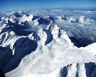
The Finsteraarhorn is the highest mountain in the Bernese Alps in Switzerland and the most prominent peak of Switzerland. The Finsteraarhorn is the ninth-highest mountain and third-most prominent peak in the Alps. In 2001 the whole massif and surrounding glaciers were designated as part of the Jungfrau-Aletsch World Heritage Site.

Wildspitze is the highest mountain in the Ötztal Alps and in North Tyrol, as well as the second highest mountain in Austria after the Großglockner and in terms of prominence is the fourth summit of the Alps and the fifteenth of Europe.

Piz Bernina or Pizzo Bernina is the highest mountain in the Eastern Alps, the highest point of the Bernina Range, and the highest peak in the Rhaetian Alps. It rises 4,048.6 m and is located south of Pontresina and near the major Alpine resort of St. Moritz, in the Engadin valley with the massif partially in Italy. It is also the most easterly mountain higher than 4,000 m (13,000 ft) in the Alps, the highest point of the Swiss canton of Graubünden, and the fifth-most prominent peak in the Alps. The minor summit known as La Spedla is the highest point in the Italian Lombardy region.
The Aletschhorn is a mountain in the Alps in Switzerland, lying within the Jungfrau-Aletsch region, which has been designated a World Heritage Site by UNESCO. The mountain shares part of its name with the Aletsch Glacier lying at its foot.

Grosses Fiescherhorn is a mountain peak of the Bernese Alps, located on the border between the cantons of Bern and ValaisValais, halfway between the Mönch and the Finsteraarhorn. At 4,049 metres (13,284 ft) above sea level, its summit culminates over the whole Fiescherhorn massif, which is also composed of the slightly lower Hinteres Fiescherhorn to the south and Kleines Fiescherhorn to the east. From the north both are well hidden behind other mountain peaks and can only been seen from Isch in Grindelwald. The mountain is shared between the municipalities of Grindelwald and Fieschertal.

The Schreckhorn is a mountain in the Bernese Alps. It is the highest peak located entirely in the canton of Berne. The Schreckhorn is the northernmost Alpine four-thousander and the northernmost summit rising above 4,000 metres in Europe.

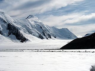
The Fiescher Glacier is a valley glacier on the south side of the Bernese Alps in the canton of Valais, Switzerland. 16 km (9.9 mi) in length, it is the second longest glacier in the Alps. The glacier covers an area of 33 km2 (13 sq mi).
The Aargletschers, literally "Aare-Glaciers", are a system of glaciers located at the sources of the Aare river in the Bernese Alps, Switzerland. The original name has no plural-"s", as in German the plural of "gletscher" is only marked by changes of the article. The Aargletschers are constituted by two distinct partial glacier systems:

The Konkordia Hut is a mountain hut of the Swiss Alpine Club, located north of Fieschertal in the canton of Valais. The hut lies above Konkordiaplatz, the point of convergence of several glaciers in the great Aletsch Glacier system of the Bernese Alps. It is located at a height of 2,850 metres above sea level, at the foot of the Fülbärg.
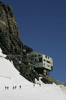
The Mönchsjoch Hut is a mountain hut located in the Bernese Alps in the canton of Valais in Switzerland. At an altitude of 3,658 metres (12,001 ft) is one of the highest huts owned by the Swiss Alpine Club.

The Schönbiel Hut is a mountain hut located north of the Matterhorn. It is situated at 2,694 metres (8,839 ft) above sea level, north of the Zmutt Glacier, a few kilometers west of the town of Zermatt in the canton of Valais in Switzerland. The actual hut was built by the Swiss Alpine Club in 1955, after the demolition of an older hut, built in 1909.

The Mischabel Hut is a mountain hut of the Academic Alpine Club of Zurich, located west of Saas Fee in the canton of Valais. It lies at a height of 3,340 metres (10,960 ft) above sea level near the Hohbalmgletscher glacier, on the eastern flanks of the Dom and the Lenzspitze in the Mischabel group.

The Hollandia Hut is a mountain hut of the Swiss Alpine Club, located east of Blatten in the canton of Valais. The hut lies at a height of 3,240 metres above sea level, just above the Lötschenlücke, the glacier pass connecting the Lötschental from the Aletsch Glacier. All accesses to the hut involve glacier crossing.

The Tschierva Hut is a mountain hut located in the Swiss canton of Graubünden at the foot of Piz Bernina, Piz Tschierva and Piz Morteratsch at the end of Val Roseg. The hut lies at 2,584 metres above sea level near the Tschierva Glacier and can be accessed from Pontresina via a trail. The hut is the starting point of the Biancograt, the serpentine north ridge of Piz Bernina.
The Jungfrau-Aletsch protected area is located in south-western Switzerland between the cantons of Berne and Valais. It is a mountainous region in the easternmost side of the Bernese Alps, containing the northern wall of Jungfrau and Eiger, and the largest glaciated area in western Eurasia, comprising the Aletsch Glacier. The Jungfrau-Aletsch protected area is the first World Natural Heritage site in the Alps, it was inscribed in 2001.
The Oberaarjoch Hut is a mountain hut of the Swiss Alpine Club, located north of Fieschertal in the canton of Valais, close to the canton of Bern. The hut lies at a height of 3,258 metres above sea level at the foot of the Oberaarhorn, just above the Oberaarjoch, the glacier pass connecting the Fiescher Glacier from the Oberaar Glacier. All accesses to the hut involve glacier crossing.
The Lauteraar Hut is a mountain hut of the Swiss Alpine Club, located south-west of Handegg in the canton of Bern. The hut lies at a height of 2,392 metres (7,848 ft) above sea level, above the Unteraar Glacier, at the foot of the Hienderstock in the Bernese Alps.

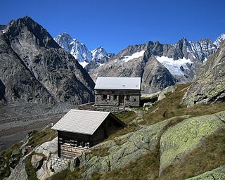
The Mutthorn Hut is a mountain hut of the Swiss Alpine Club, located between Kandersteg and Lauterbrunnen in the canton of Bern. It lies at a height of 2,900 metres above sea level, above the watershed between the Kander Glacier and the Tschingel Glacier, at the foot of the Mutthorn.