
Oberammergau is a municipality in the district of Garmisch-Partenkirchen, in Bavaria, Germany. The small town on the Ammer River is known for its woodcarvers and woodcarvings, for its NATO School, and around the world for its 380-year tradition of mounting Passion Plays.

Max Streibl was a German politician of the Christian Social Union (CSU) party and the eighth Minister President of Bavaria.

The Amper, called the Ammer upstream of the Ammersee, through which it runs, is the largest tributary of the Isar in southern Bavaria, Germany. It flows generally north-eastward, reaching the Isar in Moosburg, about 185 kilometres (115 mi) from its source in the Ammergau Alps, with a flow of 45 m³/s. Including its tributary, Linder, it is 209.5 km (130.2 mi) long. Major tributaries are the Glonn, which rises near Augsburg; the Würm, which is the outflow of Lake Starnberg; and the Maisach.
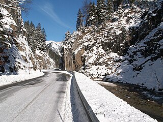
The Ammer Saddle is a high mountain pass in the Alps on the border between Tyrol, Austria and Bavaria, Germany.
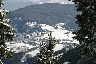
Fischbach is a municipality in the district of Weiz in Styria, Austria. It has 1530 inhabitants. On 27 February 2003, it was officially recognized as a climatic spa (Luftkurort) by the Styrian government. Fischbach is the highest place in East Styria.

The Ammergau Alps are a mountain range in the Northern Limestone Alps in the states of Bavaria (Germany) and Tyrol (Austria). They cover an area of about 30 x 30 km and begin at the outer edge of the Alps. The highest summit is the Daniel which has a height of 2,340 metres (7,680 ft).

The Bundesstraße 23 is a German federal highway in Bavaria that runs about 59.2 kilometres, from Peiting to the Austrian border near Garmisch-Partenkirchen. This highway (partially), along with the Bundesstraße 17 and Bundesstraße 472 highways, constitute the “German Alpine Road”. Coupled with the Bundesstraße 2 highway, it passes through cities such as Mittenwald, Innsbruck and the Brenner Pass.

The Sommerkahl is a small river in the northern Spessart in Lower Franconia, Bavaria, Germany. Near Langenborn the Sommerkahl empties from the left into the Kahl. Together with Westerbach, Reichenbach and Geiselbach the Sommerkahl is one of the largest tributaries of the Kahl.
Schwarzenbach is a river of Baden-Württemberg and of Bavaria, Germany.

The Berchtesgadener Ache is a river of Bavaria, Germany and of Salzburg, Austria. It is formed at the confluence of the Ramsauer Ache and the Königsseer Ache in Berchtesgaden. It flows into the Salzach near Anif.
The Fischbach is a river of Bavaria, Germany and of Salzburg, Austria.

Gersprenz is a river that starts in the Odenwald, Hesse and flows into the river Main near Aschaffenburg, Bavaria, Germany. Including its source river Mergbach, it is 62.1 km (38.6 mi) long, without the Mergbach it is 51.3 km (31.9 mi) long.
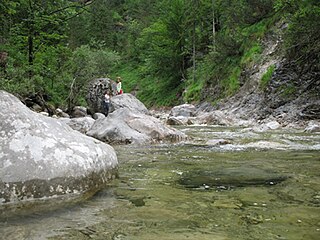
Steinbach is a river of Bavaria, Germany and of Salzburg, Austria. It is a tributary of the Saalach between Unken and Schneizlreuth.

The Weißach is a 33.5-kilometre-long (20.8 mi), right-hand, eastern tributary of the Bregenzer Ach in the German and Austrian Alps. It forms a very short section of the Austria–Germany border, just south of the confluence with the Eibelebach. It flows into the Bregenzer Ach near Doren.
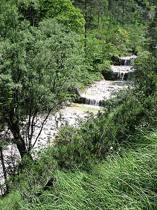
Weißbach is a river of Bavaria, Germany and Salzburg, Austria. Its source lies at the northern slope of the Dreisesselberg which is one of the Latten Mountains. Part of its course forms a section of the Austria–Germany border. It discharges in Weißbach, a district of Bad Reichenhall, into the Grabenbach, which itself discharges into the Saalach.

Rottach is a river of Bavaria, Germany. It is a right tributary of the Iller at the boundary between the municipalities Sulzberg and Rettenberg. Note that there is another river also called Rottach 18 kilometres downstream which is a left tributary of the Iller.
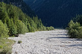
The Neualmbach, also called Neualpbach, is a river which lies in its entire course on the border between Bavaria, Germany and Tyrol, Austria, in the Ammergau Alps.

Ranna is a river of Bavaria, Germany and of Upper Austria, Austria.

Oberammergau station is a railway station in the municipality of Oberammergau, in Bavaria, Germany. It is the southern terminus of the Ammergau Railway of Deutsche Bahn.


