
The Kalamazoo River is a river in the U.S. state of Michigan. The river is 130 miles (210 km) long from the junction of its North and South branches to its mouth at Lake Michigan, with a total length extending to 178 miles (286 km) when one includes the South Branch. The river's watershed drains an area of approximately 2,020 square miles (5,200 km2) and drains portions of eight counties in southwest Michigan: Allegan, Barry, Eaton, Van Buren, Kalamazoo, Calhoun, Jackson, Hillsdale, Kent and Ottawa. The river has a median flow of 1,863 cubic feet per second (52.8 m3/s) at New Richmond, upstream from its mouth at Saugatuck.

Hat Creek is a 48.7-mile-long (78.4 km) stream and tributary of the Pit River, located in Shasta County of northern California.

The Mount Massive Wilderness is a federally designated wilderness area in the Sawatch Range, located in the U.S. state of Colorado. It is operated jointly by the United States Forest Service and the Fish and Wildlife Service as part of the San Isabel National Forest and the Leadville National Fish Hatchery. It is 30,540 acres (123.6 km2) in size, with 27,980 acres (113.2 km2) in San Isabel National Forest and 2,560 acres (10.4 km2) in Leadville National Fish Hatchery, and it was designated by the US Congress in 1980. The name comes from Mount Massive, the second highest peak in Colorado, located inside the wilderness. Elevations in the wilderness range from 9,700 feet (3,000 m) to 14,421 feet (4,396 m). It is the only federally designated wilderness area within the National Fish Hatchery System.
Fishing Creek is a 29.98-mile (48.25 km) long tributary of the Susquehanna River in Columbia County, Pennsylvania, in the United States. It joins the Susquehanna River near the census-designated place of Rupert and the town of Bloomsburg. The watershed has an area of 385 square miles (1,000 km2).

The Lochsa River is in the northwestern United States, in the mountains of north central Idaho. It is one of two primary tributaries of the Middle Fork of the Clearwater River in the Clearwater National Forest. Lochsa is a Nez Perce word meaning rough water. The Salish name is Ep Smɫí, "It Has Salmon."

Weinberg-King State Fish and Wildlife Area is an Illinois state park on 772 acres (312 ha) in Schuyler County, Illinois, United States. It is located near Augusta, Illinois.
Coffeen Lake State Fish and Wildlife Area is an Illinois state park on 297 acres (120 ha) in Montgomery County, Illinois, United States just south of Coffeen.
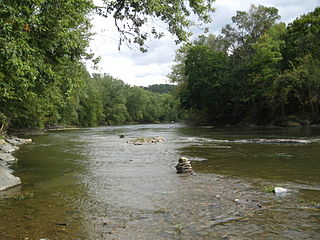
Union County State Fish and Wildlife Area is an Illinois state park on 6,202 acres (2,510 ha) in Union County, Illinois, United States. It contains extensive Clear Creek wetlands managed for fishing and bird hunting.

Mahanoy Creek is a 51.6-mile-long (83.0 km) tributary of the Susquehanna River in Northumberland and Schuylkill counties, Pennsylvania. There are at least 35 sources of acid mine drainage in the creek's watershed. Anthracite was mined in the upper part of the Mahanoy Creek watershed in the 19th and 20th centuries. Mahanoy Creek's tributaries include Schwaben Creek, Zerbe Run, Little Mahanoy Creek, Shenandoah Creek, and North Mahanoy Creek. Little Mahanoy Creek and Schwaben Creek are two streams in the watershed that are unaffected by acid mine drainage. Schwaben Creek has a higher number and diversity of fish species than the main stem.

Osage Township is a township in Bourbon County, Kansas, USA. As of the 2000 census, its population was 394.

Wano Township is a township in Cheyenne County, Kansas, USA. As of the 2000 census, its population was 2,104.

Pomona Township is a township in Franklin County, Kansas, USA. As of the 2000 census, its population was 1,174.
Tonto Creek is a 72.5-mile-long (116.7 km) stream located in the Mogollon Rim area of the state of Arizona on the north edge of the Tonto National Forest. The closest town, Payson, is 18 miles (29 km) away. Tonto Creek is a stream that flows year round, starting just below the Mogollon Rim, at the northern edge of Tonto National Forest. The creek continues its descent through the Hellsgate Wilderness area and eventually into a wide valley in the Sonoran Desert. It continues through the desert and into the Salt River within the north end of Theodore Roosevelt Lake. The facilities are maintained by Tonto National Forest division of the USDA Forest Service.

Little Butte Creek is a 17-mile-long (27 km) tributary of the Rogue River in the U.S. state of Oregon. Its drainage basin consists of approximately 354 square miles (917 km2) of Jackson County and another 19 square miles (49 km2) of Klamath County. Its two forks, the North Fork and the South Fork, both begin high in the Cascade Range near Mount McLoughlin and Brown Mountain. They both flow generally west until they meet near Lake Creek. The main stem continues west, flowing through the communities of Brownsboro, Eagle Point, and White City, before finally emptying into the Rogue River about 3 miles (5 km) southwest of Eagle Point.

Clear Creek is a small river in Southeast Texas in the United States, which channels much of the run-off in southeast Harris County into Clear Lake and Galveston Bay. Much of the length of the stream forms the boundary between Harris County and Galveston County and all of the boundary with Brazoria County. It originates in the Blue Ridge Oilfield in Fort Bend County.

The Middle Fork Eel River is a major tributary of the Eel River of northwestern California in the United States. It drains a rugged and sparsely populated region of the Yolla Bolly Mountains, part of the California Coast Range, in Trinity and Mendocino Counties. Its watershed comprises roughly 745 square miles (1,930 km2) of land, or 20% of the entire Eel River basin. The river provides groundwater recharge and is used for recreation and for industrial, agricultural and municipal water supply by residents.

Poso Creek or Posey Creek is an 87.9-mile (141.5 km) intermittent stream in Kern County, California.

South Branch Roaring Creek is a tributary of Roaring Creek in Columbia County and Northumberland County, Pennsylvania, in the United States. It is approximately 16.8 miles (27.0 km) long. The upper reaches of the creek are located in Weiser State Forest, between Big Mountain and Little Mountain. The creek is home to some trout and is considered a high-quality coldwater fishery. The Chemung Formation occurs in the creek's watershed. The watershed is 25 square miles in area.
Butternut Creek flows for 37 miles before converging with the Unadilla River just downstream of Mount Upton, New York. The creek has many fish for fishing dominated by largemouth bass, smallmouth bass, wall-eye, chain pickerel, rock bass, and yellow perch.
