
Birch Lake Township is a township in Cass County, Minnesota, United States. The population was 573 as of the 2000 census. This township took its name from Birch Lake.
Kego Township is a township in Cass County, Minnesota, United States. The population was 465 as of the 2000 census. Kego is a name derived from the Ojibwe language, meaning "fish".
Fish Lake Township is a township in Chisago County, Minnesota, United States. The population was 2,012 at the 2010 census.
Fredenberg Township is a township in Saint Louis County, Minnesota, United States. The population was 1,337 at the 2010 census.

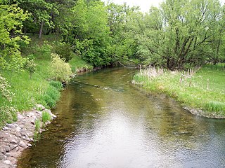
The Saint Louis River is a river in the U.S. states of Minnesota and Wisconsin that flows into Lake Superior. The largest U.S. river to flow into the lake, it is 192 miles (309 km) in length and starts 13 miles (21 km) east of Hoyt Lakes, Minnesota. The river's watershed covers 3,634 square miles (9,410 km2). Near the Twin Ports of Duluth, Minnesota and Superior, Wisconsin, the river becomes a freshwater estuary. The lower St. Louis is the only river in the state with whitewater rafting opportunities.
Okamanpeedan Lake, partially located in Martin County, Minnesota, and Emmet County, Iowa, is also known as Tuttle Lake. Okamanpeedan Lake is a roughly 2,300-acre (9.3 km²) riverine lake located on the East Fork of the Des Moines River. It has an average depth of about four to six feet. The lake has a contributing watershed of approximately 120,056 acres (486 km²) and watershed:lake ratio on the order of about 50:1. The lake is situated in a glacial till plain and is generally in an area dominated by loamy, poorly drained soils. The area is primarily level but does have some rolling hills.

Gooseberry Falls State Park is a state park of Minnesota, United States, on the North Shore of Lake Superior. The park is located in Silver Creek Township, about 13 miles (21 km) northeast of Two Harbors, Minnesota in Lake County on scenic Minnesota Highway 61. The park surrounds the mouth of the Gooseberry River and includes Upper, Middle and Lower Gooseberry Falls.
Altermatt Lake is a lake in Brown County, Minnesota, in the United States. It is a protected public lake.
Bachelor Lake is a lake in Brown County, Minnesota in the northeastern part of Stark township. Covering 79.80 acres, it is an officially protected water of the State of Minnesota. The lake is within the Cottonwood River Major Watershed. The lake’s elevation is 1,004 feet (306 m), and it is zoned as a shoreland area which is regulated as a shoreland management water.
Juni Lake is a lake in Brown County, Minnesota, in the United States. The lake is a 62.5 acre protected body of water.

Glacial Lakes State Park is a state park of Minnesota, USA, approximately 5 miles (8.0 km) south of Starbuck. It was founded in 1963 to preserve some of the remaining rolling prairie which previously covered much of the state. Located in the Leaf Mountains, the park and the area around it contains many glacial landforms created by the Wisconsonian glaciation.
The Fish Hook River, also spelled Fishhook River, is a tributary of the Shell River, 9 miles (14 km) long, in north-central Minnesota in the United States. The river's source, Fish Hook Lake, collects short tributaries known as the Portage River and the Potato River. Via the Shell and Crow Wing rivers, the Fish Hook River is part of the watershed of the Mississippi River. The river flows for its entire length in southwestern Hubbard County; its watershed extends into northeastern Becker County.
Agassiz National Wildlife Refuge is located in northwest Minnesota. Packs of wolves, moose, waterfowl, and 294 species of birds make this refuge a wildlife wonderland.
Stark is an unincorporated community in Fish Lake Township, Chisago County, Minnesota, United States.
School Lake is a lake in Brown County, Minnesota, in the United States. It is a 102-acre protected lake.
Sleepy Eye Lake is a lake in Brown County, in the U.S. state of Minnesota. The lake is a 263-acre protected body of water.
Bennettville is an unincorporated community in Hazelton Township, Aitkin County, Minnesota, United States. The community is located between Garrison and Aitkin along U.S. Highway 169 near the junction with 270th Street and Aitkin County Road 11, Tame Fish Lake Road.
Clear Lake is a lake in North Cottonwood, Township, Brown County, Minnesota, in the United States. It is a protected public lake.
