Fitzgerald County

Last updated

Map all coordinates using: OpenStreetMap  
Download coordinates as: KML  ·  GPX
Fitzgerald
New South Wales
Fitzgerald NSW.PNG
Location in New South Wales
Lands administrative divisions around Fitzgerald:
Yantara Ularara Barrona
Yungnulgra Fitzgerald Landsborough
Yungnulgra Killara Killara

Fitzgerald County is one of the 141 Cadastral divisions of New South Wales.

Fitzgerald County was named in honour of the surveyor and botanist, Robert D. FitzGerald (1830-1892). [1]

Robert D. FitzGerald surveyor, ornithologist, botanist and poet

Robert David FitzGerald was an Irish-Australian surveyor, ornithologist, botanist and poet.

Parishes within this county

A full list of parishes found within this county; their current LGA and mapping coordinates to the approximate center of each location is as follows:

Local government in Australia

Local government in Australia is the third tier of government in Australia administered by the states and territories, which in turn are beneath the federal tier. Local government is not mentioned in the Constitution of Australia and two referenda in the 1970s and 1980s to alter the Constitution relating to local government were unsuccessful. Every state government recognises local government in their respective constitutions. Unlike Canada or the United States, there is only one level of local government in each state, with no distinction such as cities and counties.

ParishLGACoordinates
Alto Central Darling Shire 30°22′39″S143°12′34″E / 30.37750°S 143.20944°E / -30.37750; 143.20944 (Alto)
Borrina Unincorporated 30°12′00″S143°54′59″E / 30.20000°S 143.91639°E / -30.20000; 143.91639 (Borrina)
Carilla Unincorporated 30°10′33″S144°01′08″E / 30.17583°S 144.01889°E / -30.17583; 144.01889 (Carilla)
Cunellie Central Darling Shire 30°30′06″S143°20′49″E / 30.50167°S 143.34694°E / -30.50167; 143.34694 (Cunellie)
Fiby Central Darling Shire 30°33′03″S143°39′49″E / 30.55083°S 143.66361°E / -30.55083; 143.66361 (Fiby)
Glespin Central Darling Shire 30°23′15″S143°52′15″E / 30.38750°S 143.87083°E / -30.38750; 143.87083 (Glespin)
Gueraleh Central Darling Shire 30°17′41″S143°40′54″E / 30.29472°S 143.68167°E / -30.29472; 143.68167 (Gueraleh)
Hogarth Central Darling Shire 30°25′24″S143°21′31″E / 30.42333°S 143.35861°E / -30.42333; 143.35861 (Hogarth)
Lestrange Central Darling Shire 30°35′13″S143°32′48″E / 30.58694°S 143.54667°E / -30.58694; 143.54667 (Lestrange)
Moollawoolka Central Darling Shire 30°33′23″S143°52′38″E / 30.55639°S 143.87722°E / -30.55639; 143.87722 (Moollawoolka)
Moorquong Central Darling Shire 30°27′17″S143°31′22″E / 30.45472°S 143.52278°E / -30.45472; 143.52278 (Moorquong)
Morton Unincorporated 30°14′09″S143°24′44″E / 30.23583°S 143.41222°E / -30.23583; 143.41222 (Morton)
Mungundi Unincorporated 30°04′55″S144°01′46″E / 30.08194°S 144.02944°E / -30.08194; 144.02944 (Mungundi)
Murpa Central Darling Shire 30°18′07″S143°53′22″E / 30.30194°S 143.88944°E / -30.30194; 143.88944 (Murpa)
Parkin Unincorporated 30°10′37″S143°45′31″E / 30.17694°S 143.75861°E / -30.17694; 143.75861 (Parkin)
Petita Unincorporated 30°14′54″S143°05′04″E / 30.24833°S 143.08444°E / -30.24833; 143.08444 (Petita)
Purranga Central Darling Shire 30°34′12″S143°27′51″E / 30.57000°S 143.46417°E / -30.57000; 143.46417 (Purranga)
Questa Central Darling Shire 30°20′05″S143°07′40″E / 30.33472°S 143.12778°E / -30.33472; 143.12778 (Questa)
Quin Central Darling Shire 30°39′40″S143°05′59″E / 30.66111°S 143.09972°E / -30.66111; 143.09972 (Quin)
Ranken Central Darling Shire 30°29′12″S143°46′22″E / 30.48667°S 143.77278°E / -30.48667; 143.77278 (Ranken)
Salisbury Unincorporated 30°10′34″S143°34′33″E / 30.17611°S 143.57583°E / -30.17611; 143.57583 (Salisbury)
Tantivy Central Darling Shire 30°18′46″S143°33′43″E / 30.31278°S 143.56194°E / -30.31278; 143.56194 (Tantivy)
Toonburra Unincorporated 30°08′48″S143°55′50″E / 30.14667°S 143.93056°E / -30.14667; 143.93056 (Toonburra)
Tungara Unincorporated 30°14′32″S143°59′54″E / 30.24222°S 143.99833°E / -30.24222; 143.99833 (Tungara)
Tungo Central Darling Shire 30°33′44″S143°44′47″E / 30.56222°S 143.74639°E / -30.56222; 143.74639 (Tungo)
Warramutty Central Darling Shire 30°27′12″S143°57′00″E / 30.45333°S 143.95000°E / -30.45333; 143.95000 (Warramutty)
Winbinyah Central Darling Shire 30°19′57″S143°47′04″E / 30.33250°S 143.78444°E / -30.33250; 143.78444 (Winbinyah)
Wonko Central Darling Shire 30°25′39″S143°40′22″E / 30.42750°S 143.67278°E / -30.42750; 143.67278 (Wonko)
Yapunya Central Darling Shire 30°24′10″S143°46′35″E / 30.40278°S 143.77639°E / -30.40278; 143.77639 (Yapunya)
Yentabangee Central Darling Shire unknown
Yooltoo Central Darling Shire 30°29′13″S143°08′34″E / 30.48694°S 143.14278°E / -30.48694; 143.14278 (Yooltoo)

Related Research Articles

South Creek (New South Wales) river in New South Wales, Australia

The South Creek or Wianamatta, a creek that is part of the Hawkesbury-Nepean catchment, is located on the Cumberland Plain, also referred to as Greater Western Sydney, New South Wales, Australia.

The Geographical Names Board of New South Wales, a statutory authority of the Land and Property Information division, Department of Finance and Services in the Government of New South Wales, is the official body for naming and recording details of places and geographical names in the state of New South Wales, Australia.

Darbalara, New South Wales Town in New South Wales, Australia

Darbalara is a rural community on the east bank of the junction of the Murrumbidgee River and Tumut River in the Riverina. It is situated by road, about 25 kilometres north east of Gundagai and 25 kilometres south of Coolac.

Cumberland was an electoral district of the Legislative Assembly in the Australian state of New South Wales from 1856 to 1859, in Cumberland County, which includes Sydney. It included all of the county north of Parramatta Road and the Great Western Highway, except for the urban electorates of Sydney (City), Sydney Hamlets, Parramatta and Cumberland Boroughs, which included Richmond and Windsor. It elected two members simultaneously, with voters casting two votes and the first two candidates being elected.

Gloucester County, New South Wales Cadastral in New South Wales, Australia

Gloucester County was one of the original Nineteen Counties in New South Wales, and is now one of the 141 cadastral divisions of New South Wales. It includes the area around Port Stephens. It is bounded on the north and west by the Manning River, and on the south-west by the Williams River.

Northumberland County, New South Wales Cadastral in New South Wales, Australia

Northumberland County was one of the original Nineteen Counties in New South Wales and is now one of the 141 Cadastral divisions of New South Wales. It included the area to the north of Broken Bay, including Lake Macquarie and Newcastle. It was bounded by the part of the Hawkesbury River to the south, the Macdonald River to the south-west, and the Hunter River to the north.

Camden County, New South Wales Cadastral in New South Wales, Australia

Camden County was one of the original Nineteen Counties in New South Wales and is now one of the 141 Cadastral divisions of New South Wales. It included the coastal area near Wollongong south to the Shoalhaven River, and also inland encompassing Berrima and Picton. Its western boundary was the Wollondilly River. The first settlement in the area was Camden Park, established by John Macarthur in 1806, just across the Nepean River from Cumberland County. It was the first land across the Nepean to be settled. Camden is a present-day suburb of Sydney in the same area, although parts of it are in Cumberland.

St Vincent County Cadastral in Australian Capital Territory

St Vincent County was one of the original Nineteen Counties in New South Wales and is now one of the 141 Cadastral divisions of New South Wales. It included the south coast area encompassing Batemans Bay, Ulladulla, Jervis Bay and inland to Braidwood. The Shoalhaven River is the boundary to the north and west, and the Deua River the boundary to the south.

Cowper County Cadastral in New South Wales, Australia

Cowper County, New South Wales is one of the 141 Cadastral divisions of New South Wales.

Evelyn County, New South Wales Cadastral in New South Wales, Australia

Evelyn County is one of the 141 Cadastral divisions of New South Wales, Australia.

Gowen County Cadastral in New South Wales, Australia

Gowen County is one of the 141 Cadastral divisions of New South Wales. It is located to the east of the Castlereagh River in the area to the east of Gilgandra, to Coonabarabran in the north-east. This includes land on both sides of the Newell Highway.

Irrara County Cadastral in New South Wales, Australia

Irrara County is one of the 141 Cadastral divisions of New South Wales. It is located south of the border with Queensland, east of the Paroo River, and west of the Warrego River.

Kennedy County Cadastral in New South Wales, Australia

Kennedy County is one of the 141 Cadastral divisions of New South Wales. It is located to the west of the Bogan River in the area around Tottenham and Tullamore.

Mootwingee County Cadastral in New South Wales, Australia

Mootwingee County, New South Wales is one of the 141 Cadastral divisions of New South Wales.

Oxley County Cadastral in New South Wales, Australia

Oxley County, New South Wales is one of the 141 Cadastral divisions of New South Wales. It is located between the Bogan River on the west, and the Macquarie River on the east. This is the area approximately between Warren and Nyngan.

Sun Valley is an address locality in the state of New South Wales, Australia in the City of Blue Mountains. The area known as Sun Valley lies between Warrimoo and Valley Heights in the lower mountains and has a wealth of historical and geological significance.

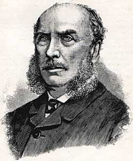
Robert George Dundas Fitzgerald was a New Zealand-born Australian politician.

Blowering, New South Wales

Blowering, New South wales is a rural locality in the Snowy Mountains of New South wales and a civil Parish of Buccleuch County.

References

  1. "Fitzgerald County". Geographical Names Register (GNR) of NSW. Geographical Names Board of New South Wales. OOjs UI icon edit-ltr-progressive.svg