Five Island Harbour is a large bay on the west coast of the island of Antigua, in Antigua and Barbuda. [1]
It is located 5 kilometres (3.1 mi) southwest of the nation's capital city of St. John's.
The town of Five Islands is on a peninsula along its northern shoreline.
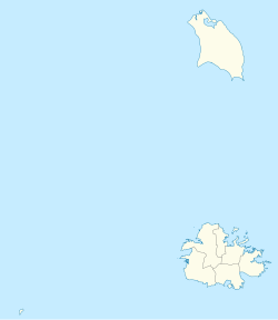
Saint Mary, officially the Parish of Saint Mary, is a parish of Antigua and Barbuda on the island of Antigua. Saint Mary borders Saint John to the north, and Saint Paul to the east. Saint Mary is dominated by the Shekerley Mountains, and its northern border is largely defined by the mountains, and by Cooks Creek. The largest city in the parish is Bolans, home to the Jolly Harbour neighbourhood, and the parish church is located in Old Road. Saint Mary was created with the other five original parishes on 11 January 1692. It had a population of 7,341 in 2011, and 8,141 in 2018.
Saint Paul is a civil parish of Antigua and Barbuda, located in the central−southern area of Antigua island. It had a population of 9,004 in 2018.
Saint Peter, officially the Parish of Saint Peter, is a parish of Antigua and Barbuda on the island of Antigua. Saint Peter borders Saint Paul to the south, Saint Philip to the east, and Saint George and Saint John to the west. Saint Peter is dominated by farmland, savanna, and undeveloped fields, and its borders are not well-defined. The largest city fully within the parish is Parham, which is also the capital. However, the portion of the city of All Saints in Saint Peter is significantly larger than Parham. Saint Peter was created with the other five original parishes on 11 January 1692. It had a population of 5,325 in 2011.
Antigua, also known as Waladli or Wadadli by the native population, is an island in the Lesser Antilles. It is one of the Leeward Islands in the Caribbean region and the most populous island of the country of Antigua and Barbuda. Antigua and Barbuda became an independent state within the Commonwealth of Nations on 1 November 1981.
Antigua Recreation Ground is the national stadium of Antigua and Barbuda. It is located in St. John's, on the island of Antigua. The ground has been used by the West Indies cricket team and Antigua and Barbuda national football team. It had Test cricket status. It was also known as the Old Recreation Ground, or the Old Rec. against England in the "Blackwash" series of 1986 at the Recreation Ground. It was also where Brian Lara twice set the record for highest individual Test innings, scoring 375 in 1994 and the current record of 400 not out in 2004, both times against England.
Cape Shirley is the southernmost point on the island of Antigua in the nation of Antigua and Barbuda. It is located at 17°0′0″N61°45′0″W between the Caribbean Sea and the Atlantic Ocean.
Mercers Creek Bay is a large bay in the northeast of Antigua. The settlements of Willikies and Seaton's lie close to the bay, which is protected from the Atlantic Ocean by a string of small islands, the largest of which is Crump Island.
Signal Hill is a mountain and the second-highest point on Antigua island, in Antigua and Barbuda.
The Shekerley Mountains are a low mountain range on southwestern Antigua island, in the nation of Antigua and Barbuda and the Leeward Islands of the eastern Caribbean.
Jolly Harbour is a township on Antigua island, in Antigua and Barbuda.
Falmouth Harbour is a horseshoe-shaped bay and natural harbour on the far southern coast of the island of Antigua in Antigua and Barbuda.
Devil's Bridge is a natural rock arch in eastern Antigua. It is located on the Atlantic coast at 17°6′1.7″N61°40′42.2″W, near Indian Town Point to the east of Willikies. The area around the arch features several natural blowholes which shoot up water and spray powered by waves from the Atlantic Ocean. This particular location is exposed to waves that are pushed by the Trade Winds with no land between here and Europe. Nearby popular local swimming spots such as Long Cove are sheltered by an offshore reef acts as a natural breakwater. In 2008 it was declared National Park.
Antigua and Barbuda lie in the eastern arc of the Leeward Islands of the Lesser Antilles, separating the Atlantic Ocean from the Caribbean Sea. Antigua is 650 km (400 mi) southeast of Puerto Rico; Barbuda lies 48 km (30 mi) due north of Antigua, and the uninhabited island of Redonda is 56 km (35 mi) southwest of Antigua.
Fitches Creek is an affluent coastal neighbourhood in Antigua and Barbuda, located on the island of Antigua. It was named for the English surname Fitch, which may have been the family name of some who originally owned the surrounding land. The surrounding area is now a neighborhood in the parish of Saint George.
The Dockyard Museum is a museum located at Nelson's Dockyard in English Harbour on Antigua island, in Antigua and Barbuda.
Saddleback Point is a headland on the northern coast of Elephant Island, in the South Shetland Islands of Antarctica. The site lies 2 km (1.2 mi) to the west of Point Wild.
17°06′N61°54′W / 17.100°N 61.900°W