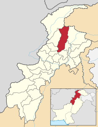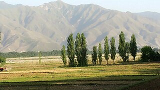
Mardan District is a district in the Mardan Division of the Khyber Pakhtunkhwa province of Pakistan. The district is named after Mardan city, which is also the headquarters of the district. The district is famous for its agriculture industry and its archaeological sites, specifically of Takht-i-Bhai, Jamal Garhi and Sawal Dher.

Shangla District is a district in Malakand Division of Khyber Pakhtunkhwa, Pakistan. The district's headquarters are located at Alpuri, while the largest city and commercial center is Besham. The district was established in 1995, having previously been a subdivision of Swat District. The total area of the district is 1,586 square kilometers. Shangla comprises three subdivisions, Alpuri, Puran, Chakesar, Martung and Besham tehsils.

Swat District, also known as the Swat Valley, is a district in the Malakand Division of Khyber Pakhtunkhwa, Pakistan. Known for its stunning natural beauty, the district is a popular tourist destination. With a population of 2,309,570 per the 2017 national census, Swat is the 15th-largest district of Khyber Pakhtunkhwa.

Saidū Sharīf is the capital of the Swat district, Khyber Pakhtunkhwa, Pakistan. The city also serves as the capital of the Malakand Division. It was named after Saidu Baba, a prominent leader of the former state of Swat.

Madyan is a popular hill station located in the Swat District of the Khyber Pakhtunkhwa province of Pakistan. It is situated at a distance of about 55 kilometres (34 mi) from Mingora. It is a tourist destination. Each year, thousands of tourists from all over Pakistan visit it, especially in summer Madyan is also famous for its trout fish. Agriculture and tourism-related businesses like handicrafts outlets, restaurants and hotels are the main sources of income for the locals, although a small fraction of the population is also working abroad, particularly in the gulf countries. Madyan Valley is known all over the district because of its perfect weather condition. Tourists are attracted by the transparent and colorless water flowing in a stream that begins from Beshigram (بشیگرام) Valley and meets with the Swat River.

Mingora is a city in the Swat District of Khyber Pakhtunkhwa, Pakistan. Located on the Swat River, it is the 3rd largest city in Khyber Pakhtunkhwa and the 26th largest in Pakistan. Mingora is the largest city and the epicenter of social, cultural, and economic activities in Malakand Division, and also the largest in the northern part of Khyber Pakhtunkhwa.

Kalam is a valley located 99 kilometres (62 mi) from Mingora in the northern upper section of Swat Valley along the banks of the Swat River in the Khyber Pakhtunkhwa province of Pakistan. The Swat River was formed as a result of the confluence of two major tributaries, the Gabral and Ushu river.

Kabal is a town in Swat District, Khyber-Pakhtunkhwa province of Pakistan located 10 kilometres (6 mi) from Mingora city. The old name of kabal was Chendakhwara. It is the tenth largest city in Khyber Pakhtunkhwa and 82nd largest in Pakistan by population
- Kabal
- Bara Bandai
- Kuza Bandai
- Kanju
- Hazara
- Bar Abakhail
- Kuz Abakhail
- Deowlai
- Shah Dehrai
- Totano Bandai

Ghalegay is a village of Swat Valley, located at a distance of 14 km south of Mingora, on the left bank of Swat River. It is one of the main villages lying between the two cities, Mingora and Barikot.

The Second Battle of Swat also known as Operation Rah-e-Rast, began in May 2009 and involved the Pakistan Army and Tehrik-i-Taliban Pakistan militants in a fight for control of the Swat district of Pakistan. The first Battle of Swat had ended with a peace agreement, that the government had signed with the Tehrik-i-Taliban Pakistan in February 2009. However, by late April 2009 government troops and the Tehrik-i-Taliban Pakistan began to clash once again, and in May the government launched a military offensive code-named Operation Black Thunderstorm throughout the Swat district and elsewhere to oppose the Tehrik-i-Taliban Pakistan.
The First Battle of Swat, also known as Operation Rah-e-Haq, was fought between Pakistan and the Tehrik-i-Taliban in late 2007 over control of the Swat District of Pakistan.

Kuza Bandai is a well developed village in Swat Valley of Khyber Pakhtunkhwa, Pakistan. It is known for its natural environment and also known as an area crossed by Alexander the Great. Later, after the Lal Masjid battle, Kuza Bandai and Bara Bandai became sympathetic to the Taliban movement. The village consists of Yusufzai Pakhtun tribes. It is one of Pakistan's Provincially Administered Tribal Areas (PATA).

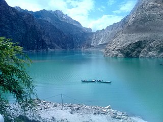
Attabad Lake Gojal is a lake located in the Gojal region of Gilgit-Baltistan, Pakistan. It was formed in January 2010 due to a significant landslide in Attabad. Encompassing an array of engaging activities, the lake has garnered attention for its boating. jet-skiing, fishing and other recreational activities.
Mohmand Dam is an under construction multi-purpose concrete-faced rock-filled dam located on the Swat River approximately 37 km north of Peshawar and 5 km upstream of Munda Headworks in Mohmand District, Khyber Pakhtunkhwa, Pakistan.
The Sarhad Rural Support Programme (SRSP) is the largest non-governmental organization working to alleviate poverty in North West Pakistan. It was established in 1989 with the aim of reducing poverty and ensuring sustainable means of livelihood in what is now Khyber Pakhtunkhwa, Pakistan. SRSP is part of the Rural Support Programmes (RSP's) initiated by United Nations Environment Programme Global 500 Award winner Shoaib Sultan Khan. It is now the largest regional RSP, with extensive outreach into communities. In recent years because of its vast outreach, SRSP has had to play a prominent role in disasters that have hit Khyber Pakhtunkhwa. As a result, humanitarian work along with development has become a core competency of the organization.
The Quaid-e-Azam Solar Park is a photovoltaic power station in Bahawalpur, Punjab, Pakistan, named in honor of Quaid-e-Azam Muhammad Ali Jinnah, the Founder of Pakistan. It is a 400 MW solar facility spanning an area of 8 km2 and hosting 1.6 million solar modules. The initial phase of the project was constructed by the Government of Punjab through a 100% owned subsidiary QA Solar in May 2015 at a cost of $131 million. On 5 May 2015, the then Prime Minister of Pakistan Nawaz Sharif inaugurated the first 100 MW project and dedicated it to the nation. Subsequent expansion was done in public-private partnership with Appolo Solar Development Pakistan Limited, Best Green Energy Pakistan Limited and Crest Energy Pakistan Limited each installing a 100 MW unit. The next phase of 100 MW will be installed by Zorlu Solar Pakistan (Pvt.) Limited, making it a 500 MW facility. Total planned capacity of the solar park is 1,000 MW.

Manglawar is an administrative unit, known as Union council of Tehsil Babuzai, of Swat District in the Khyber Pakhtunkhwa province of Pakistan and former capital of Kingdom of Swat. It is located at 34°48'30.7"N 72°25'50.0"E with an average altitude of 987 meters.

Swat Museum is a museum located in Mingora, on the road connecting Mingora and Saidu Sharif in the Swat District of the Khyber Pakhtunkhwa province of Pakistan.

The Swat Motorway(Urdu: سوات موٹر وے, Pashto: سوات بزرگراه ), also known as the M-16 or Swat Expressway, is a 160-kilometre-long (99 mi) four-lane motorway and provincial controlled-access highway in the Khyber Pakhtunkhwa province of Pakistan. Phase-1 of the project, completed in June 2019, connects the existing M-1 motorway at Nowshera to Chakdara while the under-construction second phase will extend the project to Fatehpur.

Jarogo Waterfall, also known as Jarogo Banda Waterfall, is a waterfall located in Matta Tehsil in Swat District of Khyber Pakhtunkhwa, the province of Pakistan. It is one of the famous waterfalls of Swat Valley. It is about 30 kilometres (19 mi) from Matta Tehsil and 53 kilometres (33 mi) from Mingora.


