Related Research Articles

Dunkirk is a commune in the department of Nord in northern France. It lies 10 kilometres (6.2 mi) from the Belgian border. It has the third-largest French harbour. The population of the commune in 2019 was 86,279.

The Strait of Dover or Dover Strait, is the strait at the narrowest part of the English Channel, marking the boundary between the Channel and the North Sea, and separating Great Britain from continental Europe. The shortest distance across the strait, at approximately 20 miles, is from the South Foreland, northeast of Dover in the English county of Kent, to Cap Gris Nez, a cape near to Calais in the French département of Pas-de-Calais. Between these points lies the most popular route for cross-channel swimmers. The entire strait is within the territorial waters of France and the United Kingdom, but a right of transit passage under the United Nations Convention on the Law of the Sea allows vessels of other nations to move freely through the strait.

In oceanography, geomorphology, and geoscience, a shoal is a natural submerged ridge, bank, or bar that consists of, or is covered by, sand or other unconsolidated material, and rises from the bed of a body of water close to the surface or above it, which poses a danger to navigation. Shoals are also known as sandbanks, sandbars, or gravelbars. Two or more shoals that are either separated by shared troughs or interconnected by past or present sedimentary and hydrographic processes are referred to as a shoal complex.
Landforms are categorized by characteristic physical attributes such as their creating process, shape, elevation, slope, orientation, rock exposure, and soil type.

Barrier islands are a coastal landform, a type of dune system and sand island, where an area of sand has been formed by wave and tidal action parallel to the mainland coast. They usually occur in chains, consisting of anything from a few islands to more than a dozen. They are subject to change during storms and other action, but absorb energy and protect the coastlines and create areas of protected waters where wetlands may flourish. A barrier chain may extend for hundreds of kilometers, with islands periodically separated by tidal inlets. The largest barrier island in the world is Padre Island of Texas, United States, at 113 miles (182 km) long. Sometimes an important inlet may close permanently, transforming an island into a peninsula, thus creating a barrier peninsula, often including a beach, barrier beach. Though many are long and narrow, the length and width of barriers and overall morphology of barrier coasts are related to parameters including tidal range, wave energy, sediment supply, sea-level trends, and basement controls. The amount of vegetation on the barrier has a large impact on the height and evolution of the island.

The Banc d'Arguin National Park of Bay of Arguin lies in Western Africa on the west coast of Mauritania between Nouakchott and Nouadhibou and is the former mouth of the Tamanrasset River. The World Heritage Site is a major site for migratory birds and breeding birds, including flamingos, pelicans and terns. Much of the breeding is on sand banks including the islands of Tidra, Niroumi, Nair, Kijji and Arguim. The surrounding waters are some of the richest fishing waters in western Africa and serve as nesting grounds for the entire western region.

Le Touquet-Paris-Plage, commonly referred to as Le Touquet, is a commune near Étaples, in the Pas-de-Calais department, northern France. It has a population of 4,227 (2019), but welcomes up to 250,000 people during the summer.

Seal Rock is a group of small rock formation islands in the Lands End area of the Outer Richmond District in western San Francisco, California. They are located just offshore in the Pacific Ocean, at the north end of the Ocean Beach, near the Cliff House and Sutro Baths ruins.

Bourbourg is a commune in the Nord department in northern France. It is situated in the maritime plain of northern France, in the middle of a triangle formed by Dunkirk, Calais, and Saint-Omer.

Westhoek or Maritime Flanders is a region in Belgium and France and includes the following areas:

Arcachon Basin or alternatively Arcachon Bay is a bay of the Atlantic Ocean on the southwest coast of France, situated in Pays de Buch between the Côte d'Argent and the Côte des Landes, in the region of Aquitaine. The bay covers an area of 150 square kilometres (60 sq mi) at high tide and 40 km2 (15 sq mi) at low tide. Some of its geological features are natural preservation areas.

Richel, or rather De Richel, is a permanently dry sandbank in the Wadden Sea, in the gap between the Dutch islands of Vlieland and Terschelling. It is located about 1 kilometer east of the northernmost point of Vlieland and is administered by the municipality of Vlieland. The sandbank has an average surface area of 116 hectares. It is completely flooded only during extremely high tides.

Ringkøbing Fjord, despite its name, is in fact a shallow lagoon on the west coast of Jutland.

Cape Town lies at the south-western corner of the continent of Africa. It is bounded to the south and west by the Atlantic Ocean, and to the north and east by various other municipalities in the Western Cape province of South Africa.
Tentsmuir National Nature Reserve (NNR) is located southeast of Tayport in Fife, Scotland. The reserve is made up of three parts, encompassing Morton Lochs, Tentsmuir Point and Tayport Heath, and is managed by NatureScot. The different sections of Tentsmuir NNR were originally designated as separate national nature reserves at different times: the Morton Lochs section was designated in 1952; Tentsmuir Point in 1954; and Tayport Heath in 1988. While these discrete sections are distant from one another, they form part of the extensive dune system at Tentsmuir, and in 2003 SNH combined the three sites to form Tentsmuir National Nature Reserve. The adjoining Tentsmuir Forest is managed by Forestry and Land Scotland and covers most of the land between the three portions of the NNR.

The siege of Dunkirk in 1658 was a military operation by the allied forces of France and Commonwealth England intended to take the fortified port city of Dunkirk, Spain's greatest privateer base, from the Spanish and their confederates: the English royalists and French Fronduers. Dunkirk was a strategic port on the southern coast of the English Channel in the Spanish Netherlands that had often been a point of contention previously and had changed hands a number of times. Privateers operating out of Dunkirk and other ports had cost England some 1,500 to 2,000 merchant ships in the past year. The French and their English Commonwealth allies were commanded by Marshal of France Turenne. The siege would last a month and featured numerous sorties by the garrison and a determined relief attempt by the Spanish army under the command of Don Juan of Austria and his confederate English royalists under Duke of York and rebels of the French Fronde under the Great Condé that resulted in the battle of the Dunes.
The Sandettie Bank is an elongated sandbank in the southern North Sea, more specifically about in the middle of the northeastern entrance to the Strait of Dover. North-west of it are the hazardous Goodwin Sands, south of it the sandbank Ruytingen.

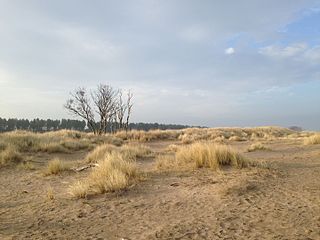
The Plain of Flanders is a low-lying plain bordering the North Sea. It is part of the Low Countries, and the North European Plain. It extends through the territories of Northern France and Belgium. It has two main sections : Maritime Flanders and Interior Flanders. The coastal plain consists mainly of sand dunes and polders.
Gridlink Interconnector is a proposed submarine power cable between England and France. The 1,400 MW high-voltage direct current connector would link Kingsnorth National Grid substation in north Kent, England, with Réseau de Transport d'Électricité Warande substation in Bourbourg (Nord) near Dunkirk in northern France.
The Étang de Sale is a coastal wetland beside the Tyrrhenian Sea on the east coast of the Haute-Corse department of the French island of Corsica.
References
- 1 2 Article de Pierre-Jean Thumerelle in Guide des merveilles naturelles de la France, Sélection du Reader's Digest, 1973, p. 220.
- ↑ Fiche sur le site Natura 2000 Bancs de Flandres