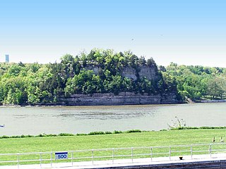
Starved Rock State Park is a state park in the U.S. state of Illinois, characterized by the many canyons within its 2,630 acres (1,064 ha). Located just southeast of the village of Utica, in Deer Park Township, LaSalle County, Illinois, along the south bank of the Illinois River, the park hosts over two million visitors annually, the most for any Illinois state park.

The National Register of Historic Places in the United States is a register including buildings, sites, structures, districts, and objects. The Register automatically includes all National Historic Landmarks as well as all historic areas administered by the U.S. National Park Service. Since its introduction in 1966, more than 90,000 separate listings have been added to the register.

This is a list of properties and districts in Illinois that are on the National Register of Historic Places. There are over 1,900 in total. Of these, 85 are National Historic Landmarks. There are listings in all of the state's 102 counties.
This National Park Service list is complete through NPS recent listings posted March 10, 2023.

Jubilee College State Park is an Illinois state park located 6 mi (9.7 km) west of Peoria, Illinois. It contains Jubilee College State Historic Site, a frontier Illinois college active from 1840 to 1862.

The Ronald Reagan Boyhood Home is the house located at 816 S. Hennepin Ave., Dixon, Illinois, in which the 40th President of the United States Ronald Reagan lived as a youth beginning in 1920. The building was listed on the National Register of Historic Places in 1982. The home is open to visitors from April to October.
This is a list of the 129 National Register of Historic Places listings in Cook County, Illinois outside Chicago and Evanston. Separate lists are provided for the 62 listed properties and historic districts in Evanston and the more than 350 listed properties and districts in Chicago. The Chicago Sanitary and Ship Canal Historic District extends through the West Side of Chicago, DuPage County and Will County to Lockport.

This is a list of the National Register of Historic Places listings in DuPage County, Illinois.

The New Philadelphia National Historic Site is the original site of the now-vanished town of New Philadelphia, Illinois, in the United States. It is located near the western Illinois city of Barry, in Pike County.
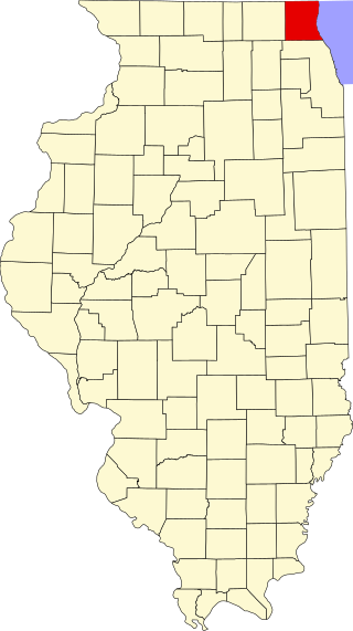
This is a list of the National Register of Historic Places listings in Lake County, Illinois.

This is a list of the National Register of Historic Places listings in Winnebago County, Illinois.

This is a list of the National Register of Historic Places listings in Coles County, Illinois.

This is a list of the National Register of Historic Places listings in Randolph County, Illinois.

This is a list of properties on the National Register of Historic Places in Vermilion County, Illinois.

This is a list of the National Register of Historic Places listings in Montgomery County, Illinois.
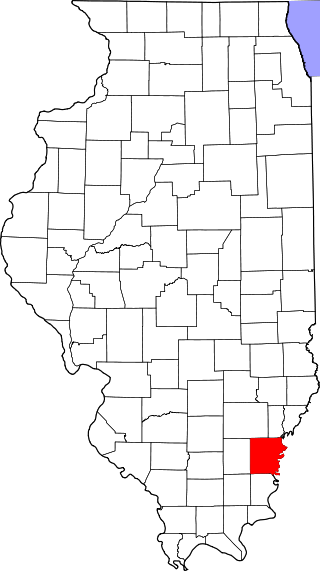
This is a list of the National Register of Historic Places listings in White County, Illinois.

This is a list of the National Register of Historic Places listings in Warren County, Illinois.
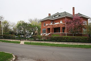
The Ravenswood Manor Historic District is a historic district in the Albany Park community area of North Side, Chicago, Illinois. It is bordered by the Chicago River on the East, and by the alley south of Lawrence Avenue on the North, Sacramento Avenue on the West, and the alley North of Montrose Avenue on the south.
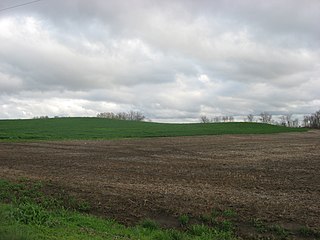
The Ware Mounds and Village Site (11U31), also known as the Running Lake Site, located west of Ware, Illinois, is an archaeological site comprising three platform mounds and a 160-acre (65 ha) village site. The site was inhabited by the Late Woodland and Mississippian cultures from c. 800 to c. 1300. The village is one of the only Mississippian villages known to have existed in the Mississippi River valley in Southern Illinois. As the village was located near two major sources of chert, which Mississippian cultures used to make agricultural tools, it was likely a trading center for the mineral.

The John Chapman Village Site is a prehistoric archaeological site located in the Apple River Valley south of Hanover, Illinois. The site includes a village area and a platform mound; the latter is the only known platform mound in the Apple River Valley. The village was occupied from roughly 1100 to 1250 A.D., toward the end of the Late Woodland period and the beginning of the Mississippian period; it is associated with a transitional phase between the two periods known as the Bennett Phase. Archaeologists have hypothesized that the site formed part of a trade network between Cahokia and settlements further north, such as Aztalan, as evidenced by the artifacts found at the site.


