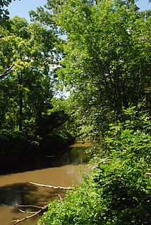
Sherwood Forest is a royal forest in Nottinghamshire, England, famous because of its historic association with the legend of Robin Hood.

Sequoia National Park is an American national park in the southern Sierra Nevada east of Visalia, California. The park was established on September 25, 1890, to protect 404,064 acres of forested mountainous terrain. Encompassing a vertical relief of nearly 13,000 feet (4,000 m), the park contains the highest point in the contiguous United States, Mount Whitney, at 14,505 feet (4,421 m) above sea level. The park is south of, and contiguous with, Kings Canyon National Park; both parks are administered by the National Park Service together as the Sequoia and Kings Canyon National Parks. UNESCO designated the areas as Sequoia-Kings Canyon Biosphere Reserve in 1976.

The Wind River Range is a mountain range of the Rocky Mountains in western Wyoming in the United States. The range runs roughly NW–SE for approximately 100 mi (160 km). The Continental Divide follows the crest of the range and includes Gannett Peak, which at 13,802 ft (4,207 m), is the highest peak in Wyoming; and also Fremont Peak at 13,750 ft (4,191 m), the third highest peak in Wyoming. There are more than 40 other named peaks in excess of 12,999 ft (3,962 m). With the exception of the Grand Teton in the Teton Range, the next 19 highest peaks in Wyoming after Gannett are also in the Winds.

The Pecatonica River is a tributary of the Rock River, 194 miles (312 km) long, in southern Wisconsin and northern Illinois in the United States.

Olympic National Forest is a U.S. National Forest located in Washington, USA. With an area of 628,115 acres (2,541.89 km2), it nearly surrounds Olympic National Park and the Olympic Mountain range. Olympic National Forest contains parts of Clallam, Grays Harbor, Jefferson, and Mason counties. The landscape of the national forest varies, from the temperate Olympic rain forest to the salt water fjord of Hood Canal to the peaks of Mt. Washington.

Gannett Peak is the highest mountain peak in the U.S. state of Wyoming at 13,804 feet (4,207 m). It lies in the Wind River Range within the Bridger Wilderness of the Bridger-Teton National Forest. Straddling the Continental Divide along the boundary between Fremont and Sublette counties, it has the second greatest topographic prominence in the state (7076') after Cloud Peak (7077'), and is the highest ground for 290.36 miles in any direction.

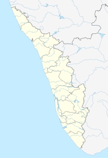
Nilambur is a major town, a municipality and a Taluk in the Malappuram district of the Indian state of Kerala. It is located close to the Nilgiris range of the Western Ghats on the banks of the Chaliyar River. This place is also known as 'Teak Town' because of the abundance of Nilambur teaks in this area; Which is a variety of a large, deciduous tree that occurs in mixed hardwood forests. Unlike many Municipalities of India; Nilambur is covered with large amounts of vegetation making it close to nature and hence make it very scenic and inspiring.

The Flathead National Forest is a national forest in the western part of the U.S. state of Montana. The forest lies primarily in Flathead County, south of Glacier National Park. The forest covers 2,404,935 acres of which about 1 million acres (4,000 km2) is designated wilderness. It is named after the Flathead Native Americans who live in the area.

The George Washington and Jefferson National Forests is an administrative entity combining two U.S. National Forests into one of the largest areas of public land in the Eastern United States. The forests cover 1.8 million acres (7,300 km2) of land in the Appalachian Mountains of Virginia, West Virginia, and Kentucky. Approximately 1 million acres (4,000 km2) of the forest are remote and undeveloped and 139,461 acres (564 km2) have been designated as wilderness areas, which eliminates future development.

The Congo Basin is the sedimentary basin of the Congo River. The Congo Basin is located in Central Africa, in a region known as west equatorial Africa. The Congo Basin region is sometimes known simply as the Congo. It contains some of the largest tropical rainforests in the world and is an important source of water used in agriculture and energy generation.

The Kootenai National Forest is a national forest located in the far northwestern section of Montana and the northeasternmost lands in the Idaho panhandle in the United States, along the Canada–US border. Of the 2.2 million acres (8,900 km2) administered by the forest, less than 3 percent is located in the state of Idaho. Forest headquarters are located in Libby, Montana. There are local ranger district offices in Eureka, Fortine, Libby, Trout Creek, and Troy, Montana. About 53 percent of the 94,272-acre (381.51 km2) Cabinet Mountains Wilderness is located within the forest, with the balance lying in neighboring Kaniksu National Forest.

The Salmon–Huckleberry Wilderness is a wilderness area located on the southern side of Mount Hood in the northwestern Cascades of Oregon, in the United States. It lies within the Mount Hood National Forest and comprises 62,061 acres (25,115 ha) of land. The United States Congress designated the area Wilderness in 1984.

Eagle Cap Wilderness is a wilderness area located in the Wallowa Mountains of northeastern Oregon, within the Wallowa–Whitman National Forest. The wilderness was established in 1940. In 1964, it was included in the National Wilderness Preservation System. A boundary revision in 1972 added 73,000 acres (30,000 ha) and the Wilderness Act of 1964 added 66,100 acres (26,700 ha) resulting in a current total of 361,446 acres, making Eagle Cap by far Oregon's largest wilderness area.

Salmo-Priest Wilderness is a 41,335 acre (167.28 km2) wilderness area located in the Selkirk Mountains in the northeast corner of Washington state, within the Colville National Forest and the Kaniksu National Forest.

The Middle Fork of the Salmon River is a 104-mile-long (167 km) river in central Idaho in the northwestern United States. It is a tributary to the Salmon River, and lies in the center of the 2.5-million-acre Frank Church-River of No Return Wilderness Area.

The White Cloud Mountains are part of the Rocky Mountains of the western United States, located in central Idaho, southeast of Stanley in Custer County. The range is located within the Sawtooth National Recreation Area (SNRA) and partially within the Cecil D. Andrus–White Clouds Wilderness.

The Barmah National Park, formerly Barmah State Park, is a national park located in the Hume region of the Australian state of Victoria. The park is located adjacent to the Murray River near the town of Barmah, approximately 225 kilometres (140 mi) north of Melbourne. The park consists of river red gum floodplain forest, interspersed with treeless freshwater marshes. The area is subject to seasonal flooding from natural and irrigation water flows.

The James River Face Wilderness is an 8,907-acre area located near Natural Bridge, Virginia that is protected by the Eastern Wilderness Act of Congress to maintain its present, natural condition. As part of the National Wilderness Preservation System, it helps to preserve a variety of natural life forms and contributes to a diversity of plant and animal gene pools. Over half of the ecosystems in the United States exist within designated wilderness.


